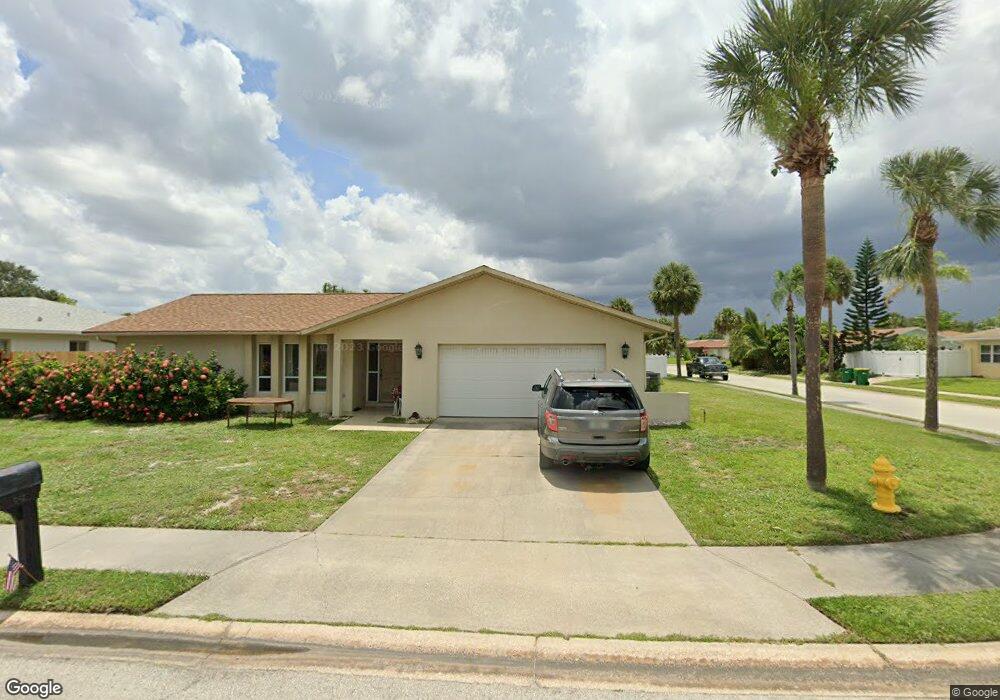
542 Carriage Cir Satellite Beach, FL 32937
Estimated Value: $573,000 - $666,000
4
Beds
2
Baths
1,964
Sq Ft
$313/Sq Ft
Est. Value
About This Home
This home is located at 542 Carriage Cir, Satellite Beach, FL 32937 and is currently estimated at $613,969, approximately $312 per square foot. 542 Carriage Cir is a home located in Brevard County with nearby schools including Surfside Elementary School, Satellite Senior High School, and DeLaura Middle School.
Ownership History
Date
Name
Owned For
Owner Type
Purchase Details
Closed on
Nov 20, 2000
Sold by
Campbell Marc E and Campbell Maryjo M
Bought by
Clark Michael E and Ouelletclark Donna M
Current Estimated Value
Home Financials for this Owner
Home Financials are based on the most recent Mortgage that was taken out on this home.
Original Mortgage
$119,920
Outstanding Balance
$44,157
Interest Rate
7.87%
Mortgage Type
Purchase Money Mortgage
Estimated Equity
$569,812
Create a Home Valuation Report for This Property
The Home Valuation Report is an in-depth analysis detailing your home's value as well as a comparison with similar homes in the area
Home Values in the Area
Average Home Value in this Area
Purchase History
| Date | Buyer | Sale Price | Title Company |
|---|---|---|---|
| Clark Michael E | $149,900 | -- |
Source: Public Records
Mortgage History
| Date | Status | Borrower | Loan Amount |
|---|---|---|---|
| Open | Clark Michael E | $119,920 |
Source: Public Records
Tax History Compared to Growth
Tax History
| Year | Tax Paid | Tax Assessment Tax Assessment Total Assessment is a certain percentage of the fair market value that is determined by local assessors to be the total taxable value of land and additions on the property. | Land | Improvement |
|---|---|---|---|---|
| 2025 | $2,614 | $175,130 | -- | -- |
| 2024 | $2,568 | $170,200 | -- | -- |
| 2023 | $2,568 | $165,250 | $0 | $0 |
| 2022 | $2,401 | $160,440 | $0 | $0 |
| 2021 | $2,468 | $155,770 | $0 | $0 |
| 2020 | $2,457 | $153,620 | $0 | $0 |
| 2019 | $2,437 | $150,170 | $0 | $0 |
| 2018 | $2,436 | $147,370 | $0 | $0 |
| 2017 | $2,271 | $144,340 | $0 | $0 |
| 2016 | $2,275 | $141,380 | $85,000 | $56,380 |
| 2015 | $2,329 | $140,400 | $75,000 | $65,400 |
| 2014 | $2,330 | $139,290 | $70,000 | $69,290 |
Source: Public Records
Map
Nearby Homes
- 550 Temple St
- 431 E Amherst Cir
- 445 Saint Johns Dr
- 435 Desoto Pkwy
- 484 Greenway Ave
- 368 Ocean Spray Ave
- 620 Jamaica Blvd
- 366 Ocean Spray Ave
- 302 Markley Ct
- 502 Bay Cir
- 699 Bimini Rd
- 370 Cinnamon Dr
- 105 Carissa Dr
- 295 Cinnamon Dr
- 426 Hawthorne Ct Unit G2
- 199 Skyline Ct
- 235 S Marco Way
- 155 Elm Ave
- 210 Queens Ct
- 527 Summerset Ct