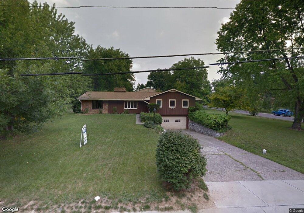
542 Chisholm Trail Cincinnati, OH 45215
Estimated Value: $530,000 - $618,000
4
Beds
3
Baths
2,064
Sq Ft
$280/Sq Ft
Est. Value
About This Home
This home is located at 542 Chisholm Trail, Cincinnati, OH 45215 and is currently estimated at $577,823, approximately $279 per square foot. 542 Chisholm Trail is a home located in Hamilton County with nearby schools including Wyoming High School and John Paul II Catholic School.
Ownership History
Date
Name
Owned For
Owner Type
Purchase Details
Closed on
Jul 29, 2021
Sold by
Fennema Dennis D
Bought by
Fennema Dennis D and The Dennis D Fennema Revocable
Current Estimated Value
Purchase Details
Closed on
Aug 31, 2011
Sold by
Lingen Carl W and Lingen Dora B
Bought by
Fennema Dennis
Home Financials for this Owner
Home Financials are based on the most recent Mortgage that was taken out on this home.
Original Mortgage
$192,500
Outstanding Balance
$133,882
Interest Rate
4.59%
Mortgage Type
Unknown
Estimated Equity
$443,941
Create a Home Valuation Report for This Property
The Home Valuation Report is an in-depth analysis detailing your home's value as well as a comparison with similar homes in the area
Home Values in the Area
Average Home Value in this Area
Purchase History
| Date | Buyer | Sale Price | Title Company |
|---|---|---|---|
| Fennema Dennis D | -- | None Available | |
| Fennema Dennis | $275,000 | Stewart Title Company |
Source: Public Records
Mortgage History
| Date | Status | Borrower | Loan Amount |
|---|---|---|---|
| Open | Fennema Dennis | $192,500 |
Source: Public Records
Tax History Compared to Growth
Tax History
| Year | Tax Paid | Tax Assessment Tax Assessment Total Assessment is a certain percentage of the fair market value that is determined by local assessors to be the total taxable value of land and additions on the property. | Land | Improvement |
|---|---|---|---|---|
| 2024 | $8,698 | $156,510 | $42,746 | $113,764 |
| 2023 | $8,062 | $156,510 | $42,746 | $113,764 |
| 2022 | $7,148 | $114,391 | $30,685 | $83,706 |
| 2021 | $6,953 | $114,391 | $30,685 | $83,706 |
| 2020 | $7,128 | $114,391 | $30,685 | $83,706 |
| 2019 | $6,949 | $103,992 | $27,895 | $76,097 |
| 2018 | $6,953 | $103,992 | $27,895 | $76,097 |
| 2017 | $6,649 | $103,992 | $27,895 | $76,097 |
| 2016 | $5,277 | $96,251 | $27,787 | $68,464 |
| 2015 | $5,348 | $96,251 | $27,787 | $68,464 |
| 2014 | $5,362 | $96,251 | $27,787 | $68,464 |
| 2013 | $5,579 | $86,954 | $23,548 | $63,406 |
Source: Public Records
Map
Nearby Homes
- 525 Chisholm Trail
- 513 Chisholm Trail
- 377 Compton Rd
- 271 Poage Farm Rd
- 9197 Long Ln
- 8932 Hollyhock Dr
- 305 Compton Hills Dr
- 9458 Long Ln
- 9497 Long Ln
- 8816 Falmouth Dr
- 926 Reily Rd
- 9416 Shadyoak Ct
- 281 Compton Rd
- 204 Brocdorf Dr
- 158 Congress Run Rd
- 216 Hilltop Ln
- 8608 Long Ln
- 239 Compton Ridge Dr
- 613 Heatherdale Dr
- 253 Compton Rd
- 548 Chisholm Trail
- 525 Cochise Ct
- 532 Chisholm Trail
- 554 Chisholm Trail
- 543 Chisholm Trail
- 537 Chisholm Trail
- 526 Cochise Ct
- 549 Chisholm Trail
- 529 Cochise Ct
- 516 Hilltop Ln
- 531 Chisholm Trail
- 526 Chisholm Trail
- 480 Hilltop Ln
- 530 Cochise Ct
- 526 Hilltop Ln
- 520 Chisholm Trail
- 519 Chisholm Trail
- 505 Hilltop Ln
- 460 Hilltop Ln
- 470 Hilltop Ln