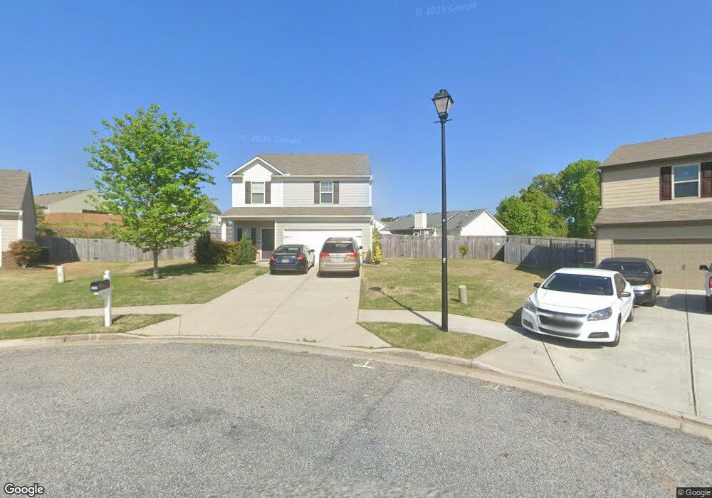
542 Dianne Ct Winder, GA 30680
Estimated Value: $339,113 - $360,000
--
Bed
3
Baths
2,000
Sq Ft
$173/Sq Ft
Est. Value
About This Home
This home is located at 542 Dianne Ct, Winder, GA 30680 and is currently estimated at $346,778, approximately $173 per square foot. 542 Dianne Ct is a home located in Barrow County with nearby schools including Kennedy Elementary School, Westside Middle School, and Apalachee High School.
Ownership History
Date
Name
Owned For
Owner Type
Purchase Details
Closed on
Mar 1, 2016
Sold by
Lgi Homes Georgia Llc
Bought by
Rojas Alvaro and Rojas Alexandra
Current Estimated Value
Home Financials for this Owner
Home Financials are based on the most recent Mortgage that was taken out on this home.
Original Mortgage
$174,677
Outstanding Balance
$142,032
Interest Rate
4.5%
Mortgage Type
FHA
Estimated Equity
$204,746
Purchase Details
Closed on
Oct 25, 2013
Sold by
Sutherland Land Llc
Bought by
Sutherland Land Llc And
Purchase Details
Closed on
Jun 28, 2012
Sold by
Afb&T A Division Of Synovus B
Bought by
Sutherland Land Llc
Purchase Details
Closed on
Jun 30, 2011
Sold by
Mark I Developers Inc
Bought by
Afb&T A Division Of Synovus Bank
Purchase Details
Closed on
Apr 23, 2004
Sold by
Maynard Jerry M
Bought by
Mark I Developers Inc
Create a Home Valuation Report for This Property
The Home Valuation Report is an in-depth analysis detailing your home's value as well as a comparison with similar homes in the area
Home Values in the Area
Average Home Value in this Area
Purchase History
| Date | Buyer | Sale Price | Title Company |
|---|---|---|---|
| Rojas Alvaro | $177,900 | -- | |
| Sutherland Land Llc And | -- | -- | |
| Sutherland Land Llc | $2,500 | -- | |
| Afb&T A Division Of Synovus Bank | -- | -- | |
| Mark I Developers Inc | $3,818,800 | -- |
Source: Public Records
Mortgage History
| Date | Status | Borrower | Loan Amount |
|---|---|---|---|
| Open | Rojas Alvaro | $174,677 |
Source: Public Records
Tax History Compared to Growth
Tax History
| Year | Tax Paid | Tax Assessment Tax Assessment Total Assessment is a certain percentage of the fair market value that is determined by local assessors to be the total taxable value of land and additions on the property. | Land | Improvement |
|---|---|---|---|---|
| 2024 | $3,199 | $116,782 | $25,600 | $91,182 |
| 2023 | $2,714 | $116,782 | $25,600 | $91,182 |
| 2022 | $2,877 | $88,862 | $20,400 | $68,462 |
| 2021 | $2,648 | $79,018 | $16,000 | $63,018 |
| 2020 | $2,392 | $73,572 | $16,000 | $57,572 |
| 2019 | $2,334 | $70,850 | $16,000 | $54,850 |
| 2018 | $2,325 | $70,850 | $16,000 | $54,850 |
| 2017 | $2,071 | $69,424 | $16,000 | $53,424 |
| 2016 | $2,176 | $64,356 | $16,000 | $48,356 |
| 2015 | $368 | $9,600 | $9,600 | $0 |
| 2014 | $195 | $4,368 | $4,368 | $0 |
| 2013 | -- | $1,965 | $1,965 | $0 |
Source: Public Records
Map
Nearby Homes
- 536 Dianne Ct
- 1053 Sutherland Dr
- 1076 Sutherland Dr
- 1106 Sutherland Dr
- 1048 Sutherland Dr
- 435 Watson Rd
- 256 Oceanliner Dr
- 252 Oceanliner Dr
- 29 Lighthouse Dr
- 0 Gordon Ct Unit 10634940
- 0 Atlanta Hwy SE Unit 10371310
- 328 Advent Dr
- 211 Brooks Ln
- 182 Nativity Cove Unit 30
- 182 Nativity Cove
- 120 2nd St
- 40 Huckleberry Ln
- 55 Huckleberry Ln
- 434 Aberdeen Way
- 422 Aberdeen Way
- 542 Dianne Ct Unit 56 C
- 540 Dianne Ct Unit 55 C
- 540 Dianne Ct
- 1312 Dianne Way
- 541 Dianne Ct
- 1314 Dianne Way
- 538 Dianne Ct Unit 54 C
- 538 Dianne Ct
- 639 Nonsuch Way Unit 38 C
- 637 Nonsuch Way
- 637 Nonsuch Way Unit 39 C
- 1308 Dianne Way
- 539 Dianne Ct
- 641 Nonsuch Way
- 641 Nonsuch Way Unit 37 C
- 635 Nonsuch Way Unit 40 C
- 635 Nonsuch Way
- 537 Dianne Ct
- 536 Dianne Ct Unit 53 C
- 1306 Dianne Way