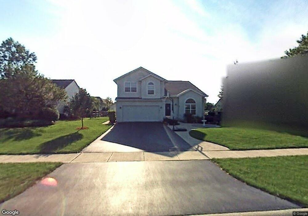
542 Harrison Rd Perrysburg, OH 43551
Estimated Value: $376,000 - $418,000
4
Beds
3
Baths
2,118
Sq Ft
$188/Sq Ft
Est. Value
About This Home
This home is located at 542 Harrison Rd, Perrysburg, OH 43551 and is currently estimated at $398,847, approximately $188 per square foot. 542 Harrison Rd is a home located in Wood County with nearby schools including Toth Elementary School, Perrysburg Junior High School, and Perrysburg High School.
Ownership History
Date
Name
Owned For
Owner Type
Purchase Details
Closed on
Mar 29, 2002
Sold by
Crissinger Paula K
Bought by
Baboun Elias and Baboun Maria
Current Estimated Value
Home Financials for this Owner
Home Financials are based on the most recent Mortgage that was taken out on this home.
Original Mortgage
$160,000
Interest Rate
6.87%
Purchase Details
Closed on
Jul 24, 1997
Sold by
Wayne Homes Inc
Bought by
Alkire Phillip B
Home Financials for this Owner
Home Financials are based on the most recent Mortgage that was taken out on this home.
Original Mortgage
$142,400
Interest Rate
7.81%
Mortgage Type
New Conventional
Purchase Details
Closed on
Feb 21, 1997
Sold by
Shawnee Trace Dev Co Inc
Bought by
Wayne Homes Inc
Create a Home Valuation Report for This Property
The Home Valuation Report is an in-depth analysis detailing your home's value as well as a comparison with similar homes in the area
Home Values in the Area
Average Home Value in this Area
Purchase History
| Date | Buyer | Sale Price | Title Company |
|---|---|---|---|
| Baboun Elias | $200,000 | Midland Title | |
| Alkire Phillip B | $178,000 | -- | |
| Wayne Homes Inc | $34,900 | -- |
Source: Public Records
Mortgage History
| Date | Status | Borrower | Loan Amount |
|---|---|---|---|
| Previous Owner | Baboun Elias | $160,000 | |
| Previous Owner | Alkire Phillip B | $142,400 |
Source: Public Records
Tax History Compared to Growth
Tax History
| Year | Tax Paid | Tax Assessment Tax Assessment Total Assessment is a certain percentage of the fair market value that is determined by local assessors to be the total taxable value of land and additions on the property. | Land | Improvement |
|---|---|---|---|---|
| 2024 | $5,626 | $106,085 | $17,640 | $88,445 |
| 2023 | $5,626 | $106,090 | $17,640 | $88,450 |
| 2021 | $4,726 | $83,650 | $13,580 | $70,070 |
| 2020 | $4,700 | $83,650 | $13,580 | $70,070 |
| 2019 | $4,089 | $71,960 | $13,580 | $58,380 |
| 2018 | $3,632 | $71,960 | $13,580 | $58,380 |
| 2017 | $3,608 | $71,960 | $13,580 | $58,380 |
| 2016 | $3,358 | $65,000 | $13,580 | $51,420 |
| 2015 | $3,358 | $65,000 | $13,580 | $51,420 |
| 2014 | $3,387 | $65,000 | $13,580 | $51,420 |
| 2013 | $3,465 | $65,000 | $13,580 | $51,420 |
Source: Public Records
Map
Nearby Homes
- 431 Blue Jacket Rd
- 454 Blue Jacket Rd
- 408 Blue Jacket Rd
- 26333 Emerald Lakes Dr
- 10919 S Lakes Dr
- 10835 S Lakes Dr
- 26395 Carronade Dr
- 26028 Turnbridge Dr
- 277 Blue Jacket Rd
- 26717 Sheringham Rd
- 26336 E Wexford Dr
- 11037 Bay Trace Dr
- 10453 White Oak Dr
- 251 Mallard Rd
- 103 Ashwood Ct
- 170 Edgewood Dr
- 135 Birchcrest Dr
- 1085 Birch Dr
- 9898 Connor Lake Cir
- 525 Orchard St
- 554 Harrison Rd
- 1939 Hamilton Dr
- 518 Harrison Rd
- 566 Harrison Rd
- 1927 Hamilton Dr
- 1953 Hamilton Dr
- 543 Harrison Rd
- 555 Harrison Rd
- 531 Harrison Rd
- 1919 Hamilton Dr
- 1967 Hamilton Dr
- 504 Harrison Rd
- 519 Harrison Rd
- 578 Harrison Rd
- 577 Harrison Rd
- 0 Hamilton Lot 65 Unit 5043320
- 1981 Hamilton Dr
- 1909 Hamilton Dr
- 507 Harrison Rd
- 1942 Hamilton Dr