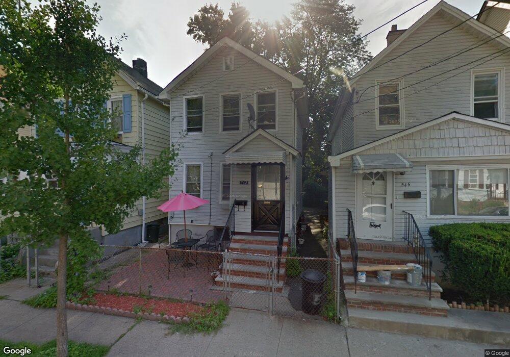
542 Liberty St Orange, NJ 07050
Estimated Value: $312,000 - $371,000
--
Bed
--
Bath
971
Sq Ft
$351/Sq Ft
Est. Value
About This Home
This home is located at 542 Liberty St, Orange, NJ 07050 and is currently estimated at $341,047, approximately $351 per square foot. 542 Liberty St is a home located in Essex County.
Ownership History
Date
Name
Owned For
Owner Type
Purchase Details
Closed on
Oct 20, 2004
Sold by
Eoff Aaron David
Bought by
Mclaurin Diane
Current Estimated Value
Home Financials for this Owner
Home Financials are based on the most recent Mortgage that was taken out on this home.
Original Mortgage
$100,916
Outstanding Balance
$50,246
Interest Rate
5.85%
Mortgage Type
FHA
Estimated Equity
$290,801
Purchase Details
Closed on
Feb 3, 1995
Sold by
Hyamn Martha
Bought by
Eoff Aaron and Eoff Jewell
Home Financials for this Owner
Home Financials are based on the most recent Mortgage that was taken out on this home.
Original Mortgage
$51,000
Interest Rate
9.13%
Create a Home Valuation Report for This Property
The Home Valuation Report is an in-depth analysis detailing your home's value as well as a comparison with similar homes in the area
Home Values in the Area
Average Home Value in this Area
Purchase History
| Date | Buyer | Sale Price | Title Company |
|---|---|---|---|
| Mclaurin Diane | $102,500 | -- | |
| Eoff Aaron | $56,800 | -- |
Source: Public Records
Mortgage History
| Date | Status | Borrower | Loan Amount |
|---|---|---|---|
| Open | Mclaurin Diane | $100,916 | |
| Previous Owner | Eoff Aaron | $51,000 |
Source: Public Records
Tax History Compared to Growth
Tax History
| Year | Tax Paid | Tax Assessment Tax Assessment Total Assessment is a certain percentage of the fair market value that is determined by local assessors to be the total taxable value of land and additions on the property. | Land | Improvement |
|---|---|---|---|---|
| 2025 | $7,607 | $204,100 | $73,000 | $131,100 |
| 2024 | $7,607 | $204,100 | $73,000 | $131,100 |
| 2022 | $7,074 | $204,100 | $73,000 | $131,100 |
| 2021 | $6,312 | $109,200 | $44,300 | $64,900 |
| 2020 | $6,123 | $109,200 | $44,300 | $64,900 |
| 2019 | $5,804 | $109,200 | $44,300 | $64,900 |
| 2018 | $5,711 | $109,200 | $44,300 | $64,900 |
| 2017 | $5,318 | $109,200 | $44,300 | $64,900 |
| 2016 | $5,218 | $109,200 | $44,300 | $64,900 |
| 2015 | $5,081 | $109,200 | $44,300 | $64,900 |
| 2014 | $4,858 | $109,200 | $44,300 | $64,900 |
Source: Public Records
Map
Nearby Homes
- 549 Liberty St
- 527 Valley St
- 585 Mcchesney St
- 567 Mcchesney St
- 468 Valley St
- 548 Tremont Ave
- 7 Lawrence Ave
- 412 S Valley Rd
- 522 Beach St
- 11 Yale Terrace
- 669 Scotland Rd
- 669 Scotland Rd Unit 2
- 656 Scotland Rd
- 562 Lincoln Ave
- 288 Gregory Ave
- 530 Lincoln Ave
- 525 Argyle Ave
- 347 S Jefferson St
- 59 Oakridge Rd
- 421 Berwick St
- 546 Liberty St
- 546 Liberty St Unit 1
- 540 Liberty St
- 538 Liberty St
- 548 Liberty St
- 536 Liberty St
- 534 Liberty St
- 541 Valley St
- 535 Valley St
- 539 Valley St
- 556 Liberty St
- 530 Liberty St
- 547 Valley St
- 545 Valley Rd
- 533 Valley St
- 541 Liberty St
- 545 Liberty St
- 545 Liberty St Unit 1
- 528 Liberty St
- 539 Liberty St