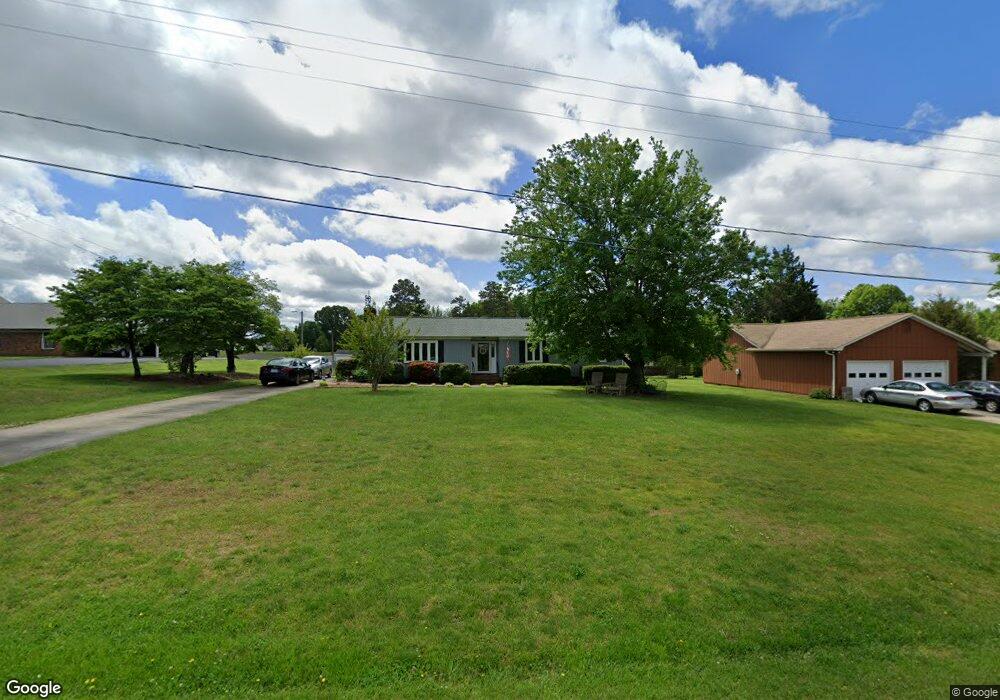
542 Tower Rd Thomasville, NC 27360
Estimated Value: $240,000 - $271,000
3
Beds
2
Baths
1,852
Sq Ft
$135/Sq Ft
Est. Value
About This Home
This home is located at 542 Tower Rd, Thomasville, NC 27360 and is currently estimated at $250,454, approximately $135 per square foot. 542 Tower Rd is a home located in Davidson County with nearby schools including Fair Grove Elementary School, E. Lawson Brown Middle School, and East Davidson High School.
Ownership History
Date
Name
Owned For
Owner Type
Purchase Details
Closed on
Mar 23, 2023
Sold by
Davis Donald A and Davis Joan P
Bought by
Shultz Jennifer D and Wolfe Mindy D
Current Estimated Value
Purchase Details
Closed on
Feb 13, 2006
Sold by
Summit Randy G and Summit Wanda C
Bought by
Davis Donald A and Davis Joan P
Home Financials for this Owner
Home Financials are based on the most recent Mortgage that was taken out on this home.
Original Mortgage
$150,000
Interest Rate
6.14%
Mortgage Type
Purchase Money Mortgage
Purchase Details
Closed on
Oct 1, 1979
Create a Home Valuation Report for This Property
The Home Valuation Report is an in-depth analysis detailing your home's value as well as a comparison with similar homes in the area
Home Values in the Area
Average Home Value in this Area
Purchase History
| Date | Buyer | Sale Price | Title Company |
|---|---|---|---|
| Shultz Jennifer D | -- | -- | |
| Davis Donald A | -- | None Listed On Document | |
| Davis Donald A | $30,000 | None Available | |
| -- | $15,500 | -- |
Source: Public Records
Mortgage History
| Date | Status | Borrower | Loan Amount |
|---|---|---|---|
| Previous Owner | Davis Donald A | $150,000 |
Source: Public Records
Tax History Compared to Growth
Tax History
| Year | Tax Paid | Tax Assessment Tax Assessment Total Assessment is a certain percentage of the fair market value that is determined by local assessors to be the total taxable value of land and additions on the property. | Land | Improvement |
|---|---|---|---|---|
| 2025 | $786 | $124,610 | $0 | $0 |
| 2024 | $786 | $124,610 | $0 | $0 |
| 2023 | $808 | $128,250 | $0 | $0 |
| 2022 | $808 | $128,250 | $0 | $0 |
| 2021 | $808 | $128,250 | $0 | $0 |
| 2020 | $696 | $110,400 | $0 | $0 |
| 2019 | $707 | $110,400 | $0 | $0 |
| 2018 | $707 | $110,400 | $0 | $0 |
| 2017 | $707 | $110,400 | $0 | $0 |
| 2016 | $684 | $110,400 | $0 | $0 |
| 2015 | $684 | $110,400 | $0 | $0 |
| 2014 | $751 | $121,170 | $0 | $0 |
Source: Public Records
Map
Nearby Homes
- 259 S Old Raleigh Rd
- 309 Aspen Place Ct
- 307 Aspen Place Ct
- 305 Aspen Place Ct
- GALEN Plan at Aspen Place
- TAYLOR Plan at Aspen Place
- KYLE Plan at Aspen Place
- PENWELL Plan at Aspen Place
- BELHAVEN Plan at Aspen Place
- HAYDEN Plan at Aspen Place
- Freeport Plan at Aspen Place
- 303 Aspen Place Ct
- 306 Aspen Place Ct
- 304 Aspen Place Ct
- 301 Aspen Place Ct
- 302 Aspen Place Ct
- 306 Locksley Ct
- 300 Aspen Place Ct
- 403 White Spruce Ct
- 401 White Spruce Ct