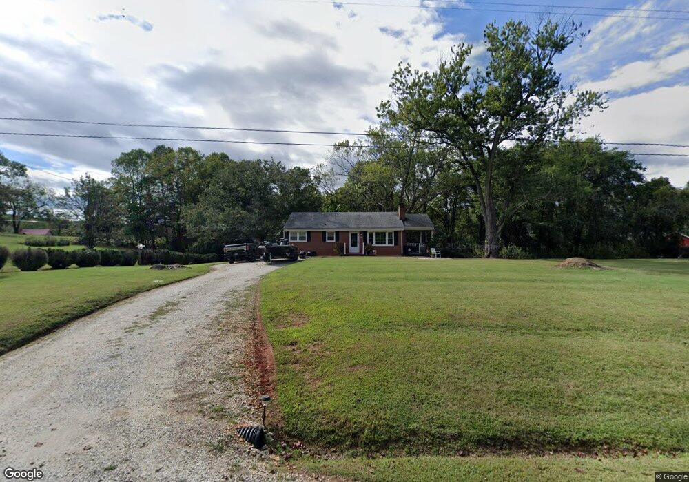
542 Waughs Ferry Rd Amherst, VA 24521
Estimated Value: $166,000 - $231,000
2
Beds
1
Bath
1,026
Sq Ft
$195/Sq Ft
Est. Value
About This Home
This home is located at 542 Waughs Ferry Rd, Amherst, VA 24521 and is currently estimated at $199,825, approximately $194 per square foot. 542 Waughs Ferry Rd is a home located in Amherst County with nearby schools including Amherst Elementary School, Amherst Middle School, and Amherst County High School.
Ownership History
Date
Name
Owned For
Owner Type
Purchase Details
Closed on
Mar 29, 2016
Sold by
Kilbore Joseph Paul
Bought by
Bryant Leo R and Bryant Betty W
Current Estimated Value
Home Financials for this Owner
Home Financials are based on the most recent Mortgage that was taken out on this home.
Original Mortgage
$65,625
Outstanding Balance
$51,370
Interest Rate
3.65%
Mortgage Type
New Conventional
Estimated Equity
$148,455
Create a Home Valuation Report for This Property
The Home Valuation Report is an in-depth analysis detailing your home's value as well as a comparison with similar homes in the area
Purchase History
| Date | Buyer | Sale Price | Title Company |
|---|---|---|---|
| Bryant Leo R | $87,500 | Attorney |
Source: Public Records
Mortgage History
| Date | Status | Borrower | Loan Amount |
|---|---|---|---|
| Open | Bryant Leo R | $65,625 |
Source: Public Records
Tax History
| Year | Tax Paid | Tax Assessment Tax Assessment Total Assessment is a certain percentage of the fair market value that is determined by local assessors to be the total taxable value of land and additions on the property. | Land | Improvement |
|---|---|---|---|---|
| 2026 | $1,232 | $201,900 | $30,000 | $171,900 |
| 2025 | $642 | $105,200 | $25,000 | $80,200 |
| 2024 | $642 | $105,200 | $25,000 | $80,200 |
| 2023 | $642 | $105,200 | $25,000 | $80,200 |
| 2022 | $657 | $107,700 | $27,500 | $80,200 |
| 2021 | $657 | $107,700 | $27,500 | $80,200 |
| 2020 | $657 | $107,700 | $27,500 | $80,200 |
| 2019 | $663 | $108,700 | $33,500 | $75,200 |
| 2018 | $663 | $108,700 | $33,500 | $75,200 |
| 2017 | $332 | $108,700 | $33,500 | $75,200 |
| 2016 | $663 | $108,700 | $33,500 | $75,200 |
| 2015 | $188 | $108,700 | $33,500 | $75,200 |
| 2014 | $188 | $108,700 | $33,500 | $75,200 |
Source: Public Records
Map
Nearby Homes
- 417 Stage Rd
- 137 Higginbotham Creek Rd
- 108 Montfair Dr
- 9 Mill Race Dr
- 1612 S Amherst Hwy
- 1697 S Amherst Hwy
- 9-F Dulwich Dr
- Parcel F Dulwich Dr Unit PARCEL F
- Parcel F Dulwich Dr
- 107 Emory Way
- 163 Loch Ln
- 135 Yahweh Dr
- 260 N Main St
- 272 Eagle Rd
- Lot 4 Fox Hall Dr
- 250 Shelter Ln
- 158 Walnut St
- 0 Fox Hall Dr
- 174 Shelter Ln
- 128 Walnut St
- 556 Waughs Ferry Rd
- 582 Waughs Ferry Rd
- 516 Waughs Ferry Rd
- 562 Waughs Ferry Rd
- 572 Waughs Ferry Rd
- 504 Waughs Ferry Rd
- 580 Waughs Ferry Rd
- 482 Waughs Ferry Rd
- 617 Waughs Ferry Rd
- 483 Waughs Ferry Rd
- 610 Waughs Ferry Rd
- 627 Waughs Ferry Rd
- 638 Waughs Ferry Rd
- 643 Waughs Ferry Rd
- 478 Waughs Ferry Rd
- 432 Waughs Ferry Rd
- 655 Waughs Ferry Rd
- 130 Briarherst Dr
- 160 Briarherst Dr
- 172 Briarherst Dr
Your Personal Tour Guide
Ask me questions while you tour the home.