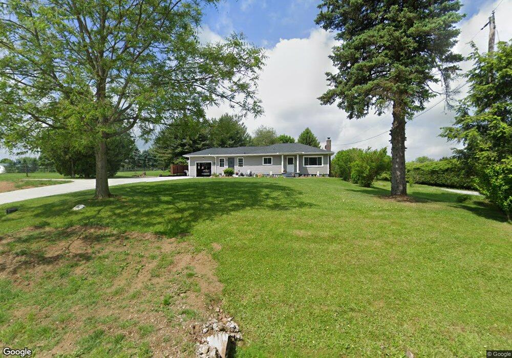
5420 Grove Rd Clinton, OH 44216
Estimated Value: $227,000 - $280,000
2
Beds
2
Baths
1,174
Sq Ft
$211/Sq Ft
Est. Value
About This Home
This home is located at 5420 Grove Rd, Clinton, OH 44216 and is currently estimated at $247,667, approximately $210 per square foot. 5420 Grove Rd is a home located in Summit County with nearby schools including Northwest Primary School, W.S. Stinson Elementary School, and Northwest Middle School.
Ownership History
Date
Name
Owned For
Owner Type
Purchase Details
Closed on
Oct 11, 2003
Sold by
Wood Terry L and Wood Clark L
Bought by
Wood Terry L and Wood Michelle L
Current Estimated Value
Home Financials for this Owner
Home Financials are based on the most recent Mortgage that was taken out on this home.
Original Mortgage
$115,000
Outstanding Balance
$54,694
Interest Rate
6.49%
Mortgage Type
Purchase Money Mortgage
Estimated Equity
$192,973
Purchase Details
Closed on
Jan 6, 1997
Sold by
Barber Linda L
Bought by
Wood Terry L and Clark Michelle
Home Financials for this Owner
Home Financials are based on the most recent Mortgage that was taken out on this home.
Original Mortgage
$76,400
Interest Rate
7.6%
Mortgage Type
New Conventional
Create a Home Valuation Report for This Property
The Home Valuation Report is an in-depth analysis detailing your home's value as well as a comparison with similar homes in the area
Home Values in the Area
Average Home Value in this Area
Purchase History
| Date | Buyer | Sale Price | Title Company |
|---|---|---|---|
| Wood Terry L | -- | Tower City Title Agency Llc | |
| Wood Terry L | $84,900 | -- |
Source: Public Records
Mortgage History
| Date | Status | Borrower | Loan Amount |
|---|---|---|---|
| Open | Wood Terry L | $115,000 | |
| Closed | Wood Terry L | $76,400 |
Source: Public Records
Tax History Compared to Growth
Tax History
| Year | Tax Paid | Tax Assessment Tax Assessment Total Assessment is a certain percentage of the fair market value that is determined by local assessors to be the total taxable value of land and additions on the property. | Land | Improvement |
|---|---|---|---|---|
| 2025 | $2,435 | $57,925 | $10,227 | $47,698 |
| 2024 | $2,435 | $57,925 | $10,227 | $47,698 |
| 2023 | $2,435 | $55,146 | $10,227 | $44,919 |
| 2022 | $2,007 | $41,202 | $7,574 | $33,628 |
| 2021 | $2,012 | $41,202 | $7,574 | $33,628 |
| 2020 | $2,017 | $41,200 | $7,570 | $33,630 |
| 2019 | $2,036 | $40,180 | $11,260 | $28,920 |
| 2018 | $2,035 | $40,180 | $11,260 | $28,920 |
| 2017 | $1,919 | $40,180 | $11,260 | $28,920 |
| 2016 | $1,889 | $35,160 | $11,260 | $23,900 |
| 2015 | $1,919 | $35,160 | $11,260 | $23,900 |
| 2014 | $2,004 | $35,160 | $11,260 | $23,900 |
| 2013 | $2,074 | $36,360 | $11,260 | $25,100 |
Source: Public Records
Map
Nearby Homes
- 2536 Emmons Dr
- 4851 Manchester Rd
- 4698 Manchester Rd
- 5239 Monroe Square E
- V/L Monroe Square
- 1850 Turkeyfoot Lake Rd
- V/L Bishop Oval
- 781 Leeman Dr
- 0 Grill Rd
- 6270 Pinto Dr
- 455 S Van Buren Ave
- 715 Highland Park Dr
- 6090 Manchester Rd Unit 6096
- 375 Big Bend Cir
- 4567 Rex Lake Dr
- 311 George St
- 6387 Hampsher Rd
- 0 W Turkeyfoot Lake Rd Unit 5157637
- 1357 S Azalea Blvd
- 3241 Grill Rd