Estimated Value: $855,000 - $974,000
4
Beds
3
Baths
1,988
Sq Ft
$459/Sq Ft
Est. Value
About This Home
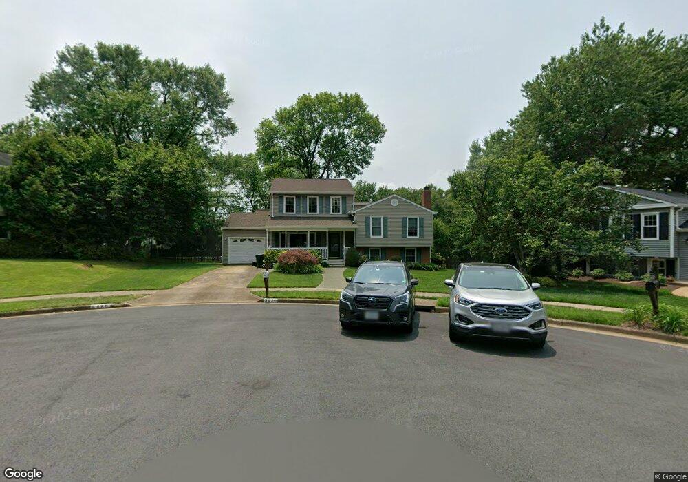
This home is located at 5420 Rumsford Ln, Burke, VA 22015 and is currently estimated at $912,458, approximately $458 per square foot. 5420 Rumsford Ln is a home located in Fairfax County with nearby schools including Kings Park Elementary School, Kings Glen Elementary School, and Lake Braddock Secondary School.
Ownership History
Date
Name
Owned For
Owner Type
Purchase Details
Closed on
Apr 18, 2025
Sold by
Brooke Edward W and Brooke Mary E
Bought by
Edward Woodall Brooke Revocable Trust and Mary Elizabeth Brooke Revocable Trust
Current Estimated Value
Purchase Details
Closed on
Nov 20, 1998
Sold by
Miley Charles W
Bought by
Brooke Edward W
Home Financials for this Owner
Home Financials are based on the most recent Mortgage that was taken out on this home.
Original Mortgage
$180,000
Interest Rate
6.49%
Create a Home Valuation Report for This Property
The Home Valuation Report is an in-depth analysis detailing your home's value as well as a comparison with similar homes in the area
Home Values in the Area
Average Home Value in this Area
Purchase History
| Date | Buyer | Sale Price | Title Company |
|---|---|---|---|
| Edward Woodall Brooke Revocable Trust | -- | None Listed On Document | |
| Edward Woodall Brooke Revocable Trust | -- | None Listed On Document | |
| Brooke Edward W | $225,000 | -- |
Source: Public Records
Mortgage History
| Date | Status | Borrower | Loan Amount |
|---|---|---|---|
| Previous Owner | Brooke Edward W | $180,000 |
Source: Public Records
Tax History Compared to Growth
Tax History
| Year | Tax Paid | Tax Assessment Tax Assessment Total Assessment is a certain percentage of the fair market value that is determined by local assessors to be the total taxable value of land and additions on the property. | Land | Improvement |
|---|---|---|---|---|
| 2025 | $9,575 | $905,490 | $371,000 | $534,490 |
| 2024 | $9,575 | $826,490 | $343,000 | $483,490 |
| 2023 | $9,164 | $812,060 | $343,000 | $469,060 |
| 2022 | $8,547 | $747,480 | $316,000 | $431,480 |
| 2021 | $7,922 | $675,100 | $283,000 | $392,100 |
| 2020 | $7,652 | $646,590 | $272,000 | $374,590 |
| 2019 | $7,104 | $600,290 | $266,000 | $334,290 |
| 2018 | $6,903 | $600,290 | $266,000 | $334,290 |
| 2017 | $6,769 | $583,010 | $255,000 | $328,010 |
| 2016 | $6,414 | $553,630 | $239,000 | $314,630 |
| 2015 | $6,543 | $586,260 | $239,000 | $347,260 |
| 2014 | $6,293 | $565,150 | $228,000 | $337,150 |
Source: Public Records
Map
Nearby Homes
- 9513 Burdett Rd
- 9662 Westport Ln
- 5658 Sutherland Ct
- 5711 Crownleigh Ct
- 9710 Ashbourn Dr
- 5502 Saddlebrook Ct
- 5714 Mason Bluff Dr
- 5432 Brixham Ct
- 9769 High Water Ct
- 9438 Wallingford Dr
- 5307 Richardson Dr
- 9909 Lakepointe Dr
- 5608 Doolittle St
- 9316 Lee St
- 5137 Richardson Dr
- 5838 High Bluff Ct
- 5361 Gainsborough Dr
- 5313 Stonington Dr
- 9717 Commonwealth Blvd
- 5055 Kenerson Dr
- 5418 Rumsford Ln
- 5421 Rumsford Ln
- 5416 Rumsford Ln
- 5419 Rumsford Ln
- 5502 Kendrick Ln
- 5504 Kendrick Ln
- 5508 Kendrick Ln
- 5510 Kendrick Ln
- 5500 Hollins Ln
- 5512 Kendrick Ln
- 5502 Hollins Ln
- 5514 Kendrick Ln
- 5417 Rumsford Ln
- 5504 Hollins Ln
- 5516 Kendrick Ln
- 5414 Rumsford Ln
- 5506 Hollins Ln
- 5508 Hollins Ln
- 5510 Hollins Ln
- 5415 Rumsford Ln