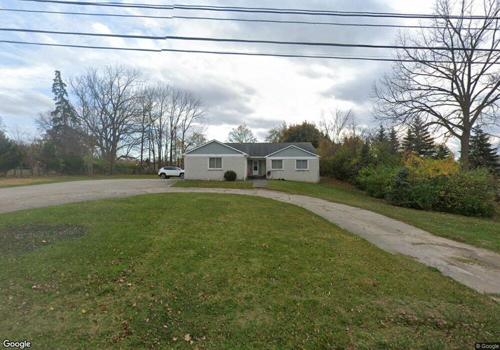
5423 W Maple Rd West Bloomfield, MI 48322
Estimated Value: $437,716 - $472,000
3
Beds
3
Baths
2,015
Sq Ft
$226/Sq Ft
Est. Value
About This Home
This home is located at 5423 W Maple Rd, West Bloomfield, MI 48322 and is currently estimated at $454,679, approximately $225 per square foot. 5423 W Maple Rd is a home located in Oakland County with nearby schools including Sheiko Elementary School, West Bloomfield Middle School, and Bloomfield Maples Montessori.
Ownership History
Date
Name
Owned For
Owner Type
Purchase Details
Closed on
Feb 4, 2025
Sold by
Kaskorkis Haifa Boutros
Bought by
Kaskorkis Haifa Boutros and Attisha Heather
Current Estimated Value
Purchase Details
Closed on
Jan 28, 2025
Sold by
Kaskorkis Haifa Boutros
Bought by
Attisha Heather
Purchase Details
Closed on
Dec 10, 2023
Sold by
Mansour Nooria Boutros
Bought by
Kaskorkis Haifa Boutros
Purchase Details
Closed on
Apr 16, 2018
Sold by
Mansour Nooria
Bought by
Mansour Nooria
Purchase Details
Closed on
Aug 9, 2016
Sold by
Mansour Nooria
Bought by
Mansour Nooria
Purchase Details
Closed on
Mar 24, 2014
Sold by
Mansour Nooria
Bought by
Mansour Nooria and Kaskorkis Yasir Francis
Purchase Details
Closed on
Jan 14, 2014
Sold by
Mansour Nooria
Bought by
Mansour Nooria and Kaskorkis Haifa
Create a Home Valuation Report for This Property
The Home Valuation Report is an in-depth analysis detailing your home's value as well as a comparison with similar homes in the area
Home Values in the Area
Average Home Value in this Area
Purchase History
| Date | Buyer | Sale Price | Title Company |
|---|---|---|---|
| Kaskorkis Haifa Boutros | -- | None Listed On Document | |
| Attisha Heather | -- | None Listed On Document | |
| Kaskorkis Haifa Boutros | -- | None Listed On Document | |
| Mansour Nooria | -- | None Available | |
| Mansour Nooria | -- | None Available | |
| Mansour Nooria | -- | None Available | |
| Mansour Nooria | -- | None Available |
Source: Public Records
Tax History Compared to Growth
Tax History
| Year | Tax Paid | Tax Assessment Tax Assessment Total Assessment is a certain percentage of the fair market value that is determined by local assessors to be the total taxable value of land and additions on the property. | Land | Improvement |
|---|---|---|---|---|
| 2024 | $2,820 | $193,780 | $0 | $0 |
| 2022 | $2,700 | $170,020 | $45,000 | $125,020 |
| 2021 | $4,103 | $159,120 | $0 | $0 |
| 2020 | $2,646 | $156,550 | $37,400 | $119,150 |
| 2018 | $3,956 | $143,780 | $29,600 | $114,180 |
| 2015 | -- | $113,920 | $0 | $0 |
| 2014 | -- | $101,350 | $0 | $0 |
| 2011 | -- | $89,910 | $0 | $0 |
Source: Public Records
Map
Nearby Homes
- 6564 Alderley Way
- 6545 Post Oak Dr
- 6624 Mellow Wood Ln
- 6769 Heather Heath
- 7023 Wild Ridge Ln
- 3035 Parkland Dr
- 6843 Leslee Crest Dr
- 7027 Beverly Crest Dr
- 5312 Cambourne Place
- 7251 N Briarcliff Knoll Dr
- 6151 Orchard Lake Rd Unit 103
- 6145 Orchard Lake Rd Unit 204
- 6109 Orchard Lake Rd Unit 101
- 7209 Stonebrook Rd
- 7335 Coach Ln
- 5815 Bloomfield Glens Rd
- 6322 Pepper Hill St Unit 62
- 6222 Pepper Hill St
- 5780 Swan Lake Ct
- 3865 Stonecrest Rd
- 5426 Centerbrook Dr
- 5405 W Maple Rd
- 5420 Centerbrook Dr
- 5425 W Maple Rd
- 5414 Centerbrook Dr
- 5432 Centerbrook Dr
- 5436 Centerbrook Ct
- 6347 Northfield Rd
- 6351 Northfield Rd
- 6514 Perham Dr
- 6528 Perham Dr
- 5440 Centerbrook Ct
- 6542 Perham Dr
- 5425 Centerbrook Dr
- 5417 Centerbrook Dr
- 5433 Centerbrook Dr
- 3193 Rutledge Park Ct
- 5444 Centerbrook Ct
- 6333 Northfield Rd
- 3198 Rutledge Park Ct