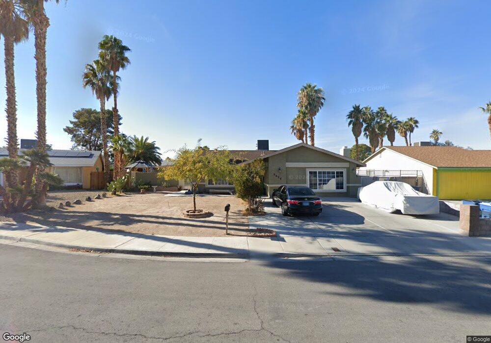
5425 Chestnut St Las Vegas, NV 89119
University District NeighborhoodEstimated Value: $375,670 - $440,000
3
Beds
2
Baths
1,640
Sq Ft
$247/Sq Ft
Est. Value
About This Home
This home is located at 5425 Chestnut St, Las Vegas, NV 89119 and is currently estimated at $404,918, approximately $246 per square foot. 5425 Chestnut St is a home located in Clark County with nearby schools including Gene Ward Elementary School, Jack Dailey Elementary School, and Helen C. Cannon Junior High School.
Ownership History
Date
Name
Owned For
Owner Type
Purchase Details
Closed on
May 23, 2002
Sold by
Smith Robert L and Smith Arlene
Bought by
Guerra Hector and Guerra Lourdes
Current Estimated Value
Home Financials for this Owner
Home Financials are based on the most recent Mortgage that was taken out on this home.
Original Mortgage
$138,050
Outstanding Balance
$58,334
Interest Rate
6.94%
Mortgage Type
FHA
Estimated Equity
$346,584
Create a Home Valuation Report for This Property
The Home Valuation Report is an in-depth analysis detailing your home's value as well as a comparison with similar homes in the area
Home Values in the Area
Average Home Value in this Area
Purchase History
| Date | Buyer | Sale Price | Title Company |
|---|---|---|---|
| Guerra Hector | $140,000 | Equity Title |
Source: Public Records
Mortgage History
| Date | Status | Borrower | Loan Amount |
|---|---|---|---|
| Open | Guerra Hector | $138,050 |
Source: Public Records
Tax History Compared to Growth
Tax History
| Year | Tax Paid | Tax Assessment Tax Assessment Total Assessment is a certain percentage of the fair market value that is determined by local assessors to be the total taxable value of land and additions on the property. | Land | Improvement |
|---|---|---|---|---|
| 2025 | $1,099 | $55,256 | $31,500 | $23,756 |
| 2024 | $1,067 | $55,256 | $31,500 | $23,756 |
| 2023 | $1,067 | $51,496 | $28,700 | $22,796 |
| 2022 | $1,036 | $49,527 | $28,000 | $21,527 |
| 2021 | $1,006 | $45,926 | $24,850 | $21,076 |
| 2020 | $974 | $44,230 | $22,750 | $21,480 |
| 2019 | $962 | $42,379 | $20,650 | $21,729 |
| 2018 | $918 | $39,960 | $18,550 | $21,410 |
| 2017 | $861 | $38,575 | $16,450 | $22,125 |
| 2016 | $861 | $34,992 | $11,900 | $23,092 |
| 2015 | $858 | $32,713 | $9,450 | $23,263 |
| 2014 | $833 | $27,545 | $7,000 | $20,545 |
Source: Public Records
Map
Nearby Homes
- 5375 Chestnut St
- 1963 Rawhide St
- 5399 Surrey St
- 5514 Oxbow St
- 5551 Corral Cir
- 2184 Sunnyslope Ave
- 5260 Dickens Dr
- 1673 Caliente Ct
- 5613 Chestnut St
- 2033 Pommel Ave
- 1655 E Hacienda Ave
- 5445 Caliente St
- 5473 Clydesdale St
- 1688 Mapleton Ln
- 5433 Latigo St
- 5167 Martingale Ave
- 2174 E Russell Rd
- 5473 S Eastern Ave
- 5143 Martingale Ave
- 5403 Tamarus St
- 5415 Chestnut St
- 5435 Chestnut St
- 5430 Oxbow St
- 5440 Oxbow St
- 5440 Oxbow St Unit SFR
- 5405 Chestnut St
- 5405 Chestnut St Unit none
- 5428 Chestnut St
- 5450 Oxbow St
- 5416 Chestnut St
- 5410 Oxbow St
- 1917 Sunnyslope Ave
- 5406 Chestnut St
- 5406 Chestnut St Unit n/a
- 5395 Chestnut St
- 5460 Oxbow St
- 1929 Sunnyslope Ave
- 5400 Oxbow St
- 1945 Sunnyslope Ave
- 5435 Oxbow St