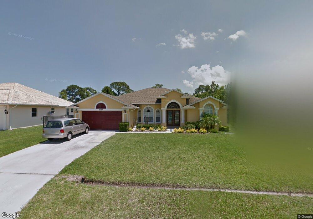
5427 NW Briscoe Dr Port Saint Lucie, FL 34986
Torino NeighborhoodEstimated Value: $418,000 - $499,000
3
Beds
2
Baths
2,053
Sq Ft
$219/Sq Ft
Est. Value
About This Home
This home is located at 5427 NW Briscoe Dr, Port Saint Lucie, FL 34986 and is currently estimated at $450,592, approximately $219 per square foot. 5427 NW Briscoe Dr is a home located in St. Lucie County with nearby schools including West Gate K-8 School, Bayshore Elementary School, and Oak Hammock K-8 School.
Ownership History
Date
Name
Owned For
Owner Type
Purchase Details
Closed on
Jun 10, 2005
Sold by
Daniel Dloughy Homes Inc
Bought by
Allen Earl C and Williams Allen Harriette
Current Estimated Value
Home Financials for this Owner
Home Financials are based on the most recent Mortgage that was taken out on this home.
Original Mortgage
$231,900
Interest Rate
6.94%
Mortgage Type
Purchase Money Mortgage
Create a Home Valuation Report for This Property
The Home Valuation Report is an in-depth analysis detailing your home's value as well as a comparison with similar homes in the area
Home Values in the Area
Average Home Value in this Area
Purchase History
| Date | Buyer | Sale Price | Title Company |
|---|---|---|---|
| Allen Earl C | $289,900 | Fidelity Natl Title Ins Co |
Source: Public Records
Mortgage History
| Date | Status | Borrower | Loan Amount |
|---|---|---|---|
| Closed | Allen Earl C | $57,950 | |
| Previous Owner | Allen Earl C | $231,900 |
Source: Public Records
Tax History Compared to Growth
Tax History
| Year | Tax Paid | Tax Assessment Tax Assessment Total Assessment is a certain percentage of the fair market value that is determined by local assessors to be the total taxable value of land and additions on the property. | Land | Improvement |
|---|---|---|---|---|
| 2024 | $3,056 | $153,822 | -- | -- |
| 2023 | $3,056 | $149,342 | $0 | $0 |
| 2022 | $2,920 | $144,993 | $0 | $0 |
| 2021 | $2,831 | $140,770 | $0 | $0 |
| 2020 | $2,842 | $138,827 | $0 | $0 |
| 2019 | $2,810 | $135,706 | $0 | $0 |
| 2018 | $2,667 | $133,176 | $0 | $0 |
| 2017 | $2,634 | $203,700 | $40,400 | $163,300 |
| 2016 | $2,595 | $183,200 | $29,800 | $153,400 |
| 2015 | $2,619 | $147,500 | $22,100 | $125,400 |
| 2014 | $2,489 | $125,860 | $0 | $0 |
Source: Public Records
Map
Nearby Homes
- 5465 NW Model Ct
- 5515 NW Downs St
- 5411 NW Cromey St
- 5260 NW Gamma St
- 5488 NW Boydga Ave
- 5121 NW Wisk Fern Cir
- 5334 NW Conley Dr
- 5321 NW Conley Dr
- 5443 NW Wisk Fern Cir
- 5231 NW Iredell St
- 5423 NW Wisk Fern Cir
- 2171 NW Treviso Cir
- 5492 NW Dabney Ct
- 5266 NW East Delwood Dr
- 5509 NW Camberly Ct
- 6124 NW Butterfly Orchid Place
- 2900 NW Treviso Cir
- 2880 NW Treviso Cir
- 5501 NW Camberly Ct
- 5501 NW Dabney Ct
- 5429 NW Briscoe Dr
- 5411 NW Bolin St
- 5413 NW Bolin St
- 5454 NW Norris Ave
- 5431 NW Briscoe Dr
- 5415 NW Bolin St
- 5428 NW Briscoe Dr
- 5424 NW Briscoe Dr
- 5433 NW Briscoe Dr
- 5430 NW Briscoe Dr
- 5451 NW Norris Ave
- 5417 NW Bolin St
- 5453 NW Norris Ave
- 5412 NW Bolin St
- 5455 NW Norris Ave
- 5410 NW Bolin St
- 5432 NW Briscoe Dr
- 5414 NW Bolin St
- 5456 NW Model Ct