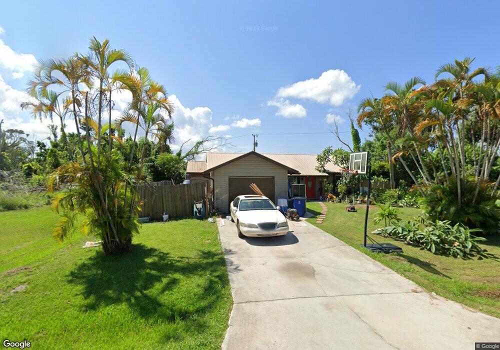
5427 Phillips St Bokeelia, FL 33922
Estimated Value: $231,746 - $258,000
3
Beds
2
Baths
1,278
Sq Ft
$194/Sq Ft
Est. Value
About This Home
This home is located at 5427 Phillips St, Bokeelia, FL 33922 and is currently estimated at $247,687, approximately $193 per square foot. 5427 Phillips St is a home located in Lee County with nearby schools including Pine Island Elementary School, Trafalgar Middle School, and Gulf Middle School.
Ownership History
Date
Name
Owned For
Owner Type
Purchase Details
Closed on
Jan 26, 2021
Sold by
Carner Reid B
Bought by
Darnell Sean
Current Estimated Value
Home Financials for this Owner
Home Financials are based on the most recent Mortgage that was taken out on this home.
Original Mortgage
$152,682
Outstanding Balance
$136,173
Interest Rate
2.67%
Mortgage Type
FHA
Estimated Equity
$111,514
Purchase Details
Closed on
Jul 20, 2006
Sold by
Reader David
Bought by
Carner Reid
Create a Home Valuation Report for This Property
The Home Valuation Report is an in-depth analysis detailing your home's value as well as a comparison with similar homes in the area
Home Values in the Area
Average Home Value in this Area
Purchase History
| Date | Buyer | Sale Price | Title Company |
|---|---|---|---|
| Darnell Sean | $155,500 | Security Ttl & Abstract Llc | |
| Carner Reid | $148,500 | None Available |
Source: Public Records
Mortgage History
| Date | Status | Borrower | Loan Amount |
|---|---|---|---|
| Open | Darnell Sean | $152,682 |
Source: Public Records
Tax History Compared to Growth
Tax History
| Year | Tax Paid | Tax Assessment Tax Assessment Total Assessment is a certain percentage of the fair market value that is determined by local assessors to be the total taxable value of land and additions on the property. | Land | Improvement |
|---|---|---|---|---|
| 2025 | $2,797 | $156,282 | $29,512 | $123,873 |
| 2024 | $3,385 | $167,674 | $32,936 | $131,783 |
| 2023 | $3,385 | $196,702 | $0 | $0 |
| 2022 | $2,916 | $178,820 | $25,200 | $153,620 |
| 2021 | $2,184 | $124,180 | $14,000 | $110,180 |
| 2020 | $2,178 | $122,734 | $14,600 | $108,134 |
| 2019 | $2,158 | $121,124 | $13,181 | $107,943 |
| 2018 | $2,003 | $108,209 | $13,181 | $95,028 |
| 2017 | $1,932 | $101,744 | $8,030 | $93,714 |
| 2016 | $1,857 | $99,557 | $8,030 | $91,527 |
| 2015 | $1,635 | $85,302 | $8,004 | $77,298 |
| 2014 | $1,607 | $88,305 | $8,004 | $80,301 |
| 2013 | -- | $73,697 | $7,083 | $66,614 |
Source: Public Records
Map
Nearby Homes
- 5384 Henley St
- 5582 Henley St
- 5509 Henley St
- 5456 Henley St
- 5395 Avenue E
- 5482 Phillips St
- 5409 Phillips St
- 5523 Thomas St
- 5548 Birdsong Ln
- 5564 Birdsong Ln
- 5428 Avenue C
- 5613 Birdsong Ln
- 10899 Russell Rd
- 10925 Russell Rd
- 10800 Habitat Cir
- 5401 Pine Island Rd NW
- 5567 Judith Rd
- 5675 Pine Island Rd NW
- 10600 Habitat Trail
- 10464 Betsy Pkwy
- 5462 Avenue E Unit 1&2
- 5474 Avenue E
- 5462 Avenue E
- 5460 Avenue E Unit 12
- 5484/5486 Avenue E
- 5428 Phillips St
- 5119 Birdsong Ln
- 5420 Phillips St
- 5452 Avenue E
- 5450 Avenue E
- 5446/5448 Phillips St
- 5446 Phillips St
- 5498 Avenue E
- 5464 Phillips St
- 5392 Phillips St
- 5117 Birdsong Ln
- 5117 Birdsong Ln
- 5181 Birdsong Ln
- 5426 Avenue E
- 5426 Avenue E Unit 9