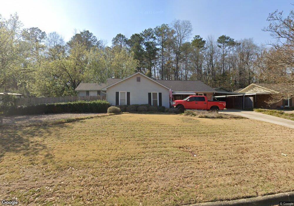
5427 Rockhurst Dr Columbus, GA 31907
Midland NeighborhoodEstimated Value: $186,000 - $208,232
3
Beds
3
Baths
1,311
Sq Ft
$151/Sq Ft
Est. Value
About This Home
This home is located at 5427 Rockhurst Dr, Columbus, GA 31907 and is currently estimated at $197,308, approximately $150 per square foot. 5427 Rockhurst Dr is a home located in Muscogee County with nearby schools including Waddell Elementary School, Midland Middle School, and Hardaway High School.
Ownership History
Date
Name
Owned For
Owner Type
Purchase Details
Closed on
Jun 24, 2008
Sold by
Gut Jacqueline J and Noble Erika S
Bought by
Gut Brandon and Gut Christy T
Current Estimated Value
Home Financials for this Owner
Home Financials are based on the most recent Mortgage that was taken out on this home.
Original Mortgage
$75,000
Outstanding Balance
$47,930
Interest Rate
5.97%
Mortgage Type
Purchase Money Mortgage
Estimated Equity
$149,378
Create a Home Valuation Report for This Property
The Home Valuation Report is an in-depth analysis detailing your home's value as well as a comparison with similar homes in the area
Home Values in the Area
Average Home Value in this Area
Purchase History
| Date | Buyer | Sale Price | Title Company |
|---|---|---|---|
| Gut Brandon | $90,000 | None Available |
Source: Public Records
Mortgage History
| Date | Status | Borrower | Loan Amount |
|---|---|---|---|
| Open | Gut Brandon | $75,000 |
Source: Public Records
Tax History Compared to Growth
Tax History
| Year | Tax Paid | Tax Assessment Tax Assessment Total Assessment is a certain percentage of the fair market value that is determined by local assessors to be the total taxable value of land and additions on the property. | Land | Improvement |
|---|---|---|---|---|
| 2025 | $981 | $57,864 | $11,236 | $46,628 |
| 2024 | $980 | $57,864 | $11,236 | $46,628 |
| 2023 | $292 | $57,864 | $11,236 | $46,628 |
| 2022 | $1,022 | $47,860 | $11,236 | $36,624 |
| 2021 | $1,015 | $45,800 | $11,236 | $34,564 |
| 2020 | $1,015 | $45,800 | $11,236 | $34,564 |
| 2019 | $1,020 | $45,800 | $11,236 | $34,564 |
| 2018 | $1,020 | $45,800 | $11,236 | $34,564 |
| 2017 | $1,025 | $45,800 | $11,236 | $34,564 |
| 2016 | $1,030 | $38,246 | $6,660 | $31,586 |
| 2015 | $632 | $38,246 | $6,660 | $31,586 |
| 2014 | $633 | $38,246 | $6,660 | $31,586 |
| 2013 | -- | $38,246 | $6,660 | $31,586 |
Source: Public Records
Map
Nearby Homes
- 5434 Rockhurst Dr
- 6236 Olde Towne Dr
- 6215 Parker Dr
- 5640 Lakeshore Rd
- 5717 Flat Rock Rd
- 5804 Dearborn Ave
- 7101 Cross Tie Dr
- 5966 Fornof Rd
- 4931 Woodruff Farm Rd
- 6321 Milgen Rd Unit 3
- 5408 Old Dominion Rd
- 5422 Colony Dr
- 6222 Goodwin Dr
- 4700 Bondale Dr
- 6251 Rockefeller Dr
- 5324 Colony Dr
- 7170 Beaver Run Rd
- 6454 Patriot Dr
- 6 Jamestown Ct
- 6437 Woodbriar Ln
- 5433 Rockhurst Dr
- 5415 Rockhurst Dr
- 5439 Rockhurst Dr
- 5428 Rockhurst Dr
- 5422 Rockhurst Dr
- 5445 Rockhurst Dr
- 5409 Rockhurst Dr
- 5416 Rockhurst Dr
- 5440 Rockhurst Dr
- 5410 Rockhurst Dr
- 6400 Sam Hurst Dr
- 5451 Rockhurst Dr
- 4 Ellsworth Ct
- 5401 Rockhurst Dr
- 3 Ellsworth Ct
- 6401 Garnet Dr
- 6408 Sam Hurst Dr
- 5501 Rockhurst Dr
- 5 Ellsworth Ct
- 5375 Rockhurst Dr