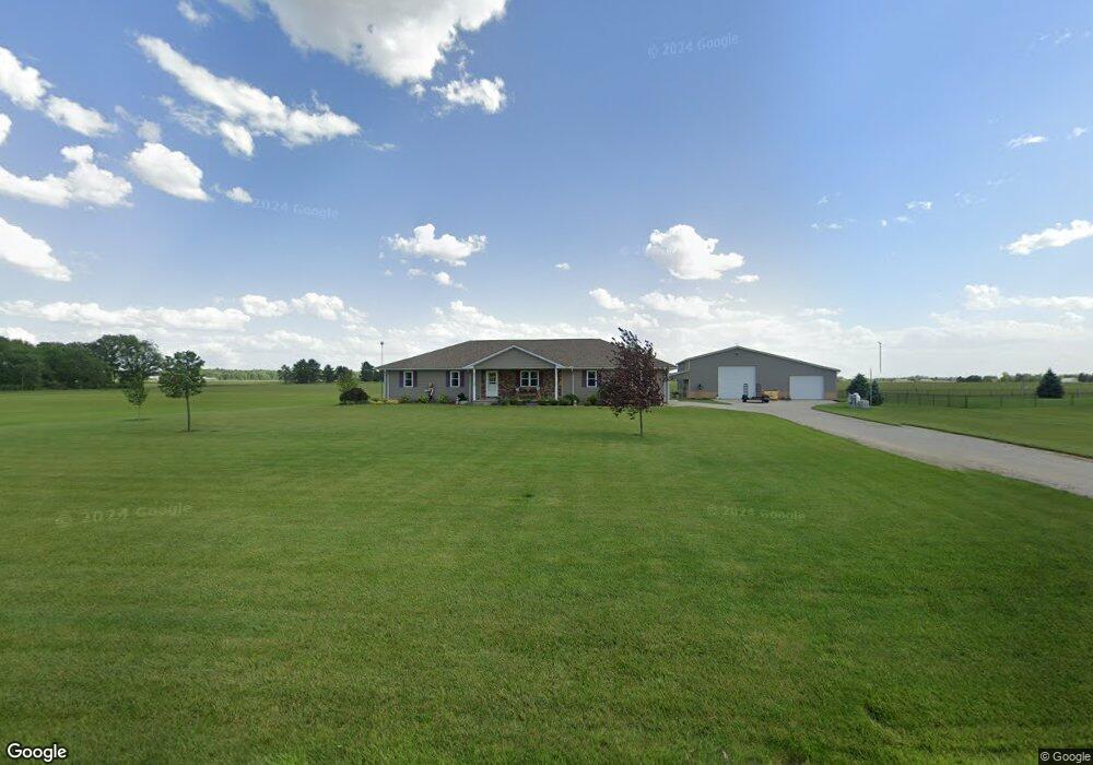
5427 State Route 412 Vickery, OH 43464
Estimated Value: $302,000 - $377,863
2
Beds
2
Baths
1,900
Sq Ft
$180/Sq Ft
Est. Value
About This Home
This home is located at 5427 State Route 412, Vickery, OH 43464 and is currently estimated at $342,288, approximately $180 per square foot. 5427 State Route 412 is a home with nearby schools including Margaretta Elementary School and Margaretta High School.
Ownership History
Date
Name
Owned For
Owner Type
Purchase Details
Closed on
Jul 29, 2025
Sold by
Bruce L Meggitt Trust and Vicki S Meggitt Trust
Bought by
Bruce L Meggitt Trust and Vicki S Meggitt Trust
Current Estimated Value
Purchase Details
Closed on
Dec 1, 2020
Sold by
Meggitt Bruce L Trustee & Vicki S Trustee
Bought by
Meggitt Bruce L Trustee & Vicki S Trustee
Purchase Details
Closed on
Feb 6, 2012
Sold by
Meggitt Bruce L and Meggitt Vicki S
Bought by
Meggitt Bruce L and The Bruce L Meggitt Trust Agreement
Purchase Details
Closed on
Jul 20, 2005
Sold by
Meggitt Bruce L and Meggitt Vicki S
Bought by
Griffith David H and Griffith Karen J
Home Financials for this Owner
Home Financials are based on the most recent Mortgage that was taken out on this home.
Original Mortgage
$179,703
Interest Rate
5.68%
Mortgage Type
Fannie Mae Freddie Mac
Create a Home Valuation Report for This Property
The Home Valuation Report is an in-depth analysis detailing your home's value as well as a comparison with similar homes in the area
Home Values in the Area
Average Home Value in this Area
Purchase History
| Date | Buyer | Sale Price | Title Company |
|---|---|---|---|
| Bruce L Meggitt Trust | -- | None Listed On Document | |
| Bruce L Meggitt Trust | -- | None Listed On Document | |
| Meggitt Bruce L Trustee & Vicki S Trustee | -- | -- | |
| Meggitt Bruce L | -- | Attorney | |
| Griffith David H | -- | -- |
Source: Public Records
Mortgage History
| Date | Status | Borrower | Loan Amount |
|---|---|---|---|
| Previous Owner | Griffith David H | $179,703 |
Source: Public Records
Tax History Compared to Growth
Tax History
| Year | Tax Paid | Tax Assessment Tax Assessment Total Assessment is a certain percentage of the fair market value that is determined by local assessors to be the total taxable value of land and additions on the property. | Land | Improvement |
|---|---|---|---|---|
| 2024 | $4,808 | $121,590 | $10,430 | $111,160 |
| 2023 | $4,808 | $95,770 | $8,230 | $87,540 |
| 2022 | $4,160 | $95,770 | $8,230 | $87,540 |
| 2021 | $4,125 | $95,770 | $8,230 | $87,540 |
| 2020 | $3,938 | $86,000 | $7,460 | $78,540 |
| 2019 | $3,946 | $86,000 | $7,460 | $78,540 |
| 2018 | $4,405 | $86,000 | $7,460 | $78,540 |
| 2017 | $2,589 | $53,940 | $7,460 | $46,480 |
| 2016 | $480 | $3,640 | $3,640 | $0 |
| 2015 | $46 | $3,640 | $3,640 | $0 |
| 2014 | $25 | $1,090 | $1,090 | $0 |
| 2013 | $24 | $1,090 | $1,090 | $0 |
Source: Public Records
Map
Nearby Homes
- 0 County Rd 260 Rd Unit 5061556
- 1766 County Road 260 Elm St
- 710 N State Route 510
- 3850 County Road 231
- 5943 County Road 279
- 550 County Road 242
- 810 N Main St
- 0 Ohio 101
- 625 Ames St
- 0 W Mcpherson Hwy
- 0 Ames St
- 1337 E Sr 20
- 1420 County Road 302 Unit 14
- 0 Durnwald Dr
- CR 260 89.6 acres Durnwald Dr
- 117 Nelson St
- 118 E Buckeye St
- 761 N Woodland Ave
- 1270 W Mcpherson Hwy
- 315 E Grant St
- 5411 State Route 412
- 5391 State Route 412
- 5500 State Route 412
- 5391 Ohio 412
- 5267 State Route 412
- 0 Ohio 412
- 1315 County Road 272
- 5625 State Route 412
- 5647 State Route 412
- 1410 County Road 272
- 5394 County Road 237
- 5407 County Road 237
- 5489 County Road 237
- 5505 County Road 237
- 205 Bellevue
- 1273 County Road 268
- 987 County Road 268
- 5557 County Road 237
- 1212 County Road 268
- 5575 County Road 237