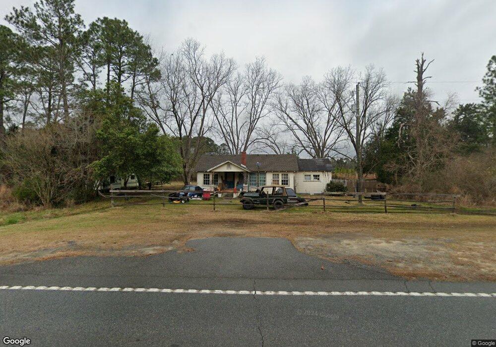
5427 Us Highway 221 Soperton, GA 30457
Estimated Value: $58,099 - $112,000
--
Bed
--
Bath
1,236
Sq Ft
$71/Sq Ft
Est. Value
About This Home
This home is located at 5427 Us Highway 221, Soperton, GA 30457 and is currently estimated at $87,700, approximately $70 per square foot. 5427 Us Highway 221 is a home with nearby schools including Treutlen Elementary School, Treutlen Middle/High School, and Faith Tabernacle Christian Academy.
Ownership History
Date
Name
Owned For
Owner Type
Purchase Details
Closed on
Nov 3, 2020
Sold by
Phillips Family Resources Llc
Bought by
Denham Jonathan
Current Estimated Value
Purchase Details
Closed on
Nov 25, 2014
Sold by
Martin Karen P
Bought by
Phillips Fam Resources Llc
Purchase Details
Closed on
Aug 14, 2014
Sold by
Phillips Mary Ida
Bought by
Martin Karen P and Phillips Kenneth L
Purchase Details
Closed on
Feb 21, 1995
Bought by
Phillips Mrs and Phillips Lonzo
Purchase Details
Closed on
Jan 31, 1995
Sold by
Wight Wight F and Wight Jo
Bought by
Phillips Mary Ida
Purchase Details
Closed on
Jan 30, 1995
Sold by
Phillips Mrs and Phillips Lonzo
Bought by
Wight Wight F and Wight Jo
Create a Home Valuation Report for This Property
The Home Valuation Report is an in-depth analysis detailing your home's value as well as a comparison with similar homes in the area
Home Values in the Area
Average Home Value in this Area
Purchase History
| Date | Buyer | Sale Price | Title Company |
|---|---|---|---|
| Denham Jonathan | $20,000 | -- | |
| Phillips Fam Resources Llc | -- | -- | |
| Martin Karen P | -- | -- | |
| Phillips Mrs | -- | -- | |
| Phillips Mary Ida | $4,500 | -- | |
| Wight Wight F | -- | -- |
Source: Public Records
Tax History Compared to Growth
Tax History
| Year | Tax Paid | Tax Assessment Tax Assessment Total Assessment is a certain percentage of the fair market value that is determined by local assessors to be the total taxable value of land and additions on the property. | Land | Improvement |
|---|---|---|---|---|
| 2024 | $133 | $4,760 | $1,720 | $3,040 |
| 2023 | $133 | $4,760 | $1,720 | $3,040 |
| 2022 | $125 | $4,640 | $1,720 | $2,920 |
| 2021 | $125 | $4,640 | $1,720 | $2,920 |
| 2020 | $125 | $4,640 | $1,720 | $2,920 |
| 2019 | $125 | $4,640 | $1,720 | $2,920 |
| 2018 | $113 | $4,640 | $1,720 | $2,920 |
| 2017 | $123 | $4,640 | $1,720 | $2,920 |
| 2016 | $120 | $4,640 | $1,720 | $2,920 |
| 2015 | -- | $5,840 | $1,720 | $4,120 |
| 2014 | -- | $8,120 | $1,720 | $6,400 |
| 2013 | -- | $8,120 | $1,720 | $6,400 |
Source: Public Records
Map
Nearby Homes
- 4004 E Louisiana Ave
- 46 Georgia 46
- 1785 Martin Luther King jr Dr
- 4687 W Main St
- 7586 Eastman Rd
- 0 Beasley Hill Place Unit 10640367
- 0 Cedar Grove Rd
- 0 Rivoli Clay Rd
- 00 Rivoli Clay Rd
- 1936 Cedar Grove Rd
- 95 Railroad Ave
- 0 Knox Mill Rd Unit 10640244
- 0 Muskogee Trail Unit 25917
- 0 Muskogee Trail Unit LOT 78 20128125
- 0 County Line Rd Unit n/a 113727
- 4281 Ga Highway 46
- 4281 Sr-46
- 481 Windmill Way
- 0 Lake Helen Loop Unit 10640271
- 82 Truckers Trail
- 5373 Us Highway 221
- 5316 Us Highway 221
- 5281 Us Highway 221
- 5262 Us Highway 221
- 5262 Us Highway 221
- 0 Highway 221 Unit 7500476
- 0 Hwy 221 Unit 7548502
- 0 Us Hwy 221 Unit 8035406
- 0 Us Hwy 221 Unit 15257
- 0 Hwy 221 Unit 14732
- 0 Us Hwy 221 Unit 14151
- 0 Highway 221 Unit 10357
- 0 Hwy 221 Unit 10369
- 0 Hwy 221 Unit 10655
- 0 Highway 221 Unit 11180
- 0 Hwy 221 Unit 13312
- 5191 Us Highway 221
- 5735 Us Highway 221
- 5705 Us Highway 221
- 9089 Ga Highway 46