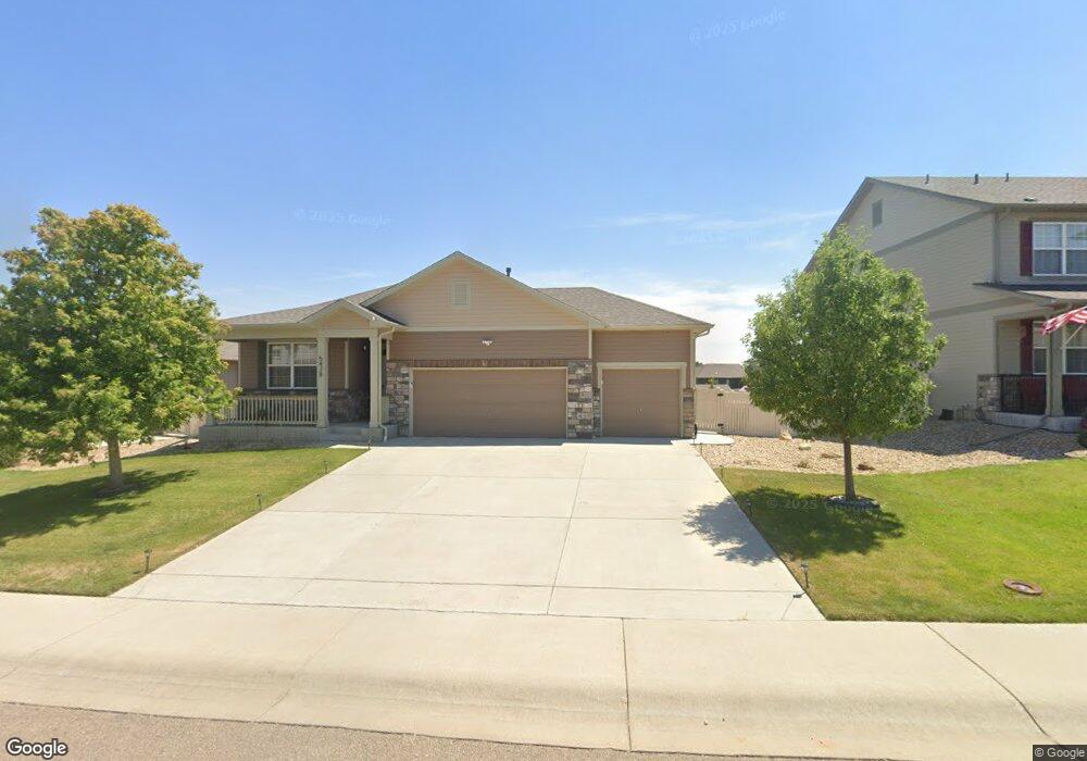
5428 Neighbors Pkwy Firestone, CO 80504
Estimated Value: $534,000 - $565,000
3
Beds
2
Baths
1,724
Sq Ft
$318/Sq Ft
Est. Value
About This Home
This home is located at 5428 Neighbors Pkwy, Firestone, CO 80504 and is currently estimated at $547,407, approximately $317 per square foot. 5428 Neighbors Pkwy is a home with nearby schools including Centennial Elementary School, Coal Ridge Middle School, and Mead High School.
Ownership History
Date
Name
Owned For
Owner Type
Purchase Details
Closed on
Aug 31, 2016
Sold by
Melody Homes Inc
Bought by
West William F and Bell West Donna R
Current Estimated Value
Home Financials for this Owner
Home Financials are based on the most recent Mortgage that was taken out on this home.
Original Mortgage
$348,249
Outstanding Balance
$278,168
Interest Rate
3.43%
Mortgage Type
VA
Estimated Equity
$269,239
Create a Home Valuation Report for This Property
The Home Valuation Report is an in-depth analysis detailing your home's value as well as a comparison with similar homes in the area
Home Values in the Area
Average Home Value in this Area
Purchase History
| Date | Buyer | Sale Price | Title Company |
|---|---|---|---|
| West William F | $340,920 | Heritage Title Co |
Source: Public Records
Mortgage History
| Date | Status | Borrower | Loan Amount |
|---|---|---|---|
| Open | West William F | $348,249 |
Source: Public Records
Tax History Compared to Growth
Tax History
| Year | Tax Paid | Tax Assessment Tax Assessment Total Assessment is a certain percentage of the fair market value that is determined by local assessors to be the total taxable value of land and additions on the property. | Land | Improvement |
|---|---|---|---|---|
| 2025 | $5,402 | $32,990 | $7,380 | $25,610 |
| 2024 | $5,402 | $32,990 | $7,380 | $25,610 |
| 2023 | $5,263 | $36,620 | $7,980 | $28,640 |
| 2022 | $4,367 | $26,950 | $5,980 | $20,970 |
| 2021 | $4,395 | $27,730 | $6,150 | $21,580 |
| 2020 | $4,232 | $26,840 | $4,650 | $22,190 |
| 2019 | $4,272 | $26,840 | $4,650 | $22,190 |
| 2018 | $3,724 | $24,020 | $3,740 | $20,280 |
| 2017 | $3,777 | $24,020 | $3,740 | $20,280 |
| 2016 | $419 | $2,730 | $2,730 | $0 |
| 2015 | $379 | $2,520 | $2,520 | $0 |
| 2014 | $141 | $940 | $940 | $0 |
Source: Public Records
Map
Nearby Homes
- 10134 Carefree St
- 5583 Riverbend Ave
- 5614 Riverbend Ave
- 5286 Rustic Ave
- 10414 Cherryvale St
- 5822 Shenandoah Ave
- 10497 Booth Dr
- 5870 Scenic Ave
- 5230 Warrior St
- 10540 Barron Cir
- 4768 Silverleaf Ave
- 10574 Bald Eagle Cir
- 10686 Baily St Unit 153
- 10597 Bald Eagle Cir Unit 244
- 4795 Audrey St Unit 260
- 10611 Barron Cir Unit 426
- 10844 Belmont St
- 10529 Bald Eagle Cir Unit 394
- 10529 Bald Eagle Cir
- 10818 Cimarron St Unit 307
- 5442 Neighbors Pkwy
- 5416 Neighbors Pkwy
- 5456 Neighbors Pkwy
- 5404 Neighbors Pkwy
- 5417 Neighbors Pkwy
- 5455 Scenic Ave
- 5441 Neighbors Pkwy
- 5407 Neighbors Pkwy
- 5451 Scenic Ave
- 5470 Neighbors Pkwy
- 5455 Neighbors Pkwy
- 5397 Neighbors Pkwy
- 10210 Cedar St
- 5384 Neighbors Pkwy
- 5469 Neighbors Pkwy
- 10206 Cedar St
- 10252 Stagecoach Ave
- 10316 Chinook St
- 5387 Neighbors Pkwy
- 5400 Silverleaf Ave