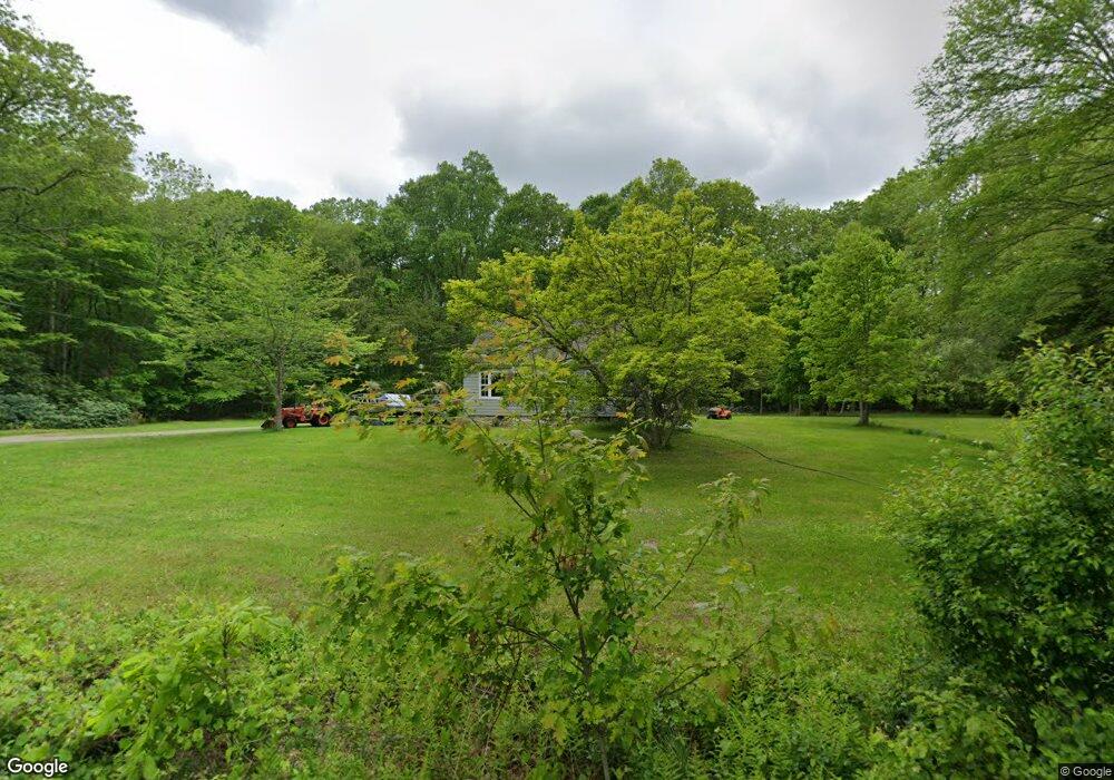
543 Al Harvey Rd Stonington, CT 06378
Estimated Value: $368,000 - $464,289
3
Beds
2
Baths
1,152
Sq Ft
$361/Sq Ft
Est. Value
About This Home
This home is located at 543 Al Harvey Rd, Stonington, CT 06378 and is currently estimated at $416,072, approximately $361 per square foot. 543 Al Harvey Rd is a home located in New London County with nearby schools including Stonington Middle School, Stonington High School, and North Stonington Christian Academy.
Ownership History
Date
Name
Owned For
Owner Type
Purchase Details
Closed on
Nov 22, 1993
Sold by
Blanchard Jessie J
Bought by
Lorch William C
Current Estimated Value
Home Financials for this Owner
Home Financials are based on the most recent Mortgage that was taken out on this home.
Original Mortgage
$91,900
Interest Rate
6.77%
Mortgage Type
Unknown
Create a Home Valuation Report for This Property
The Home Valuation Report is an in-depth analysis detailing your home's value as well as a comparison with similar homes in the area
Home Values in the Area
Average Home Value in this Area
Purchase History
| Date | Buyer | Sale Price | Title Company |
|---|---|---|---|
| Lorch William C | $115,000 | -- | |
| Lorch William C | $115,000 | -- |
Source: Public Records
Mortgage History
| Date | Status | Borrower | Loan Amount |
|---|---|---|---|
| Open | Lorch William C | $114,000 | |
| Closed | Lorch William C | $91,900 |
Source: Public Records
Tax History Compared to Growth
Tax History
| Year | Tax Paid | Tax Assessment Tax Assessment Total Assessment is a certain percentage of the fair market value that is determined by local assessors to be the total taxable value of land and additions on the property. | Land | Improvement |
|---|---|---|---|---|
| 2025 | $6,034 | $291,800 | $146,800 | $145,000 |
| 2024 | $5,821 | $291,800 | $146,800 | $145,000 |
| 2023 | $5,792 | $291,800 | $146,800 | $145,000 |
| 2022 | $5,715 | $216,800 | $125,700 | $91,100 |
| 2021 | $3,847 | $216,800 | $125,700 | $91,100 |
| 2020 | $5,693 | $216,800 | $125,700 | $91,100 |
| 2019 | $3,801 | $216,800 | $125,700 | $91,100 |
| 2018 | $5,546 | $216,800 | $125,700 | $91,100 |
| 2017 | $3,933 | $215,800 | $131,300 | $84,500 |
| 2016 | $5,451 | $215,800 | $131,300 | $84,500 |
| 2015 | $5,227 | $215,800 | $131,300 | $84,500 |
| 2014 | $5,013 | $215,800 | $131,300 | $84,500 |
Source: Public Records
Map
Nearby Homes
- 137 Stephen Dr
- 130 Stephen Dr
- 22 Oak Ln
- 106 Stephen Dr
- 508 Al Harvey Rd
- 15 Circle Dr
- 1 Circle Dr
- 360 New London Turnpike
- 368 N Stonington Rd
- 355 N Stonington Rd
- 55 Wolf Neck Rd
- 41 Wolf Neck Rd
- 587 Taugwonk Rd
- 579 Taugwonk Rd
- 69 Wolf Neck Rd
- 188 Wolf Neck Rd
- 362 Lantern Hill Rd
- 332 Lantern Hill Rd
- 216 Al Harvey Rd
- 135 Stony Brook Rd
- 531 Al Harvey Rd
- 550 A Al Harvey Rd
- 518 Al Harvey Rd
- 485 New London Turnpike
- 519 Al Harvey Rd
- 506 Al Harvey Rd
- 506 Al Harvey Rd Unit 1
- 491 New London Turnpike
- 544 New London Turnpike
- 490 Al Harvey Rd
- 591 New London Turnpike
- 597 New London Turnpike
- 560 New London Turnpike
- Lot New London Turnpike
- 592 New London Turnpike
- 564 New London Turnpike
- 578 New London Turnpike
- 450 Al Harvey Rd
- 630 Al Harvey Rd
- 630 Al Harvey Rd Unit B