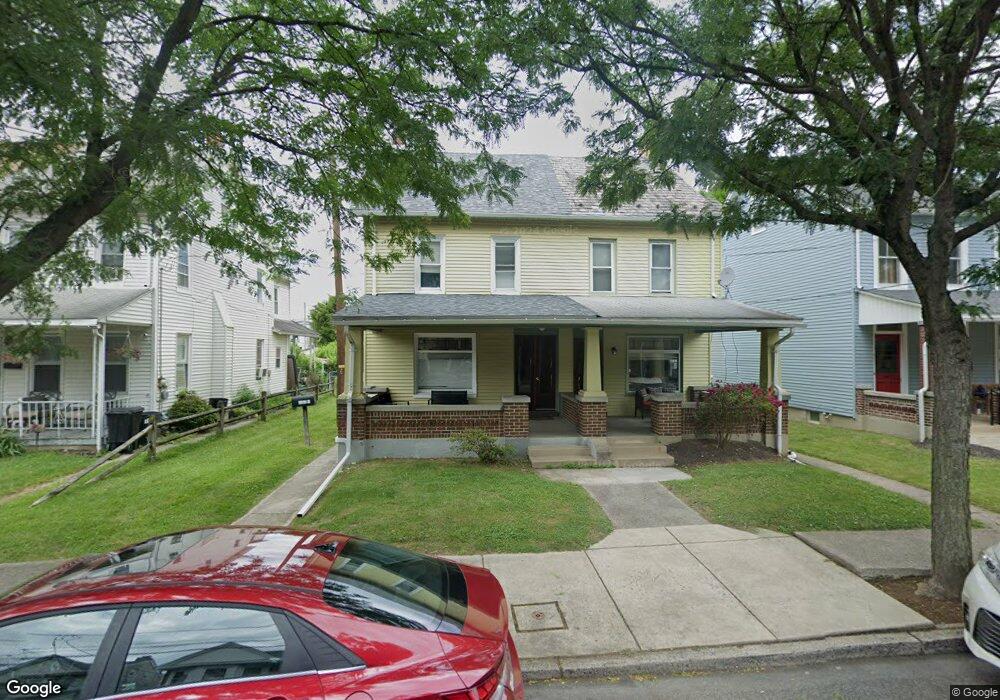
543 Chestnut St Unit 2 Emmaus, PA 18049
Estimated Value: $303,000 - $369,000
4
Beds
3
Baths
2,564
Sq Ft
$127/Sq Ft
Est. Value
About This Home
This home is located at 543 Chestnut St Unit 2, Emmaus, PA 18049 and is currently estimated at $324,656, approximately $126 per square foot. 543 Chestnut St Unit 2 is a home located in Lehigh County with nearby schools including Jefferson Elementary School, Lower Macungie Middle School, and Emmaus High School.
Ownership History
Date
Name
Owned For
Owner Type
Purchase Details
Closed on
Sep 5, 2019
Sold by
Minton Jeffrey W
Bought by
Just Limin Llc
Current Estimated Value
Purchase Details
Closed on
Jun 26, 2012
Sold by
Gilbert Gary R
Bought by
Minton Jeffrey W
Home Financials for this Owner
Home Financials are based on the most recent Mortgage that was taken out on this home.
Original Mortgage
$170,563
Interest Rate
3.84%
Mortgage Type
FHA
Purchase Details
Closed on
Dec 14, 1945
Bought by
Gilbert Verna
Create a Home Valuation Report for This Property
The Home Valuation Report is an in-depth analysis detailing your home's value as well as a comparison with similar homes in the area
Home Values in the Area
Average Home Value in this Area
Purchase History
| Date | Buyer | Sale Price | Title Company |
|---|---|---|---|
| Just Limin Llc | $170,000 | Keystone Premier Setmnt Svcs | |
| Minton Jeffrey W | $175,000 | -- | |
| Gilbert Verna | -- | -- |
Source: Public Records
Mortgage History
| Date | Status | Borrower | Loan Amount |
|---|---|---|---|
| Previous Owner | Minton Jeffrey W | $170,563 |
Source: Public Records
Tax History Compared to Growth
Tax History
| Year | Tax Paid | Tax Assessment Tax Assessment Total Assessment is a certain percentage of the fair market value that is determined by local assessors to be the total taxable value of land and additions on the property. | Land | Improvement |
|---|---|---|---|---|
| 2025 | $5,953 | $169,000 | $24,800 | $144,200 |
| 2024 | $5,453 | $169,000 | $24,800 | $144,200 |
| 2023 | $5,347 | $169,000 | $24,800 | $144,200 |
| 2022 | $5,171 | $169,000 | $144,200 | $24,800 |
| 2021 | $5,041 | $169,000 | $24,800 | $144,200 |
| 2020 | $4,998 | $169,000 | $24,800 | $144,200 |
| 2019 | $4,864 | $169,000 | $24,800 | $144,200 |
| 2018 | $4,681 | $169,000 | $24,800 | $144,200 |
| 2017 | $4,537 | $169,000 | $24,800 | $144,200 |
| 2016 | -- | $169,000 | $24,800 | $144,200 |
| 2015 | -- | $169,000 | $24,800 | $144,200 |
| 2014 | -- | $169,000 | $24,800 | $144,200 |
Source: Public Records
Map
Nearby Homes
- 569 Chestnut St Unit 571
- 543 Long St
- 657 Walnut St
- 659 Broad St
- 331 Minor St
- 120 N 2nd St
- 521 Wood St
- 118 N 2nd St
- 610 Wood St
- 41 S 2nd St
- 106 Garden Ct
- 104 Garden Ct
- 943 N 6th St
- 507 Iroquois St
- 101 E George St
- 3430 Gentlewind Way Unit IC 109
- 4109 Eveningstar Rd
- 3420 Gentlewind Way Unit IC 110
- 339 Delong Ave Unit 343
- 4360 Hillary Dr
- 543 Chestnut St
- 543 Chestnut St Unit Rear Bldg
- 541 Chestnut St
- 547 Chestnut St
- 549 Chestnut St
- 551 Chestnut St
- 533 Chestnut St
- 553 Chestnut St
- 555 Chestnut St
- 557 Chestnut St
- 557 Chestnut St Unit 2
- 559 Chestnut St
- 523 Chestnut St
- 546 Chestnut St
- 548 Chestnut St
- 544 Chestnut St
- 550 Chestnut St
- 542 Chestnut St
- 552 Chestnut St
- 540 Chestnut St