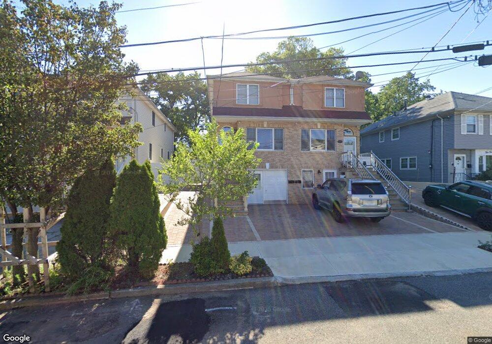
543 Hanover Ave Staten Island, NY 10304
Concord NeighborhoodEstimated Value: $733,000 - $848,000
3
Beds
3
Baths
1,440
Sq Ft
$543/Sq Ft
Est. Value
About This Home
This home is located at 543 Hanover Ave, Staten Island, NY 10304 and is currently estimated at $782,262, approximately $543 per square foot. 543 Hanover Ave is a home located in Richmond County with nearby schools including P.S. 48 - William C. Wilcox, I.S. 49 Berta A Dreyfus, and New Dorp High School.
Ownership History
Date
Name
Owned For
Owner Type
Purchase Details
Closed on
Apr 15, 2021
Sold by
Chan Suk Ching
Bought by
Li Miranda Q
Current Estimated Value
Purchase Details
Closed on
Feb 5, 2020
Sold by
Li Miranda Q
Bought by
Li Miranda Q and Lin Peter
Purchase Details
Closed on
Mar 15, 2017
Sold by
Li Miranda Q
Bought by
Li Miranda Q and Chan Suk Ching
Purchase Details
Closed on
Feb 20, 1997
Sold by
Larson Judith E
Bought by
Larson Judith E
Create a Home Valuation Report for This Property
The Home Valuation Report is an in-depth analysis detailing your home's value as well as a comparison with similar homes in the area
Home Values in the Area
Average Home Value in this Area
Purchase History
| Date | Buyer | Sale Price | Title Company |
|---|---|---|---|
| Li Miranda Q | -- | None Available | |
| Li Miranda Q | -- | Federal Standard Abstract In | |
| Li Miranda Q | -- | None Available | |
| Larson Judith E | -- | -- |
Source: Public Records
Tax History Compared to Growth
Tax History
| Year | Tax Paid | Tax Assessment Tax Assessment Total Assessment is a certain percentage of the fair market value that is determined by local assessors to be the total taxable value of land and additions on the property. | Land | Improvement |
|---|---|---|---|---|
| 2025 | $6,924 | $47,160 | $5,393 | $41,767 |
| 2024 | $6,924 | $46,320 | $5,180 | $41,140 |
| 2023 | $6,615 | $32,573 | $4,630 | $27,943 |
| 2022 | $6,503 | $44,580 | $6,960 | $37,620 |
| 2021 | $6,793 | $41,340 | $6,960 | $34,380 |
| 2020 | $6,446 | $40,260 | $6,960 | $33,300 |
| 2019 | $6,010 | $39,360 | $6,960 | $32,400 |
| 2018 | $5,533 | $27,144 | $5,583 | $21,561 |
| 2017 | $5,533 | $27,144 | $6,573 | $20,571 |
| 2016 | $5,377 | $26,898 | $6,768 | $20,130 |
| 2015 | $4,594 | $25,376 | $5,139 | $20,237 |
| 2014 | $4,594 | $23,940 | $5,820 | $18,120 |
Source: Public Records
Map
Nearby Homes
- 561 Hanover Ave
- 1890 Clove Rd
- 72 Alan Loop
- 31 Alan Loop Unit 65
- 1 Neckar Ave
- 4 Sheridan Ave
- 325 Oder Ave
- 164 Stonegate Dr
- 315 Oder Ave
- 24 Roosevelt St
- 174 Pierce St
- 190A Pierce St
- 15 Roosevelt St
- 0 Douglas Rd
- 190 Pierce St Unit A
- 56 Stonegate Dr
- 215 Pierce St
- 63 Gateway Dr Unit 172
- 1 Douglas Ct
- 80 Hillcrest Terrace
- 541 Hanover Ave Unit 545
- 541-545 Hanover Ave
- 545 Hanover Ave
- 539 Hanover Ave
- 547 Hanover Ave
- 549 Hanover Ave
- 553 Hanover Ave
- 1926 Clove Rd
- 1924 Clove Rd
- 1928 Clove Rd
- 555 Hanover Ave
- 546 Hanover Ave
- 1936 Clove Rd
- 1936 Clove Rd Unit 2
- 540 Hanover Ave
- 557 Hanover Ave
- 550 Hanover Ave
- 536 Hanover Ave
- 1938 Clove Rd
- 552 Hanover Ave