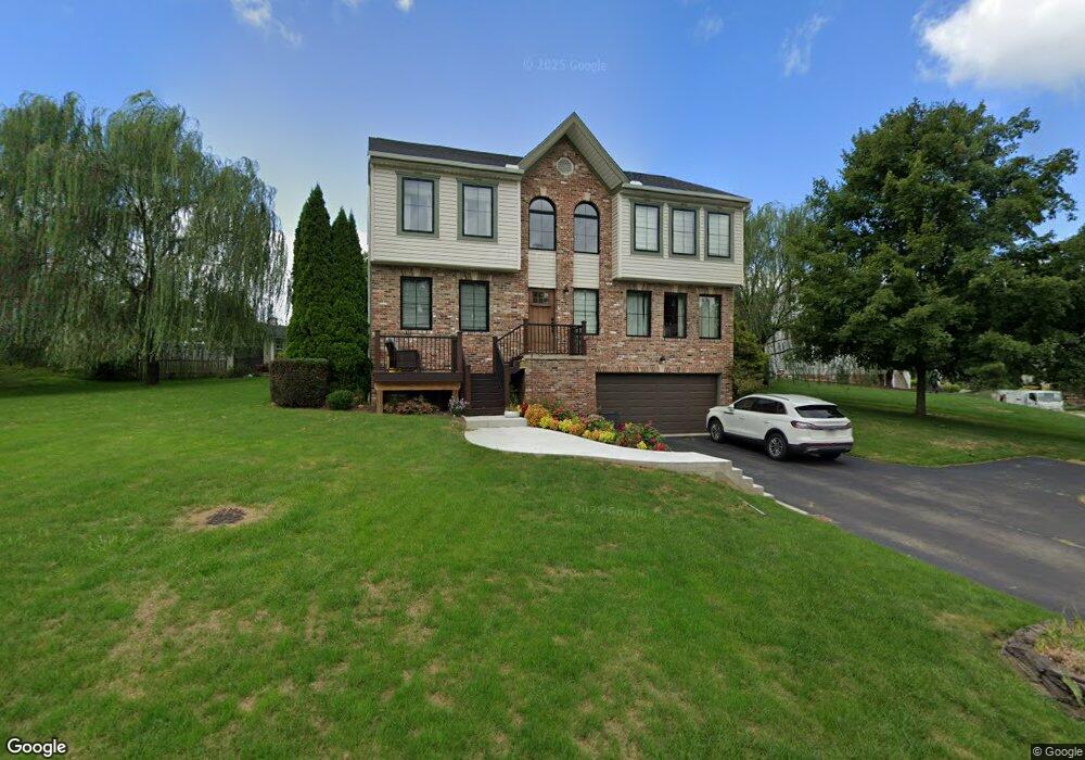
543 Jackson Dr Apollo, PA 15613
Washington Township NeighborhoodEstimated Value: $337,000 - $404,000
--
Bed
--
Bath
2,240
Sq Ft
$164/Sq Ft
Est. Value
About This Home
This home is located at 543 Jackson Dr, Apollo, PA 15613 and is currently estimated at $368,000, approximately $164 per square foot. 543 Jackson Dr is a home located in Westmoreland County with nearby schools including Kiski Area High School.
Ownership History
Date
Name
Owned For
Owner Type
Purchase Details
Closed on
Dec 31, 2001
Sold by
Maronda Homes Inc
Bought by
Caron Daniel J and Caron Dena M
Current Estimated Value
Home Financials for this Owner
Home Financials are based on the most recent Mortgage that was taken out on this home.
Original Mortgage
$155,700
Outstanding Balance
$63,626
Interest Rate
7.04%
Mortgage Type
Purchase Money Mortgage
Estimated Equity
$304,374
Create a Home Valuation Report for This Property
The Home Valuation Report is an in-depth analysis detailing your home's value as well as a comparison with similar homes in the area
Home Values in the Area
Average Home Value in this Area
Purchase History
| Date | Buyer | Sale Price | Title Company |
|---|---|---|---|
| Caron Daniel J | $164,175 | -- |
Source: Public Records
Mortgage History
| Date | Status | Borrower | Loan Amount |
|---|---|---|---|
| Open | Caron Daniel J | $155,700 |
Source: Public Records
Tax History Compared to Growth
Tax History
| Year | Tax Paid | Tax Assessment Tax Assessment Total Assessment is a certain percentage of the fair market value that is determined by local assessors to be the total taxable value of land and additions on the property. | Land | Improvement |
|---|---|---|---|---|
| 2025 | $5,286 | $35,440 | $4,110 | $31,330 |
| 2024 | $5,012 | $35,440 | $4,110 | $31,330 |
| 2023 | $4,574 | $35,440 | $4,110 | $31,330 |
| 2022 | $4,433 | $35,440 | $4,110 | $31,330 |
| 2021 | $4,434 | $35,440 | $4,110 | $31,330 |
| 2020 | $4,422 | $35,440 | $4,110 | $31,330 |
| 2019 | $4,368 | $35,440 | $4,110 | $31,330 |
| 2018 | $4,297 | $35,440 | $4,110 | $31,330 |
| 2017 | $4,192 | $35,440 | $4,110 | $31,330 |
| 2016 | $4,127 | $35,440 | $4,110 | $31,330 |
| 2015 | $4,127 | $35,440 | $4,110 | $31,330 |
| 2014 | $4,105 | $35,440 | $4,110 | $31,330 |
Source: Public Records
Map
Nearby Homes
- Parcel A Beighley Rd
- 1749 Washington Rd
- 5330 Greensburg Rd
- 474 Exton Lake Rd
- 145 Shelby Ln
- 4302 Michel Ct
- 4677 Hilty Rd
- 1248 Saltsburg Rd
- 3513 Lashan Dr
- 5150 Mamont Rd
- 5879 Steele Rd
- 440 Chapeldale Dr
- 4830 Dargate Ln
- 185 Kistler Dr
- 4838 Sardis Rd
- Lot 1 Sardis Rd
- Lot 2 Sardis Rd
- 280 Kistler Dr
- 3913 Bridgewood Cir
- 4941 Bulltown Rd