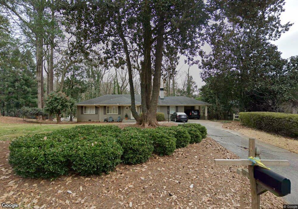
543 Loridans Dr NE Unit 1 Atlanta, GA 30342
North Buckhead NeighborhoodEstimated Value: $874,000 - $1,078,000
2
Beds
2
Baths
3,013
Sq Ft
$326/Sq Ft
Est. Value
About This Home
This home is located at 543 Loridans Dr NE Unit 1, Atlanta, GA 30342 and is currently estimated at $982,396, approximately $326 per square foot. 543 Loridans Dr NE Unit 1 is a home located in Fulton County with nearby schools including Smith Elementary School, Sutton Middle School, and North Atlanta High School.
Ownership History
Date
Name
Owned For
Owner Type
Purchase Details
Closed on
Jan 26, 2001
Sold by
Jackson James M
Bought by
Jackson James M and Jackson Barbara P
Current Estimated Value
Home Financials for this Owner
Home Financials are based on the most recent Mortgage that was taken out on this home.
Original Mortgage
$255,000
Outstanding Balance
$91,972
Interest Rate
7.06%
Mortgage Type
New Conventional
Estimated Equity
$890,424
Purchase Details
Closed on
Oct 10, 1997
Sold by
Meyers Katherine J
Bought by
Starling Michael S
Home Financials for this Owner
Home Financials are based on the most recent Mortgage that was taken out on this home.
Original Mortgage
$183,200
Interest Rate
6.5%
Mortgage Type
New Conventional
Create a Home Valuation Report for This Property
The Home Valuation Report is an in-depth analysis detailing your home's value as well as a comparison with similar homes in the area
Home Values in the Area
Average Home Value in this Area
Purchase History
| Date | Buyer | Sale Price | Title Company |
|---|---|---|---|
| Jackson James M | -- | -- | |
| Jackson James M | $300,000 | -- | |
| Starling Michael S | $229,000 | -- |
Source: Public Records
Mortgage History
| Date | Status | Borrower | Loan Amount |
|---|---|---|---|
| Open | Jackson James M | $255,000 | |
| Previous Owner | Starling Michael S | $183,200 |
Source: Public Records
Tax History Compared to Growth
Tax History
| Year | Tax Paid | Tax Assessment Tax Assessment Total Assessment is a certain percentage of the fair market value that is determined by local assessors to be the total taxable value of land and additions on the property. | Land | Improvement |
|---|---|---|---|---|
| 2025 | $6,903 | $329,920 | $146,600 | $183,320 |
| 2023 | $11,910 | $287,680 | $168,880 | $118,800 |
| 2022 | $8,445 | $287,680 | $168,880 | $118,800 |
| 2021 | $7,746 | $307,440 | $168,880 | $138,560 |
| 2020 | $7,759 | $260,000 | $96,640 | $163,360 |
| 2019 | $497 | $260,000 | $96,640 | $163,360 |
| 2018 | $7,022 | $268,960 | $96,640 | $172,320 |
| 2017 | $7,311 | $198,080 | $73,720 | $124,360 |
| 2016 | $6,921 | $198,080 | $73,720 | $124,360 |
| 2015 | $6,224 | $160,680 | $73,720 | $86,960 |
| 2014 | $5,923 | $160,680 | $73,720 | $86,960 |
Source: Public Records
Map
Nearby Homes
- 4082 McClatchey Cir NE
- 4056 McClatchey Cir NE
- 4366 Skyland Dr NE
- 4288 Olde Mill Ln NE
- 4217 Wieuca Overlook NE
- 4276 Wieuca Rd NE
- 9468 Pincecrest Path Unit 321
- 4097 Wieuca Rd NE
- 4225 Wieuca Rd NE
- 514 Valley Green Dr NE Unit 5
- 337 W Wieuca Rd NE
- 4212 Wieuca Rd NE
- 333 W Wieuca Rd NE
- 329 W Wieuca Rd NE
- 306 Pinecrest Rd NE
- 4036 Statewood Rd NE
- 4620 Wieuca Rd NE Unit 25
- 4620 Wieuca Rd NE Unit 26
- 553 Loridans Dr NE
- 4261 Potters Walk NE
- 4251 Potters Walk NE
- 4087 McClatchey Cir NE Unit 7
- 561 Loridans Dr NE
- 4099 McClatchey Cir NE
- 4075 McClatchey Cir NE
- 544 Loridans Dr NE
- 4260 Potters Walk NE
- 554 Loridans Dr NE
- 569 Loridans Dr NE Unit 1
- 532 Loridans Dr NE
- 4051 McClatchey Cir NE
- 4231 Potters Walk NE
- 562 Loridans Dr NE
- 4240 Potters Walk NE
- 523 Loridans Dr NE
- 577 Loridans Dr NE
- 4039 McClatchey Cir NE
- 512 Loridans Dr NE