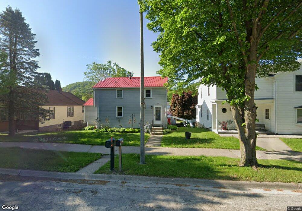
543 Main St Lansing, IA 52151
Estimated Value: $168,000 - $227,000
About This Home
This home is located at 543 Main St, Lansing, IA 52151 and is currently estimated at $190,732, approximately $169 per square foot. 543 Main St is a home with nearby schools including New Albin Elementary School, Lansing Middle School, and Kee High School.
Ownership History
We collect this data history from publicly available records. To have your information removed, we recommend requesting removal directly through your county’s website.
Purchase Details
Home Financials for this Owner
Home Financials are based on the most recent Mortgage that was taken out on this home.Purchase History
We collect this data history from publicly available records. To have your information removed, we recommend requesting removal directly through your county’s website.
| Date | Buyer | Sale Price | Title Company |
|---|---|---|---|
| $67,000 | None Available |
Mortgage History
We collect this data history from publicly available records. To have your information removed, we recommend requesting removal directly through your county’s website.
| Date | Status | Borrower | Loan Amount |
|---|---|---|---|
| Open | $53,600 |
Tax History
We collect this data history from publicly available records. To have your information removed, we recommend requesting removal directly through your county’s website.
| Year | Tax Paid | Tax Assessment Tax Assessment Total Assessment is a certain percentage of the fair market value that is determined by local assessors to be the total taxable value of land and additions on the property. | Land | Improvement |
|---|---|---|---|---|
| 2025 | $2,488 | $158,100 | $19,100 | $139,000 |
| 2024 | $2,488 | $141,800 | $11,200 | $130,600 |
| 2023 | $2,528 | $141,800 | $11,200 | $130,600 |
| 2022 | $2,082 | $101,900 | $11,200 | $90,700 |
| 2021 | $2,230 | $101,900 | $11,200 | $90,700 |
| 2020 | $2,230 | $102,900 | $11,200 | $91,700 |
| 2019 | $2,018 | $91,200 | $0 | $0 |
| 2018 | $1,984 | $91,200 | $0 | $0 |
| 2017 | $1,984 | $79,600 | $0 | $0 |
| 2016 | $1,626 | $79,600 | $0 | $0 |
| 2015 | $1,626 | $79,600 | $0 | $0 |
| 2014 | $1,546 | $80,600 | $0 | $0 |
Map
- 514 Main St
- 399 Center St
- Lot 4 Majestic Heights Ln
- 1440 Westgate Dr
- 1381 N 2nd St
- 420 Lansing Harpers Rd
- 1930 Hideaway Hills Ln Unit 36
- 2183 Waterview Ln
- 1906 Blue Heron Ln
- 1886 Great River Rd
- Lot 6 Grand View Dr
- 11215 Midway Ct
- 1862 Village Creek Dr
- 65566 Desoto Ridge Dr
- 65741 Desoto Bluffs Dr
- 0 Desoto Bluffs Dr Unit 1936123
- 65930 Desoto Bluffs Dr
- 65416 Desoto Bluffs Dr
- 1738 Point Vista Ln
- 1580 Lansing Harpers Rd
Ask me questions while you tour the home.