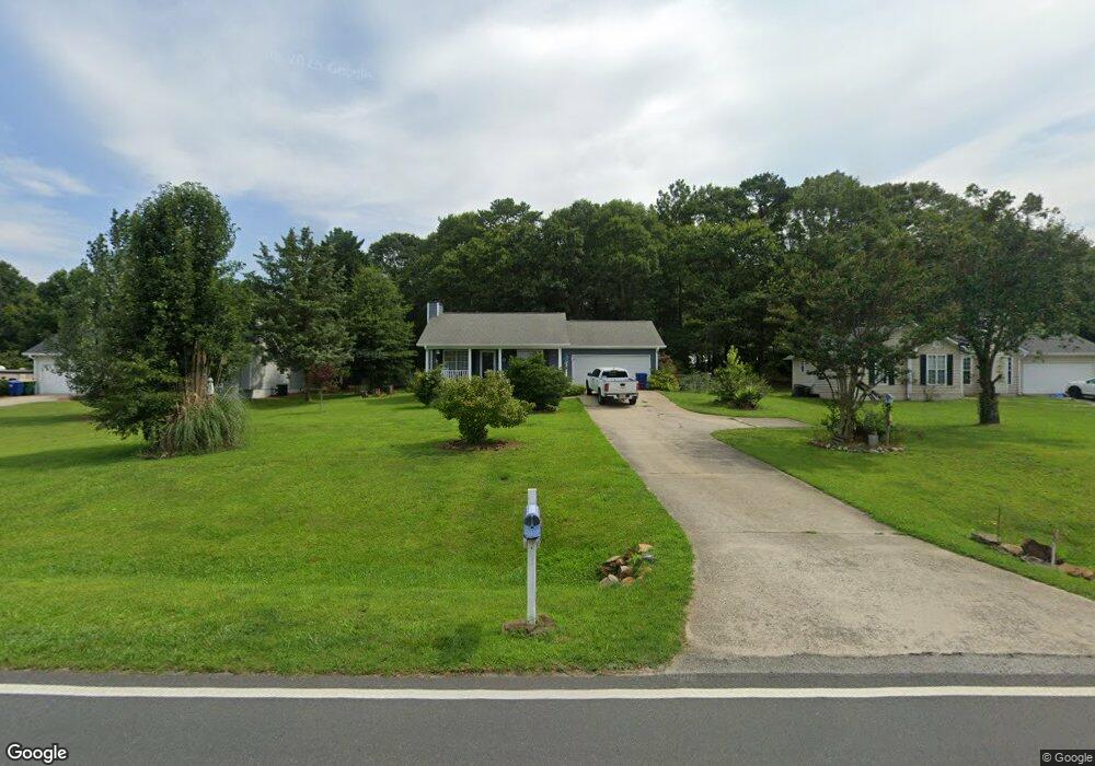
543 Miles Patrick Rd Winder, GA 30680
Estimated Value: $267,000 - $318,000
3
Beds
2
Baths
1,242
Sq Ft
$236/Sq Ft
Est. Value
About This Home
This home is located at 543 Miles Patrick Rd, Winder, GA 30680 and is currently estimated at $293,063, approximately $235 per square foot. 543 Miles Patrick Rd is a home located in Barrow County with nearby schools including County Line Elementary School, Russell Middle School, and Winder-Barrow High School.
Ownership History
Date
Name
Owned For
Owner Type
Purchase Details
Closed on
Jan 15, 1998
Sold by
Taylor Jane M
Bought by
Self Mitchell C and Robinson Julie A
Current Estimated Value
Home Financials for this Owner
Home Financials are based on the most recent Mortgage that was taken out on this home.
Original Mortgage
$72,250
Outstanding Balance
$11,313
Interest Rate
7.16%
Mortgage Type
New Conventional
Estimated Equity
$281,750
Purchase Details
Closed on
Aug 6, 1993
Sold by
Farmer Daniel B
Bought by
Taylor Jone M
Home Financials for this Owner
Home Financials are based on the most recent Mortgage that was taken out on this home.
Original Mortgage
$61,600
Interest Rate
7.26%
Create a Home Valuation Report for This Property
The Home Valuation Report is an in-depth analysis detailing your home's value as well as a comparison with similar homes in the area
Home Values in the Area
Average Home Value in this Area
Purchase History
| Date | Buyer | Sale Price | Title Company |
|---|---|---|---|
| Self Mitchell C | $85,000 | -- | |
| Taylor Jone M | $64,900 | -- |
Source: Public Records
Mortgage History
| Date | Status | Borrower | Loan Amount |
|---|---|---|---|
| Open | Self Mitchell C | $72,250 | |
| Previous Owner | Taylor Jone M | $61,600 |
Source: Public Records
Tax History
| Year | Tax Paid | Tax Assessment Tax Assessment Total Assessment is a certain percentage of the fair market value that is determined by local assessors to be the total taxable value of land and additions on the property. | Land | Improvement |
|---|---|---|---|---|
| 2025 | $1,708 | $64,380 | $16,800 | $47,580 |
| 2024 | $1,713 | $63,008 | $16,800 | $46,208 |
| 2023 | $1,232 | $63,008 | $16,800 | $46,208 |
| 2022 | $1,716 | $52,222 | $16,800 | $35,422 |
| 2021 | $1,724 | $46,222 | $10,800 | $35,422 |
| 2020 | $1,650 | $46,222 | $10,800 | $35,422 |
| 2019 | $1,626 | $44,821 | $10,800 | $34,021 |
| 2018 | $1,622 | $44,821 | $10,800 | $34,021 |
| 2017 | $1,044 | $34,984 | $10,800 | $24,184 |
| 2016 | $1,183 | $34,299 | $12,000 | $22,299 |
| 2015 | $1,194 | $34,576 | $12,000 | $22,576 |
| 2014 | $1,006 | $28,733 | $5,880 | $22,853 |
| 2013 | -- | $27,677 | $5,880 | $21,797 |
Source: Public Records
Map
Nearby Homes
- 128 Northridge Dr
- 538 Valleyview Dr
- 932 Century Oak Dr
- 2050 Whispering Way
- 845 Idlewood Rd
- 311 Rockwell Church Rd NW
- 615 Wellington Dr
- 27 Creekside Dr
- 716 Michael Dr
- 421 N 5th Ave
- 0 E Northcrest Dr Unit 10648147
- 469 Plantation Dr
- 403 Ryan Cir
- 318 Ryan Rd
- 436 Northcrest Dr
- 236 Hidden Ct
- 222 Ryan Rd
- 223 Lacey Ln
- 719 Mallard Dr
- 326 Miles Patrick Rd
- 539 Miles Patrick Rd
- 547 Miles Patrick Rd
- 535 Miles Patrick Rd
- 551 Miles Patrick Rd
- 102 Ashwood Dr Unit 1
- 540 Miles Patrick Rd Unit 1
- 536 Miles Patrick Rd
- 531 Miles Patrick Rd
- 555 Miles Patrick Rd
- 105 Northridge Dr
- 103 Ashwood Dr
- 104 Ashwood Dr
- 104 Ashwood Dr Unit 1
- 96 Northridge Dr Unit 10
- 109 Northridge Dr
- 559 Miles Patrick Rd
- 521 Miles Patrick Rd
- 111 Northridge Dr
- 106 Ashwood Dr
- 106 Ashwood Dr
Your Personal Tour Guide
Ask me questions while you tour the home.