Estimated Value: $134,525 - $188,000
4
Beds
2
Baths
1,200
Sq Ft
$135/Sq Ft
Est. Value
About This Home
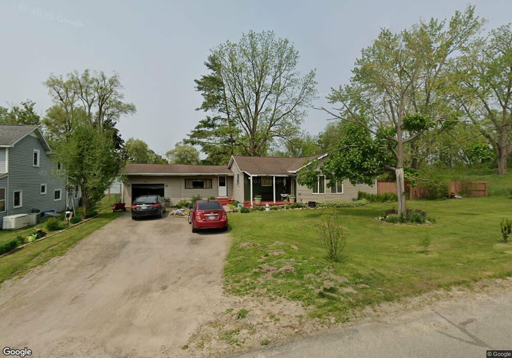
This home is located at 543 Nicholson St, Ionia, MI 48846 and is currently estimated at $162,131, approximately $135 per square foot. 543 Nicholson St is a home located in Ionia County with nearby schools including Ionia High School, Saints Peter and Paul Catholic School, and Ionia Seventh Day Adventist Elementary School.
Ownership History
Date
Name
Owned For
Owner Type
Purchase Details
Closed on
Jul 17, 2012
Sold by
Jamison Carla
Bought by
Kozdemba Gregory
Current Estimated Value
Purchase Details
Closed on
Sep 30, 2008
Sold by
Alcalar Julie A and Alcalar Ricky L
Bought by
Jamison Carla B
Home Financials for this Owner
Home Financials are based on the most recent Mortgage that was taken out on this home.
Original Mortgage
$78,030
Interest Rate
6.43%
Mortgage Type
FHA
Create a Home Valuation Report for This Property
The Home Valuation Report is an in-depth analysis detailing your home's value as well as a comparison with similar homes in the area
Home Values in the Area
Average Home Value in this Area
Purchase History
| Date | Buyer | Sale Price | Title Company |
|---|---|---|---|
| Kozdemba Gregory | -- | -- | |
| Jamison Carla B | $75,000 | Cislo Title Co |
Source: Public Records
Mortgage History
| Date | Status | Borrower | Loan Amount |
|---|---|---|---|
| Previous Owner | Jamison Carla B | $78,030 |
Source: Public Records
Tax History Compared to Growth
Tax History
| Year | Tax Paid | Tax Assessment Tax Assessment Total Assessment is a certain percentage of the fair market value that is determined by local assessors to be the total taxable value of land and additions on the property. | Land | Improvement |
|---|---|---|---|---|
| 2025 | $819 | $57,400 | $4,300 | $53,100 |
| 2024 | $283 | $57,400 | $4,300 | $53,100 |
| 2023 | $270 | $46,500 | $4,000 | $42,500 |
| 2022 | $257 | $46,500 | $4,000 | $42,500 |
| 2021 | $723 | $35,200 | $3,100 | $32,100 |
| 2020 | $247 | $35,200 | $3,100 | $32,100 |
| 2019 | $228 | $32,800 | $3,100 | $29,700 |
| 2018 | $680 | $32,400 | $3,100 | $29,300 |
| 2017 | $230 | $32,400 | $3,100 | $29,300 |
| 2016 | $228 | $25,200 | $3,100 | $22,100 |
| 2015 | -- | $25,200 | $3,100 | $22,100 |
| 2014 | $294 | $20,800 | $3,100 | $17,700 |
Source: Public Records
Map
Nearby Homes
- 556 Price St
- 721 Chapman St
- 916 Yeomans St
- 407 Forest St
- 710 Elmwood Dr
- 428 W Lincoln Ave
- 1133 Yeomans St Unit 99
- 1133 Yeomans St Unit 118
- 1133 Yeomans St Unit 105
- 1133 Yeomans St Unit 243
- 1133 Yeomans St Unit 55
- 1133 Yeomans St Unit 130
- 1133 Yeomans St Unit 129
- 1133 Yeomans St Unit 138
- 1133 Yeomans St Unit 256
- 1133 Yeomans St Unit 19
- 1133 Yeomans St Unit 193
- 947 W Main St
- 442 Baldie St
- 217 Dye St
- 535 Nicholson St
- 540 Nicholson St
- 536 Nicholson St
- 540 Price St
- 525 Nicholson St
- 932 Branch St
- 554 Nicholson St
- 555 Nicholson St
- 0 Price St
- 0 Price St
- Parcel B Price St
- Parcel A Price St
- 526 Nicholson St
- 530 Price St
- 517 Nicholson St
- 1441 Branch St
- 557 Price St
- 925 Forest St
- 551 Price St
- 543 Price St