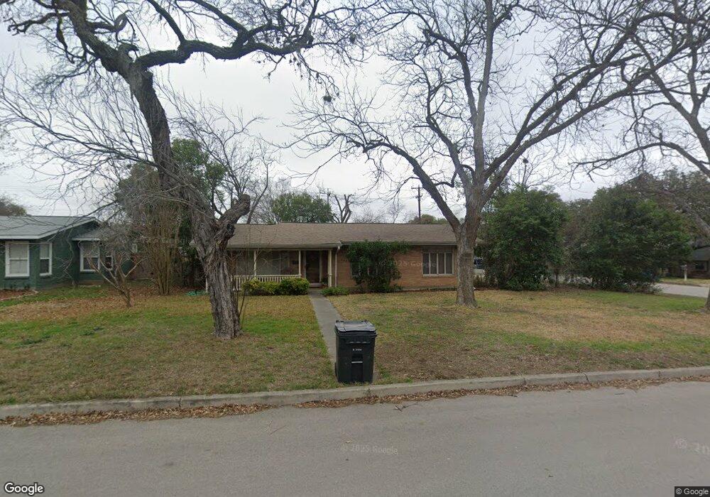
543 Oakleaf Dr San Antonio, TX 78209
Oak Park-Northwood NeighborhoodEstimated Value: $386,041 - $516,000
3
Beds
2
Baths
1,613
Sq Ft
$280/Sq Ft
Est. Value
About This Home
This home is located at 543 Oakleaf Dr, San Antonio, TX 78209 and is currently estimated at $452,260, approximately $280 per square foot. 543 Oakleaf Dr is a home located in Bexar County with nearby schools including Northwood Elementary School, Garner Middle School, and MacArthur High School.
Ownership History
Date
Name
Owned For
Owner Type
Purchase Details
Closed on
Nov 9, 2001
Sold by
Pratt Trisha D M
Bought by
Zaldivar Christopher L and Zaldivar Molly M
Current Estimated Value
Home Financials for this Owner
Home Financials are based on the most recent Mortgage that was taken out on this home.
Original Mortgage
$100,000
Outstanding Balance
$39,056
Interest Rate
6.71%
Estimated Equity
$413,204
Purchase Details
Closed on
Apr 23, 2001
Sold by
Wells Artie Sue
Bought by
Pratt Trisha D M
Home Financials for this Owner
Home Financials are based on the most recent Mortgage that was taken out on this home.
Original Mortgage
$83,300
Interest Rate
6.89%
Create a Home Valuation Report for This Property
The Home Valuation Report is an in-depth analysis detailing your home's value as well as a comparison with similar homes in the area
Home Values in the Area
Average Home Value in this Area
Purchase History
| Date | Buyer | Sale Price | Title Company |
|---|---|---|---|
| Zaldivar Christopher L | -- | Commerce Land Title | |
| Pratt Trisha D M | -- | Commerce Land Title |
Source: Public Records
Mortgage History
| Date | Status | Borrower | Loan Amount |
|---|---|---|---|
| Open | Zaldivar Christopher L | $100,000 | |
| Previous Owner | Pratt Trisha D M | $83,300 |
Source: Public Records
Tax History Compared to Growth
Tax History
| Year | Tax Paid | Tax Assessment Tax Assessment Total Assessment is a certain percentage of the fair market value that is determined by local assessors to be the total taxable value of land and additions on the property. | Land | Improvement |
|---|---|---|---|---|
| 2025 | $6,215 | $350,440 | $164,510 | $185,930 |
| 2024 | $6,215 | $350,440 | $164,510 | $185,930 |
| 2023 | $6,215 | $344,234 | $164,510 | $179,724 |
| 2022 | $7,987 | $323,686 | $143,060 | $203,020 |
| 2021 | $7,518 | $294,260 | $124,390 | $169,870 |
| 2020 | $7,276 | $280,550 | $110,550 | $170,000 |
| 2019 | $7,115 | $267,130 | $110,550 | $156,580 |
| 2018 | $8,065 | $302,060 | $88,440 | $213,620 |
| 2017 | $7,913 | $293,630 | $88,440 | $205,190 |
| 2016 | $7,229 | $268,240 | $52,760 | $215,480 |
| 2015 | $6,173 | $254,366 | $52,760 | $208,480 |
| 2014 | $6,173 | $231,242 | $0 | $0 |
Source: Public Records
Map
Nearby Homes
- 530 Burnside Dr
- 510 Burnside Dr
- 419 Woodcrest Dr
- 446 Forrest Hill Dr
- 351 Northridge Dr
- 7606 N Vandiver Rd
- 2603 Brookhurst Dr
- 7238 Seidel Rd
- 318 Northridge Dr
- 371 Pike Rd
- 315 Tophill Rd
- 210 Laramie Dr
- 623 E Nottingham Dr
- 631 Robinhood Place
- 7226 N Vandiver Rd
- 2822 Knight Robin Dr
- 7114 Bethencourt
- 2611 Eisenhauer Rd Unit 1502
- 2611 Eisenhauer Rd Unit 504
- 2611 Eisenhauer Rd Unit 1103