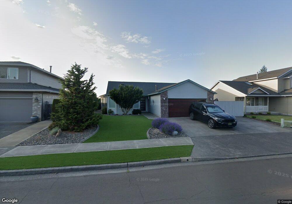
543 SW 25th Cir Troutdale, OR 97060
Sunrise NeighborhoodEstimated Value: $459,000 - $512,000
3
Beds
2
Baths
1,571
Sq Ft
$313/Sq Ft
Est. Value
About This Home
This home is located at 543 SW 25th Cir, Troutdale, OR 97060 and is currently estimated at $491,132, approximately $312 per square foot. 543 SW 25th Cir is a home located in Multnomah County with nearby schools including Sweetbriar Elementary School, Walt Morey Middle School, and Reynolds High School.
Ownership History
Date
Name
Owned For
Owner Type
Purchase Details
Closed on
Jun 18, 2014
Sold by
Robbins Vera M
Bought by
Mcelroy Ronald L and Mcelroy Patricia
Current Estimated Value
Purchase Details
Closed on
Dec 27, 1996
Sold by
Slayton & Blubaugh Construction Inc
Bought by
Robbins Vera M
Purchase Details
Closed on
May 29, 1996
Sold by
Cascade Communities Inc
Bought by
Slayton & Blubaugh Construction Inc
Create a Home Valuation Report for This Property
The Home Valuation Report is an in-depth analysis detailing your home's value as well as a comparison with similar homes in the area
Home Values in the Area
Average Home Value in this Area
Purchase History
| Date | Buyer | Sale Price | Title Company |
|---|---|---|---|
| Mcelroy Ronald L | $215,000 | First American | |
| Robbins Vera M | $160,000 | Fidelity National Title Co | |
| Slayton & Blubaugh Construction Inc | $48,000 | Chicago Title Insurance Co |
Source: Public Records
Tax History Compared to Growth
Tax History
| Year | Tax Paid | Tax Assessment Tax Assessment Total Assessment is a certain percentage of the fair market value that is determined by local assessors to be the total taxable value of land and additions on the property. | Land | Improvement |
|---|---|---|---|---|
| 2025 | $5,282 | $286,400 | -- | -- |
| 2024 | $4,991 | $278,060 | -- | -- |
| 2023 | $4,860 | $269,970 | $0 | $0 |
| 2022 | $4,743 | $262,110 | $0 | $0 |
| 2021 | $4,633 | $254,480 | $0 | $0 |
| 2020 | $4,333 | $247,070 | $0 | $0 |
| 2019 | $4,159 | $239,880 | $0 | $0 |
| 2018 | $4,131 | $232,900 | $0 | $0 |
| 2017 | $4,122 | $226,120 | $0 | $0 |
| 2016 | $3,984 | $219,540 | $0 | $0 |
| 2015 | $3,884 | $213,150 | $0 | $0 |
| 2014 | $3,777 | $206,950 | $0 | $0 |
Source: Public Records
Map
Nearby Homes
- 665 SW 24th St
- 1021 SW 24th St
- 2020 SW Laura Ct
- 724 SW 28th St
- 2511 S Troutdale Rd
- 2846 SW Faith Ct
- 1427 SW 24th St
- 1330 SW 28th St Unit 1332
- 2154 SE Sandy Ct
- 839 SW Grant Way
- 2326 SW Mcginnis Ave
- 821 SW 14th St
- 216 SE 34th Cir
- 3300 NE 29th St Unit 28
- 3248 NE 29th St Unit 31
- 2701 SW Latourell Place
- 3240 NE 29th St
- 1226 SW Hensley Rd
- 3230 NE 29th St Unit 40
- 1019 SE 27th St
- 559 SW 25th Cir
- 521 SW 25th Cir
- 587 SW 25th Cir
- 499 SW 25th Cir
- 536 SW 25th Cir
- 558 SW 25th Cir
- 457 SW 25th Cir
- 603 SW 25th Cir
- 518 SW 25th Cir
- 2438 SW Fox Ln
- 492 SW 25th Cir
- 590 SW 25th Cir
- 564 SW 26th St
- 460 SW 25th Cir
- 2402 SW Fox Ln
- 433 SW 25th Cir Unit CR
- 433 SW 25th Cir
- 612 SW 25th Cir
- 400 SW 25th Cir
- 570 SW 26th St