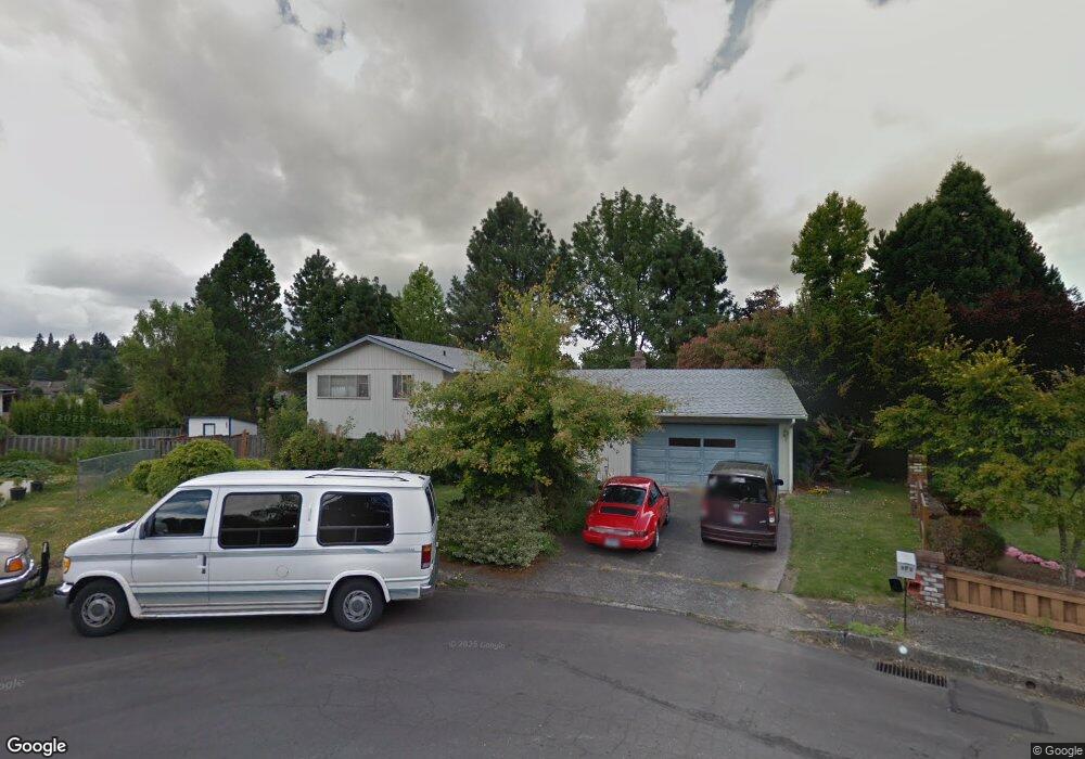
543 SW 6th Ct Gresham, OR 97080
Gresham Butte NeighborhoodEstimated Value: $459,000 - $496,000
About This Home
This home is located at 543 SW 6th Ct, Gresham, OR 97080 and is currently estimated at $475,767, approximately $415 per square foot. 543 SW 6th Ct is a home located in Multnomah County with nearby schools including Dexter McCarty Middle School, Gresham High School, and Gresham Arthur Academy.
Ownership History
We collect this data history from publicly available records. To have your information removed, we recommend requesting removal directly through your county’s website.
Purchase Details
Purchase Details
Home Financials for this Owner
Home Financials are based on the most recent Mortgage that was taken out on this home.Home Values in the Area
Average Home Value in this Area
Purchase History
We collect this data history from publicly available records. To have your information removed, we recommend requesting removal directly through your county’s website.
| Date | Buyer | Sale Price | Title Company |
|---|---|---|---|
| -- | -- | ||
| $139,950 | Oregon Title Insurance Co |
Mortgage History
We collect this data history from publicly available records. To have your information removed, we recommend requesting removal directly through your county’s website.
| Date | Status | Borrower | Loan Amount |
|---|---|---|---|
| Open | $80,000 | ||
| Closed | $52,950 |
Tax History
We collect this data history from publicly available records. To have your information removed, we recommend requesting removal directly through your county’s website.
| Year | Tax Paid | Tax Assessment Tax Assessment Total Assessment is a certain percentage of the fair market value that is determined by local assessors to be the total taxable value of land and additions on the property. | Land | Improvement |
|---|---|---|---|---|
| 2025 | $5,369 | $263,820 | -- | -- |
| 2024 | $5,139 | $256,140 | -- | -- |
| 2023 | $4,682 | $248,680 | $0 | $0 |
| 2022 | $4,551 | $241,440 | $0 | $0 |
| 2021 | $4,437 | $234,410 | $0 | $0 |
| 2020 | $4,174 | $227,590 | $0 | $0 |
| 2019 | $4,065 | $220,970 | $0 | $0 |
| 2018 | $3,876 | $214,540 | $0 | $0 |
| 2017 | $3,719 | $208,300 | $0 | $0 |
| 2016 | $3,279 | $202,240 | $0 | $0 |
| 2015 | $3,208 | $196,350 | $0 | $0 |
| 2014 | $3,129 | $190,640 | $0 | $0 |
Map
- 828 SW Wilson Ct
- 404 SW Overlook Ct
- 159 SW Florence Ave Unit 26
- 85 NW Sleret Ave
- 1113 W Powell Blvd
- 512 SW Eastman Pkwy Unit 13
- 345 NW Norman Ave
- 1386 SW 4th St
- 1130 NW 1st St
- 1454 SW 4th St
- 415 SE Roberts Ave
- 1407 SW Walters Dr
- 1105 SW 10th Dr
- 318 NE Roberts Ave Unit 308
- 318 NE Roberts Ave Unit 203
- 318 NE Roberts Ave Unit 204
- 0 NE 5th St
- 0 SW Miller Ct Unit 470855683
- 231 SE Elliott Ave
- 765 775 SE Roberts Ave
Ask me questions while you tour the home.