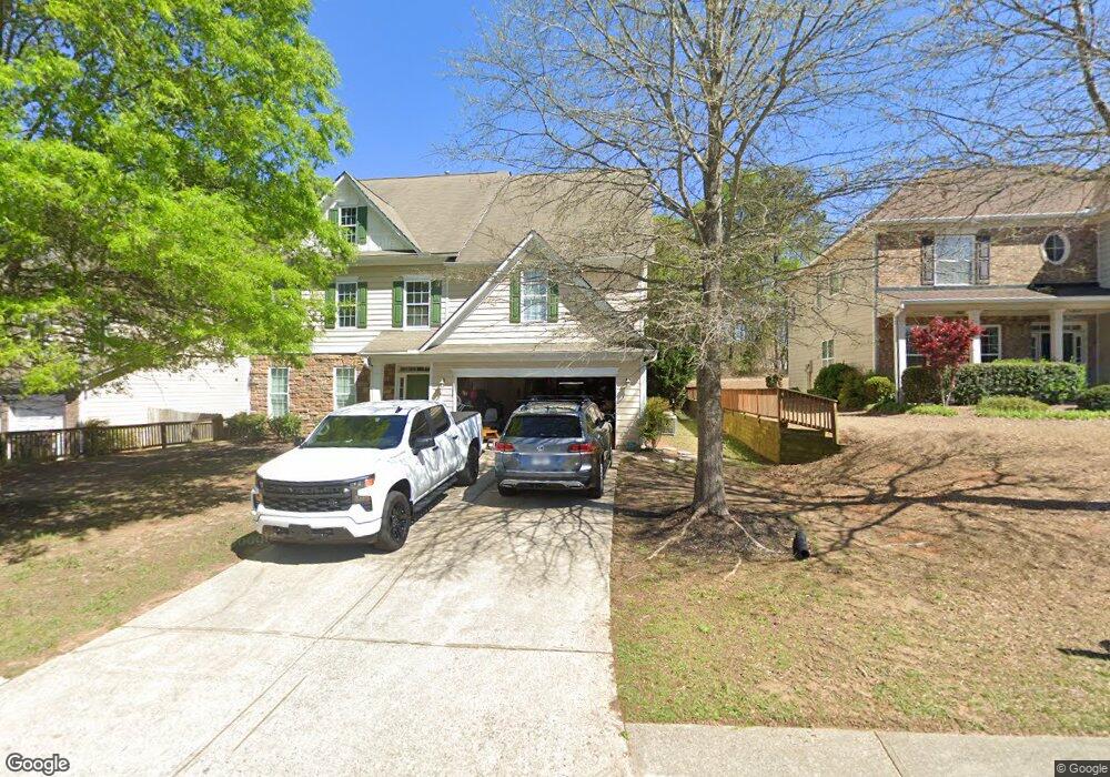
5430 Fieldgate Ridge Dr Unit 1 Cumming, GA 30028
Estimated Value: $520,000 - $592,000
7
Beds
4
Baths
4,462
Sq Ft
$127/Sq Ft
Est. Value
About This Home
This home is located at 5430 Fieldgate Ridge Dr Unit 1, Cumming, GA 30028 and is currently estimated at $566,982, approximately $127 per square foot. 5430 Fieldgate Ridge Dr Unit 1 is a home located in Forsyth County with nearby schools including Silver City Elementary School, North Forsyth Middle School, and North Forsyth High School.
Ownership History
Date
Name
Owned For
Owner Type
Purchase Details
Closed on
Apr 6, 2012
Sold by
Razavi Seyed Mohammad Hass
Bought by
Razavi Bijan Hassan Pour and Razavi Seyed Mohammad Hassan
Current Estimated Value
Purchase Details
Closed on
Feb 9, 2011
Sold by
Federal Natl Mtg Assn Fnma
Bought by
Razavi Seyed M H P
Purchase Details
Closed on
Oct 5, 2010
Sold by
Bac Hm Lns Svcng Lp
Bought by
Federal Natl Mtg Assn Fnma
Purchase Details
Closed on
May 31, 2007
Sold by
Castoire Jacob
Bought by
Castoire Jacob and Castoire Sondra L
Create a Home Valuation Report for This Property
The Home Valuation Report is an in-depth analysis detailing your home's value as well as a comparison with similar homes in the area
Home Values in the Area
Average Home Value in this Area
Purchase History
| Date | Buyer | Sale Price | Title Company |
|---|---|---|---|
| Razavi Bijan Hassan Pour | -- | -- | |
| Razavi Seyed M H P | -- | -- | |
| Federal Natl Mtg Assn Fnma | -- | -- | |
| Bac Hm Lns Svcng Lp | $254,278 | -- | |
| Castoire Jacob | -- | -- | |
| Castoire Jacob | $276,800 | -- |
Source: Public Records
Tax History Compared to Growth
Tax History
| Year | Tax Paid | Tax Assessment Tax Assessment Total Assessment is a certain percentage of the fair market value that is determined by local assessors to be the total taxable value of land and additions on the property. | Land | Improvement |
|---|---|---|---|---|
| 2025 | $4,903 | $199,960 | $35,120 | $164,840 |
| 2024 | $4,903 | $199,960 | $35,120 | $164,840 |
| 2023 | $4,184 | $199,960 | $35,120 | $164,840 |
| 2022 | $4,490 | $144,988 | $18,000 | $126,988 |
| 2021 | $4,004 | $144,988 | $18,000 | $126,988 |
| 2020 | $3,752 | $135,884 | $18,000 | $117,884 |
| 2019 | $3,694 | $133,584 | $18,000 | $115,584 |
| 2018 | $3,962 | $143,284 | $18,000 | $125,284 |
| 2017 | $3,476 | $125,228 | $18,000 | $107,228 |
| 2016 | $3,103 | $111,788 | $15,200 | $96,588 |
| 2015 | $3,206 | $115,308 | $15,200 | $100,108 |
| 2014 | $2,618 | $98,888 | $0 | $0 |
Source: Public Records
Map
Nearby Homes
- 5415 Fieldfreen Dr
- 5260 Fieldgate Ridge Dr
- 5340 Mundy Ct
- 5270 Mundy Ct
- 4810 Hopewell Manor Dr
- 5030 Mundy Dr
- 5315 Hopewell Manor Dr
- Essex Plan at Kennison Creek
- 4950 Fieldstone View Cir
- Shelby Plan at Hopewell Reserve
- Emerson Plan at Hopewell Reserve
- Canton II Plan at Hopewell Reserve
- Riverside Plan at Hopewell Reserve
- 4720 Montane St
- 4730 Montane St
- 5435 Trescott Path
- 4775 Baldwin Dr
- 4840 Montane St
- 4830 Montane St
- 5040 Fieldstone Bend Dr Unit 1
- 5430 Fieldgate Ridge Dr
- 5420 Fieldgate Ridge Dr
- 5440 Fieldgate Ridge Dr
- 5410 Fieldgate Ridge Dr
- 5450 Fieldgate Ridge Dr
- 5445 Fieldgate Ridge Dr
- 5330 Fieldgate Ridge Dr
- 5410 Fieldfreen Dr
- 5414 Fieldfreen Dr
- 5510 Stevehaven Ln
- 5420 Fieldfreen Dr
- 5320 Fieldgate Ridge Dr
- 5520 Stevehaven Ln
- 5490 Stevehaven Ln
- 5495 Stevehaven Ln
- 4635 Walt Ct
- 5405 Fieldfreen Dr
- 4625 Walt Ct Unit 90
- 4625 Walt Ct
- 4645 Walt Ct