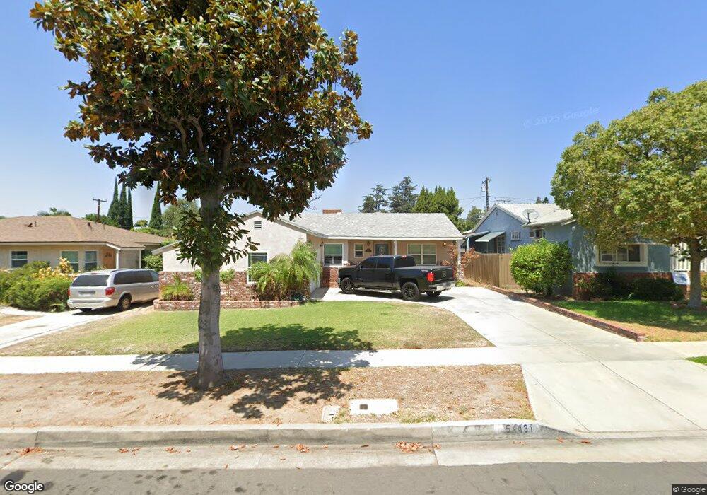
5431 Mavis Ave Whittier, CA 90601
West Whittier NeighborhoodEstimated Value: $795,000 - $828,000
3
Beds
2
Baths
1,289
Sq Ft
$630/Sq Ft
Est. Value
About This Home
This home is located at 5431 Mavis Ave, Whittier, CA 90601 and is currently estimated at $811,459, approximately $629 per square foot. 5431 Mavis Ave is a home located in Los Angeles County with nearby schools including Orange Grove Elementary School, Walter F. Dexter Middle School, and Whittier High School.
Ownership History
Date
Name
Owned For
Owner Type
Purchase Details
Closed on
Apr 28, 2016
Sold by
Zendejas Sarah M
Bought by
Guerra Robert T and Guerra Lauren M
Current Estimated Value
Home Financials for this Owner
Home Financials are based on the most recent Mortgage that was taken out on this home.
Original Mortgage
$360,000
Outstanding Balance
$281,901
Interest Rate
3.66%
Mortgage Type
New Conventional
Estimated Equity
$529,558
Purchase Details
Closed on
Oct 26, 2009
Sold by
Parral Sarah M
Bought by
Zendejas Sarah M
Purchase Details
Closed on
Aug 11, 2009
Sold by
Zendejas Sarah M and Zendejas Javier C
Bought by
Zendejas Sarah M
Home Financials for this Owner
Home Financials are based on the most recent Mortgage that was taken out on this home.
Original Mortgage
$316,000
Interest Rate
5.19%
Mortgage Type
New Conventional
Purchase Details
Closed on
Jun 3, 2004
Sold by
Parral Sarah M
Bought by
Parral Sarah M
Home Financials for this Owner
Home Financials are based on the most recent Mortgage that was taken out on this home.
Original Mortgage
$280,000
Interest Rate
5.37%
Mortgage Type
Negative Amortization
Purchase Details
Closed on
May 13, 2004
Sold by
Parral Fernando E
Bought by
Parral Sarah M
Home Financials for this Owner
Home Financials are based on the most recent Mortgage that was taken out on this home.
Original Mortgage
$280,000
Interest Rate
5.37%
Mortgage Type
Negative Amortization
Purchase Details
Closed on
Nov 12, 2002
Sold by
Alvarado Linda
Bought by
Parral Fernando E
Home Financials for this Owner
Home Financials are based on the most recent Mortgage that was taken out on this home.
Original Mortgage
$206,250
Interest Rate
5.86%
Purchase Details
Closed on
Nov 12, 1997
Sold by
Alvarado Susana
Bought by
Alvarado Linda
Purchase Details
Closed on
Nov 29, 1993
Sold by
Vanvalkenburg John L
Bought by
Alvarado Linda
Home Financials for this Owner
Home Financials are based on the most recent Mortgage that was taken out on this home.
Original Mortgage
$155,250
Interest Rate
7.16%
Create a Home Valuation Report for This Property
The Home Valuation Report is an in-depth analysis detailing your home's value as well as a comparison with similar homes in the area
Home Values in the Area
Average Home Value in this Area
Purchase History
We collect this data history from publicly available records. To have your information removed, we recommend requesting removal directly through your county’s website.
| Date | Buyer | Sale Price | Title Company |
|---|---|---|---|
| Guerra Robert T | $450,000 | Corinthian Title Company Inc | |
| Zendejas Sarah M | -- | None Available | |
| Zendejas Sarah M | -- | Orange Coast Title | |
| Parral Sarah M | -- | Southland Title | |
| Parral Sarah M | -- | -- | |
| Parral Fernando E | $275,000 | Ticor Title Insurance Compan | |
| Alvarado Linda | -- | -- | |
| Alvarado Linda | $172,500 | Old Republic Title Co |
Source: Public Records
Mortgage History
We collect this data history from publicly available records. To have your information removed, we recommend requesting removal directly through your county’s website.
| Date | Status | Borrower | Loan Amount |
|---|---|---|---|
| Open | Guerra Robert T | $360,000 | |
| Previous Owner | Zendejas Sarah M | $316,000 | |
| Previous Owner | Parral Sarah M | $280,000 | |
| Previous Owner | Parral Fernando E | $206,250 | |
| Previous Owner | Alvarado Linda | $155,250 | |
| Closed | Parral Fernando E | $27,500 |
Source: Public Records
Tax History
| Year | Tax Paid | Tax Assessment Tax Assessment Total Assessment is a certain percentage of the fair market value that is determined by local assessors to be the total taxable value of land and additions on the property. | Land | Improvement |
|---|---|---|---|---|
| 2025 | $5,386 | $398,264 | $267,059 | $131,205 |
| 2024 | $4,978 | $390,456 | $261,823 | $128,633 |
| 2023 | $4,949 | $382,801 | $256,690 | $126,111 |
| 2022 | $4,942 | $375,296 | $251,657 | $123,639 |
| 2021 | $4,694 | $367,938 | $246,723 | $121,215 |
| 2019 | $4,608 | $357,027 | $239,406 | $117,621 |
| 2018 | $4,435 | $350,027 | $234,712 | $115,315 |
| 2016 | $4,443 | $336,437 | $225,599 | $110,838 |
| 2015 | $4,377 | $331,385 | $222,211 | $109,174 |
| 2014 | $4,259 | $324,895 | $217,859 | $107,036 |
Source: Public Records
Map
Nearby Homes
- 10602 Monaco Ct
- 10605 Cordoba Ct
- 5112 Cape Tenez Dr
- 10812 Indiana St
- 5411 Cadbury Rd
- 5519 Pioneer Blvd Unit 42
- 5593 Pioneer Blvd Unit 18
- 5593 Pioneer Blvd
- 5456 Cadbury Rd
- 5487 Cadbury Rd
- 5903 Redman Ave
- 5729 Juarez Ave
- 11045 Howard St
- 5739 Westmont Ln
- 10608 Whittier Blvd
- 3832 Abbeywood Ave
- 10919 See Dr
- 10853 Glencannon Dr
- 6233 Vicki Dr
- 12202 Orange Dr
- 5416 Carley Ave
- 5408 Carley Ave
- 5402 Carley Ave
- 5428 Carley Ave
- 5427 Mavis Ave
- 5413 Mavis Ave
- 5419 Mavis Ave
- 5409 Mavis Ave
- 5425 Mavis Ave
- 5434 Carley Ave
- 5403 Mavis Ave
- 5415 Carley Ave
- 5421 Carley Ave
- 5409 Carley Ave
- 5427 Carley Ave
- 5403 Carley Ave
- 5440 Carley Ave
- 5435 Mavis Ave
- 5433 Carley Ave
- 5340 Carley Ave
Your Personal Tour Guide
Ask me questions while you tour the home.