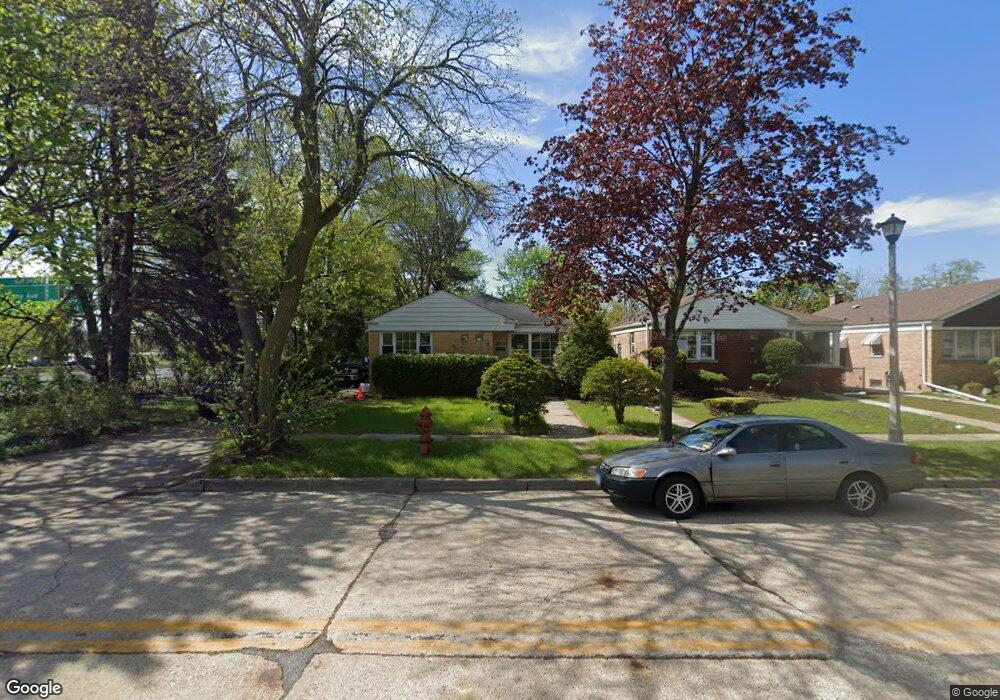
5431 Suffield Ct Skokie, IL 60077
Estimated Value: $339,000 - $413,165
3
Beds
1
Bath
1,176
Sq Ft
$319/Sq Ft
Est. Value
About This Home
This home is located at 5431 Suffield Ct, Skokie, IL 60077 and is currently estimated at $375,041, approximately $318 per square foot. 5431 Suffield Ct is a home located in Cook County with nearby schools including Old Orchard Jr High School, Jane Stenson School, and Niles North High School.
Ownership History
Date
Name
Owned For
Owner Type
Purchase Details
Closed on
Nov 19, 2004
Sold by
Estate Of Mary Pouliot
Bought by
Roxas Oscar D
Current Estimated Value
Home Financials for this Owner
Home Financials are based on the most recent Mortgage that was taken out on this home.
Original Mortgage
$188,000
Outstanding Balance
$86,494
Interest Rate
4.62%
Mortgage Type
Unknown
Estimated Equity
$288,547
Create a Home Valuation Report for This Property
The Home Valuation Report is an in-depth analysis detailing your home's value as well as a comparison with similar homes in the area
Home Values in the Area
Average Home Value in this Area
Purchase History
| Date | Buyer | Sale Price | Title Company |
|---|---|---|---|
| Roxas Oscar D | $235,000 | -- |
Source: Public Records
Mortgage History
| Date | Status | Borrower | Loan Amount |
|---|---|---|---|
| Open | Roxas Oscar D | $188,000 |
Source: Public Records
Tax History Compared to Growth
Tax History
| Year | Tax Paid | Tax Assessment Tax Assessment Total Assessment is a certain percentage of the fair market value that is determined by local assessors to be the total taxable value of land and additions on the property. | Land | Improvement |
|---|---|---|---|---|
| 2024 | $6,667 | $30,000 | $6,006 | $23,994 |
| 2023 | $6,463 | $30,000 | $6,006 | $23,994 |
| 2022 | $6,463 | $30,000 | $6,006 | $23,994 |
| 2021 | $6,163 | $25,847 | $3,696 | $22,151 |
| 2020 | $6,164 | $25,847 | $3,696 | $22,151 |
| 2019 | $6,310 | $29,042 | $3,696 | $25,346 |
| 2018 | $5,320 | $23,182 | $3,349 | $19,833 |
| 2017 | $5,375 | $23,182 | $3,349 | $19,833 |
| 2016 | $5,366 | $23,182 | $3,349 | $19,833 |
| 2015 | $4,543 | $18,899 | $2,887 | $16,012 |
| 2014 | $4,452 | $18,899 | $2,887 | $16,012 |
| 2013 | $4,426 | $18,899 | $2,887 | $16,012 |
Source: Public Records
Map
Nearby Homes
- 5459 Suffield Ct
- 5352 Greenwood St
- 5536 Greenwood St
- 8918 Parkside Ave
- 5247 Suffield Ct
- 5449 Arcadia St
- 8655 Harms Rd
- 8708 Central Ave
- 5309 Crain St
- 8841 Menard Ave
- 5128 Suffield Ct
- 9234 Central Ave
- 8836 Mansfield Ave
- 8541 Lotus Ave Unit 914
- 8605 Laramie Ave
- 5644 Lyons St
- 5510 Lincoln Ave Unit B301
- 5510 Lincoln Ave Unit B101
- 5506 Lincoln Ave Unit A117
- 5506 Lincoln Ave Unit A216
- 5435 Suffield Ct
- 5439 Suffield Ct
- 5443 Suffield Ct
- 5428 Greenwood St
- 5447 Suffield Ct
- 5436 Greenwood St
- 5428 Suffield Ct
- 5432 Suffield Ct
- 5432 Suffield Ct
- 5436 Suffield Ct
- 5442 Greenwood St
- 5440 Suffield Ct
- 5451 Suffield Ct
- 5446 Greenwood St
- 5444 Suffield Ct
- 5444 Suffield Ct
- 5455 Suffield Ct
- 5450 Greenwood St
- 5450 Suffield Ct
- 5454 Greenwood St