Estimated Value: $239,897 - $288,000
3
Beds
2
Baths
1,111
Sq Ft
$232/Sq Ft
Est. Value
About This Home
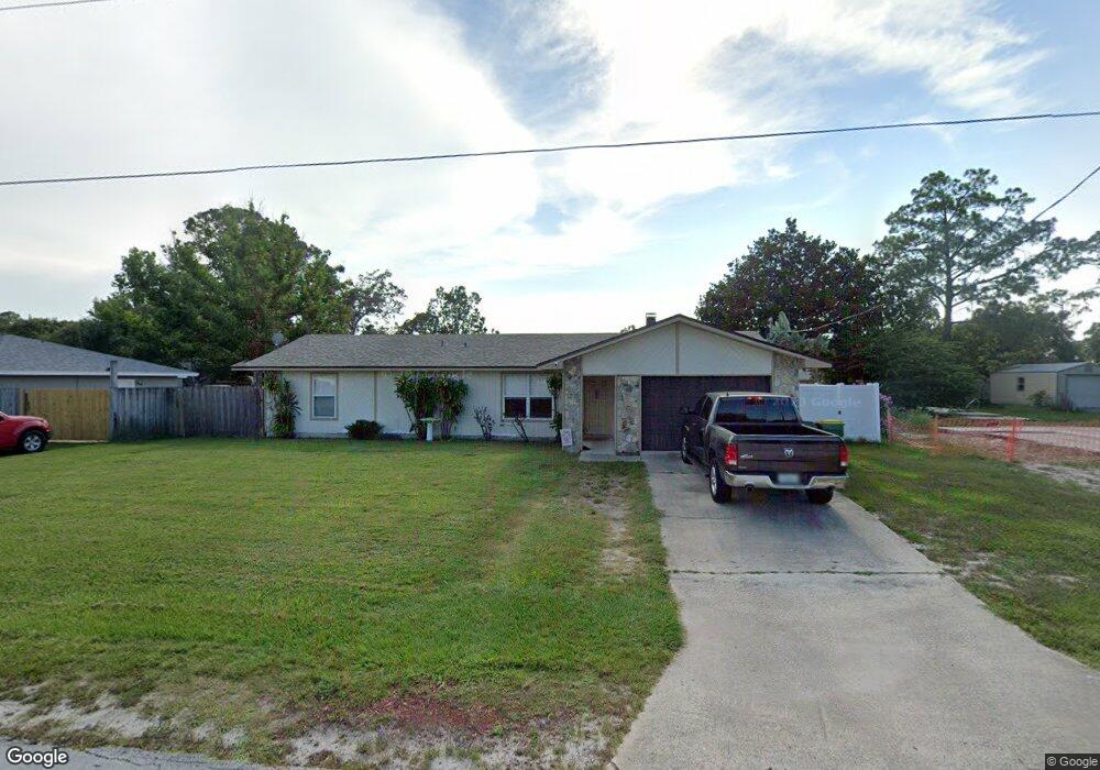
This home is located at 5432 Flint Rd, Cocoa, FL 32927 and is currently estimated at $257,974, approximately $232 per square foot. 5432 Flint Rd is a home located in Brevard County with nearby schools including Enterprise Elementary School, Space Coast Junior/Senior High School, and East Atlantic Prep of Brevard County.
Ownership History
Date
Name
Owned For
Owner Type
Purchase Details
Closed on
Mar 30, 2009
Sold by
Heneghan Stephen J and Heneghan Betty B
Bought by
Heneghan Stephen J and Heneghan Betty B
Current Estimated Value
Home Financials for this Owner
Home Financials are based on the most recent Mortgage that was taken out on this home.
Original Mortgage
$94,080
Interest Rate
5.18%
Create a Home Valuation Report for This Property
The Home Valuation Report is an in-depth analysis detailing your home's value as well as a comparison with similar homes in the area
Home Values in the Area
Average Home Value in this Area
Purchase History
We collect this data history from publicly available records. To have your information removed, we recommend requesting removal directly through your county’s website.
| Date | Buyer | Sale Price | Title Company |
|---|---|---|---|
| Heneghan Stephen J | $47,100 | Landmark Title Agency Inc |
Source: Public Records
Mortgage History
We collect this data history from publicly available records. To have your information removed, we recommend requesting removal directly through your county’s website.
| Date | Status | Borrower | Loan Amount |
|---|---|---|---|
| Closed | Heneghan Stephen J | $94,080 |
Source: Public Records
Tax History
| Year | Tax Paid | Tax Assessment Tax Assessment Total Assessment is a certain percentage of the fair market value that is determined by local assessors to be the total taxable value of land and additions on the property. | Land | Improvement |
|---|---|---|---|---|
| 2025 | $970 | $65,840 | -- | -- |
| 2024 | $951 | $63,990 | -- | -- |
| 2023 | $951 | $62,130 | $0 | $0 |
| 2022 | $904 | $60,330 | $0 | $0 |
| 2021 | $905 | $58,580 | $0 | $0 |
| 2020 | $859 | $57,780 | $0 | $0 |
| 2019 | $807 | $56,490 | $0 | $0 |
| 2018 | $807 | $55,440 | $0 | $0 |
| 2017 | $807 | $54,300 | $0 | $0 |
| 2016 | $812 | $53,190 | $18,000 | $35,190 |
| 2015 | $816 | $52,830 | $15,000 | $37,830 |
| 2014 | $821 | $52,420 | $11,000 | $41,420 |
Source: Public Records
Map
Nearby Homes
- 5424 Flint Rd
- 6450 Ember Ave
- 6438 Hudson Rd
- 5525 Fairbridge St
- 6601 Cedar Ave
- 6615 Dock Ave
- 00 Unknown
- 6581 Bancroft Ave
- 5220 Holden Rd
- 6760 Cairo Rd
- 6643 Emil Ave
- 5221 Carrick Rd
- 6815 Bryant Rd
- 5770 Fairbridge St
- 6375 Cable Ave
- 6813 Cecil Rd
- 6965 Hundred Acre Dr
- 0000 Grissom Pkwy
- 6020 Cannon Ave
- 6240 Grissom Pkwy
- 5416 Flint Rd
- 6435 Gillette Ave
- 6425 Gillette Ave
- 5408 Flint Rd
- 5425 Flint Rd
- 5417 Flint Rd
- 6455 Gillette Ave
- 5440 Flint Rd
- 5441 Flint Rd
- 5409 Flint Rd
- 5400 Fruitport St
- 5448 Flint Rd
- 5400 Flint Rd
- 6405 Gillette Ave
- 5385 Fruitport St
- 5449 Flint Rd
- 6454 Fairchild Ave
- 6430 Gillette Ave
- 6442 Fairchild Ave
- 5401 Flint Rd
Your Personal Tour Guide
Ask me questions while you tour the home.