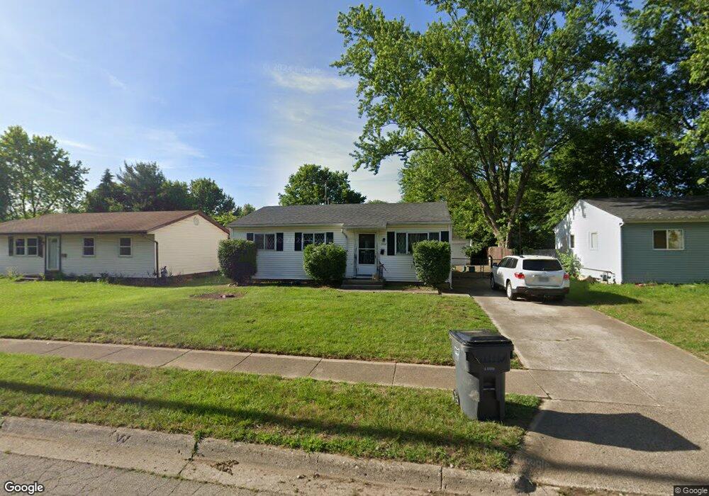
5432 Newport Rd Columbus, OH 43232
East Columbus-White Ash NeighborhoodEstimated Value: $206,000 - $232,000
5
Beds
3
Baths
1,192
Sq Ft
$185/Sq Ft
Est. Value
About This Home
This home is located at 5432 Newport Rd, Columbus, OH 43232 and is currently estimated at $220,450, approximately $184 per square foot. 5432 Newport Rd is a home located in Franklin County with nearby schools including Groveport Madison High School, Eastland Preparatory Academy, and A+ Arts Academy.
Ownership History
Date
Name
Owned For
Owner Type
Purchase Details
Closed on
Dec 11, 2018
Sold by
Natonstar Mortgage Llc
Bought by
Kenabre Enterprises Llc
Current Estimated Value
Purchase Details
Closed on
Oct 8, 2018
Sold by
Carrel Lisa A
Bought by
Nationstar Mortgage Llc
Purchase Details
Closed on
Nov 18, 1999
Sold by
Walls Dale C and Walls Madeline A
Bought by
Carrel Lisa A
Home Financials for this Owner
Home Financials are based on the most recent Mortgage that was taken out on this home.
Original Mortgage
$85,787
Interest Rate
7.88%
Mortgage Type
FHA
Purchase Details
Closed on
Sep 1, 1993
Bought by
Walls Dale C and Walls Madeline A
Purchase Details
Closed on
Sep 28, 1988
Create a Home Valuation Report for This Property
The Home Valuation Report is an in-depth analysis detailing your home's value as well as a comparison with similar homes in the area
Home Values in the Area
Average Home Value in this Area
Purchase History
| Date | Buyer | Sale Price | Title Company |
|---|---|---|---|
| Kenabre Enterprises Llc | $50,360 | Sojourners Title Agency | |
| Nationstar Mortgage Llc | $62,310 | Insight Title | |
| Carrel Lisa A | $86,500 | Chicago Title | |
| Walls Dale C | $70,000 | -- | |
| -- | -- | -- |
Source: Public Records
Mortgage History
| Date | Status | Borrower | Loan Amount |
|---|---|---|---|
| Previous Owner | Carrel Lisa A | $85,787 |
Source: Public Records
Tax History Compared to Growth
Tax History
| Year | Tax Paid | Tax Assessment Tax Assessment Total Assessment is a certain percentage of the fair market value that is determined by local assessors to be the total taxable value of land and additions on the property. | Land | Improvement |
|---|---|---|---|---|
| 2024 | $3,132 | $63,290 | $14,180 | $49,110 |
| 2023 | $3,110 | $63,280 | $14,175 | $49,105 |
| 2022 | $2,112 | $34,090 | $6,300 | $27,790 |
| 2021 | $2,155 | $34,090 | $6,300 | $27,790 |
| 2020 | $2,161 | $34,090 | $6,300 | $27,790 |
| 2019 | $1,989 | $28,320 | $5,250 | $23,070 |
| 2018 | $1,593 | $28,320 | $5,250 | $23,070 |
| 2017 | $2,194 | $28,320 | $5,250 | $23,070 |
| 2016 | $1,767 | $22,370 | $3,920 | $18,450 |
| 2015 | $1,768 | $22,370 | $3,920 | $18,450 |
| 2014 | $1,619 | $22,370 | $3,920 | $18,450 |
| 2013 | $786 | $24,850 | $4,340 | $20,510 |
Source: Public Records
Map
Nearby Homes
- 5391 Newport Rd
- 5522 Newport Ct
- 5254 Sedalia Dr
- 3773 Tylor Dr
- 3773 Clearwater Dr
- 3739 Atkinson Rd
- 3246 Latonia Rd
- 5397 Jack Russell Way
- 5408 Rohden Dr
- 3493 Tremaine Rd
- 3387 Retriever Rd
- 5152 Burdett Dr
- 5106 Harbor Blvd
- 3567 Wymore Place
- 3496 Cadell Rd
- 5323 Sundale Place S
- 5044 Albany Dr
- 3721 Aurelia Dr
- 5218 Fullerton Dr
- 5004 Bentler Dr
- 5424 Newport Rd
- 5444 Newport Rd
- 5416 Newport Rd
- 5452 Newport Rd
- 5415 Sedalia Dr
- 5407 Sedalia Dr
- 5423 Sedalia Dr
- 5431 Sedalia Dr
- 5433 Newport Rd
- 5425 Newport Rd
- 5399 Sedalia Dr
- 5460 Newport Rd
- 5408 Newport Rd
- 5445 Newport Rd
- 5417 Newport Rd
- 5439 Sedalia Dr
- 5400 Newport Rd
- 5453 Newport Rd
- 5391 Sedalia Dr
- 5411 Newport Rd