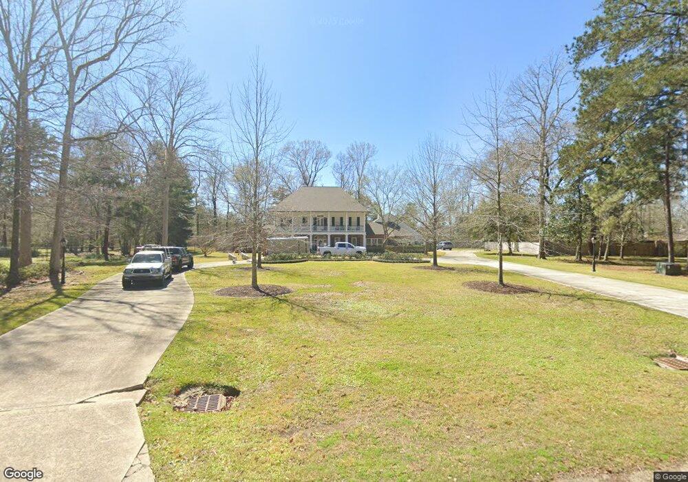
5433 Lost Oak Dr Baton Rouge, LA 70817
Shenandoah NeighborhoodEstimated Value: $784,000 - $932,436
--
Bed
--
Bath
5,675
Sq Ft
$150/Sq Ft
Est. Value
About This Home
This home is located at 5433 Lost Oak Dr, Baton Rouge, LA 70817 and is currently estimated at $850,109, approximately $149 per square foot. 5433 Lost Oak Dr is a home located in East Baton Rouge Parish with nearby schools including Shenandoah Elementary School, Woodlawn Middle School, and Woodlawn High School.
Ownership History
Date
Name
Owned For
Owner Type
Purchase Details
Closed on
Aug 30, 2023
Sold by
Palombo Cynthia Marie Messenger
Bought by
Miller Eric B and Miller Brooke A
Current Estimated Value
Home Financials for this Owner
Home Financials are based on the most recent Mortgage that was taken out on this home.
Original Mortgage
$1,000,000
Outstanding Balance
$978,066
Interest Rate
6.78%
Mortgage Type
Seller Take Back
Estimated Equity
-$127,957
Create a Home Valuation Report for This Property
The Home Valuation Report is an in-depth analysis detailing your home's value as well as a comparison with similar homes in the area
Home Values in the Area
Average Home Value in this Area
Purchase History
| Date | Buyer | Sale Price | Title Company |
|---|---|---|---|
| Miller Eric B | -- | None Listed On Document |
Source: Public Records
Mortgage History
| Date | Status | Borrower | Loan Amount |
|---|---|---|---|
| Open | Miller Eric B | $1,000,000 |
Source: Public Records
Tax History Compared to Growth
Tax History
| Year | Tax Paid | Tax Assessment Tax Assessment Total Assessment is a certain percentage of the fair market value that is determined by local assessors to be the total taxable value of land and additions on the property. | Land | Improvement |
|---|---|---|---|---|
| 2024 | $8,133 | $78,200 | $7,500 | $70,700 |
| 2023 | $8,133 | $71,700 | $7,500 | $64,200 |
| 2022 | $8,076 | $71,700 | $7,500 | $64,200 |
| 2021 | $7,918 | $71,700 | $7,500 | $64,200 |
| 2020 | $8,022 | $71,700 | $7,500 | $64,200 |
| 2019 | $7,539 | $64,700 | $7,500 | $57,200 |
| 2018 | $7,442 | $64,700 | $7,500 | $57,200 |
| 2017 | $7,442 | $64,700 | $7,500 | $57,200 |
| 2016 | $6,413 | $64,700 | $7,500 | $57,200 |
| 2015 | $5,798 | $59,200 | $7,500 | $51,700 |
| 2014 | $5,672 | $59,200 | $7,500 | $51,700 |
| 2013 | -- | $59,200 | $7,500 | $51,700 |
Source: Public Records
Map
Nearby Homes
- 5730 N Shore Dr
- 5487 Hagerstown Dr
- 19222 Indian Ridge Ave
- 6046 Hagerstown Dr
- 5845 S Shore Dr
- 5246 Stones River Ave
- 5927 S Shore Dr
- 6134 Hagerstown Dr
- 18343 Wildlife Way Dr
- 6226 Double Tree Dr
- 17633 E Fort Pickens Ave
- 4921 Piney Point Ave
- 4633 Elm Shadow Dr
- 6130 Wildlife Way Ct
- 5211 Fort Gregg Dr
- 17845 Coffee Rd
- 5532 Summer Lake Dr
- 19537 Creek Round Ave
- 18518 Cedar Line Dr
- 17630 Creek Hollow Rd
- 5443 Lost Oak Dr
- 5423 Lost Oak Dr
- 5812 N Shore Dr
- 5822 N Shore Dr
- 5740 N Shore Dr
- 5832 N Shore Dr
- 5842 N Shore Dr
- 5513 Lost Oak Dr
- 5852 N Shore Dr
- 5852 N Shore Dr
- 5720 N Shore Dr
- 5413 Lost Oak Dr
- 5900 N Shore Dr
- 5444 Lost Oak Dr
- 5924 N Shore Dr
- 5934 N Shore Dr
- 5710 N North Shore Dr
- 5710 N Shore Dr
- 5523 Lost Oak Dr
- 5414 Lost Oak Dr