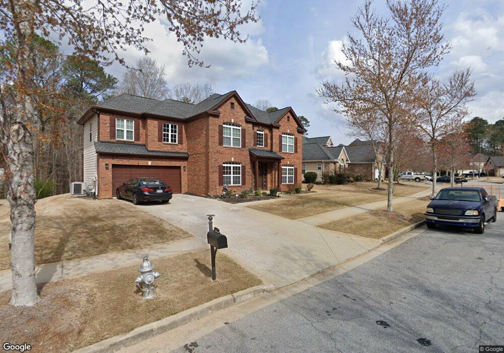
5437 the Vyne Ave Atlanta, GA 30349
Estimated Value: $392,000 - $510,000
4
Beds
3
Baths
2,756
Sq Ft
$156/Sq Ft
Est. Value
About This Home
This home is located at 5437 the Vyne Ave, Atlanta, GA 30349 and is currently estimated at $430,882, approximately $156 per square foot. 5437 the Vyne Ave is a home located in Fulton County with nearby schools including Wolf Creek Elementary, Sandtown Middle School, and Westlake High School.
Ownership History
Date
Name
Owned For
Owner Type
Purchase Details
Closed on
Nov 29, 2006
Sold by
Gilbert Cedrick D
Bought by
Gilbert Cedrick D and Gilbert Antoinette
Current Estimated Value
Home Financials for this Owner
Home Financials are based on the most recent Mortgage that was taken out on this home.
Original Mortgage
$264,669
Outstanding Balance
$156,391
Interest Rate
6.1%
Mortgage Type
New Conventional
Estimated Equity
$274,492
Create a Home Valuation Report for This Property
The Home Valuation Report is an in-depth analysis detailing your home's value as well as a comparison with similar homes in the area
Home Values in the Area
Average Home Value in this Area
Purchase History
| Date | Buyer | Sale Price | Title Company |
|---|---|---|---|
| Gilbert Cedrick D | -- | -- | |
| Gilbert Cedrick D | $264,700 | -- |
Source: Public Records
Mortgage History
| Date | Status | Borrower | Loan Amount |
|---|---|---|---|
| Open | Gilbert Cedrick D | $264,669 |
Source: Public Records
Tax History Compared to Growth
Tax History
| Year | Tax Paid | Tax Assessment Tax Assessment Total Assessment is a certain percentage of the fair market value that is determined by local assessors to be the total taxable value of land and additions on the property. | Land | Improvement |
|---|---|---|---|---|
| 2025 | $2,773 | $149,200 | $42,720 | $106,480 |
| 2023 | $4,011 | $142,120 | $42,600 | $99,520 |
| 2022 | $2,437 | $114,600 | $33,200 | $81,400 |
| 2021 | $2,318 | $101,880 | $21,280 | $80,600 |
| 2020 | $2,328 | $100,680 | $21,040 | $79,640 |
| 2019 | $2,635 | $98,880 | $20,640 | $78,240 |
| 2018 | $2,567 | $81,800 | $13,920 | $67,880 |
| 2017 | $1,873 | $63,040 | $15,240 | $47,800 |
| 2016 | $1,872 | $63,040 | $15,240 | $47,800 |
| 2015 | $1,878 | $63,040 | $15,240 | $47,800 |
| 2014 | $1,954 | $63,040 | $15,240 | $47,800 |
Source: Public Records
Map
Nearby Homes
- 3858 Parham Way
- 3820 Union Rd SW
- 3870 Parham Way
- 5663 Eternal Dr
- 5618 Livesage Dr
- 145 Redsage Ridge
- 3665 Union Rd SW
- 0 Peace Valley Dr SW Unit 7621854
- 5692 Greensage Dr
- 3640 Union Rd SW
- 3560 Union Rd SW
- 5270 Serenity Ln SW
- 4114 Bigsage Dr
- 4040 Trimrose Ct
- 4040 Trimrose Ct Unit LOT 71
- 4044 Trimrose Ct
- 4044 Trimrose Ct Unit LOT 72
- 4116 Thronbud Rd
- 4116 Thronbud Rd Unit LOT 120
- 4112 Thronbud Rd Unit LOT 119
- 5439 the Vyne Ave
- 5433 the Vyne Ave
- 0 the Vyne Ave Unit 7519619
- 0 the Vyne Ave Unit 8693445
- 0 the Vyne Ave Unit 8577844
- 0 the Vyne Ave Unit 8507345
- 0 the Vyne Ave Unit 8492112
- 0 the Vyne Ave Unit 8441823
- 0 the Vyne Ave Unit 8368891
- 0 the Vyne Ave Unit 8096224
- 0 the Vyne Ave Unit 8064429
- 0 the Vyne Ave Unit 8001899
- 0 the Vyne Ave Unit 8612752
- 0 the Vyne Ave Unit 8053957
- 0 the Vyne Ave Unit 8424614
- 0 the Vyne Ave Unit 8830121
- 0 the Vyne Ave Unit 7026725
- 0 the Vyne Ave Unit 8966489
- 0 the Vyne Ave Unit 3198420
- 0 the Vyne Ave