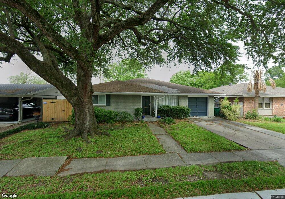
544 Andrews Ave Metairie, LA 70005
Bonnabel Place NeighborhoodEstimated Value: $373,000 - $459,000
4
Beds
2
Baths
2,056
Sq Ft
$197/Sq Ft
Est. Value
About This Home
This home is located at 544 Andrews Ave, Metairie, LA 70005 and is currently estimated at $405,086, approximately $197 per square foot. 544 Andrews Ave is a home located in Jefferson Parish with nearby schools including Metairie Academy For Advanced Studies, Marie B. Riviere Elementary School, and J.D. Meisler Middle School.
Ownership History
Date
Name
Owned For
Owner Type
Purchase Details
Closed on
Oct 14, 2010
Sold by
Holstein Robert S
Bought by
Brooks Roy E
Current Estimated Value
Home Financials for this Owner
Home Financials are based on the most recent Mortgage that was taken out on this home.
Original Mortgage
$264,438
Outstanding Balance
$173,611
Interest Rate
4.25%
Mortgage Type
FHA
Estimated Equity
$231,475
Purchase Details
Closed on
Nov 23, 2005
Sold by
Mitchell Susan L
Bought by
Holstein Robert S
Home Financials for this Owner
Home Financials are based on the most recent Mortgage that was taken out on this home.
Original Mortgage
$65,000
Interest Rate
6.3%
Create a Home Valuation Report for This Property
The Home Valuation Report is an in-depth analysis detailing your home's value as well as a comparison with similar homes in the area
Home Values in the Area
Average Home Value in this Area
Purchase History
| Date | Buyer | Sale Price | Title Company |
|---|---|---|---|
| Brooks Roy E | $268,000 | -- | |
| Holstein Robert S | $264,000 | -- |
Source: Public Records
Mortgage History
| Date | Status | Borrower | Loan Amount |
|---|---|---|---|
| Open | Brooks Roy E | $264,438 | |
| Previous Owner | Holstein Robert S | $65,000 |
Source: Public Records
Tax History Compared to Growth
Tax History
| Year | Tax Paid | Tax Assessment Tax Assessment Total Assessment is a certain percentage of the fair market value that is determined by local assessors to be the total taxable value of land and additions on the property. | Land | Improvement |
|---|---|---|---|---|
| 2024 | $542 | $28,160 | $11,590 | $16,570 |
| 2023 | $2,701 | $28,030 | $11,590 | $16,440 |
| 2022 | $3,591 | $28,030 | $11,590 | $16,440 |
| 2021 | $3,335 | $28,030 | $11,590 | $16,440 |
| 2020 | $3,312 | $28,030 | $11,590 | $16,440 |
| 2019 | $3,385 | $27,870 | $11,040 | $16,830 |
| 2018 | $2,310 | $27,870 | $11,040 | $16,830 |
| 2017 | $3,161 | $27,870 | $11,040 | $16,830 |
| 2016 | $3,099 | $27,870 | $11,040 | $16,830 |
| 2015 | $2,171 | $26,800 | $10,010 | $16,790 |
| 2014 | $2,171 | $26,800 | $10,010 | $16,790 |
Source: Public Records
Map
Nearby Homes
- 500-506 Andrews Ave
- 601 Andrews Ave
- 421 Oaklawn Dr
- 401 E William David Pkwy
- 429 Aris Ave
- 800 Rue Rampart None Unit 230
- 800 Rue Rampart Unit 230
- 800 Rue Rampart Unit 103
- 513 Oaklawn Dr
- 510 Nursery Ave
- none Canal St
- 801 Rue Burgundy Unit 218
- 319 E William David Pkwy
- 632 Rosa Ave
- 501 Rue Saint Peter Unit 206
- 400 Aris Ave
- 548 Andrews Ave
- 540 Andrews Ave
- 552 Andrews Ave
- 549 Andrews Ave
- 545 Andrews Ave
- 801 S Interstate 10 Service Rd E
- 801 N I 10 Service Rd E
- 541 Andrews Ave
- 553 Andrews Ave
- 556 Andrews Ave
- 557 Andrews Ave
- 552 Smith Dr
- 556 Smith Dr
- 560 Andrews Ave
- 548 Smith Dr
- 561 Andrews Ave
- 523 Rosa Ave
- 560 Smith Dr
- 517 Rosa Ave
- 564 Smith Dr