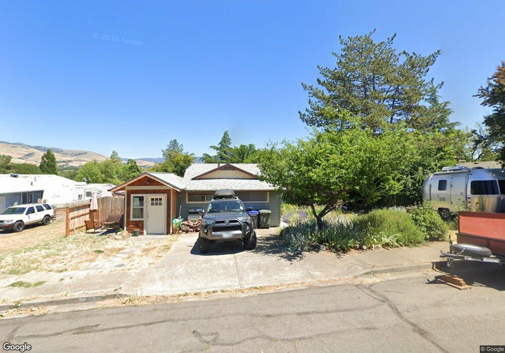
544 Carol St Ashland, OR 97520
Cottage District NeighborhoodEstimated Value: $531,982 - $665,000
5
Beds
3
Baths
1,989
Sq Ft
$295/Sq Ft
Est. Value
About This Home
This home is located at 544 Carol St, Ashland, OR 97520 and is currently estimated at $587,496, approximately $295 per square foot. 544 Carol St is a home located in Jackson County with nearby schools including Walker Elementary School, Ashland Middle School, and Ashland High School.
Ownership History
Date
Name
Owned For
Owner Type
Purchase Details
Closed on
Sep 10, 2018
Sold by
Scholl Steven D and Lineberger Janice A
Bought by
Stroud Crystal and Stroud Steve G
Current Estimated Value
Home Financials for this Owner
Home Financials are based on the most recent Mortgage that was taken out on this home.
Original Mortgage
$334,400
Interest Rate
4.5%
Mortgage Type
New Conventional
Purchase Details
Closed on
Jun 11, 2003
Sold by
Olsen Ruth M
Bought by
Scholl Steven D and Lineberger Janice A
Home Financials for this Owner
Home Financials are based on the most recent Mortgage that was taken out on this home.
Original Mortgage
$196,000
Interest Rate
5.61%
Mortgage Type
Purchase Money Mortgage
Create a Home Valuation Report for This Property
The Home Valuation Report is an in-depth analysis detailing your home's value as well as a comparison with similar homes in the area
Home Values in the Area
Average Home Value in this Area
Purchase History
| Date | Buyer | Sale Price | Title Company |
|---|---|---|---|
| Stroud Crystal | $418,000 | First American Title | |
| Scholl Steven D | $245,000 | Lawyers Title Insurance Corp | |
| Scholl Steven D | -- | Lawyers Title Insurance Corp |
Source: Public Records
Mortgage History
| Date | Status | Borrower | Loan Amount |
|---|---|---|---|
| Closed | Stroud Crystal | $334,400 | |
| Previous Owner | Scholl Steven D | $196,000 | |
| Closed | Scholl Steven D | $39,000 |
Source: Public Records
Tax History Compared to Growth
Tax History
| Year | Tax Paid | Tax Assessment Tax Assessment Total Assessment is a certain percentage of the fair market value that is determined by local assessors to be the total taxable value of land and additions on the property. | Land | Improvement |
|---|---|---|---|---|
| 2025 | $3,998 | $257,900 | $112,820 | $145,080 |
| 2024 | $3,998 | $250,390 | $109,530 | $140,860 |
| 2023 | $3,868 | $243,100 | $106,340 | $136,760 |
| 2022 | $3,744 | $243,100 | $106,340 | $136,760 |
| 2021 | $3,486 | $241,150 | $103,240 | $137,910 |
| 2020 | $3,388 | $220,840 | $100,240 | $120,600 |
| 2019 | $3,334 | $208,170 | $94,490 | $113,680 |
| 2018 | $3,150 | $202,110 | $91,740 | $110,370 |
| 2017 | $3,127 | $202,110 | $91,740 | $110,370 |
| 2016 | $3,045 | $190,520 | $86,480 | $104,040 |
| 2015 | $2,928 | $190,520 | $86,480 | $104,040 |
| 2014 | $2,833 | $179,600 | $81,510 | $98,090 |
Source: Public Records
Map
Nearby Homes
- 401 Clinton St
- 500 Poplar Place
- 403 Briscoe Place
- 224 Alicia St
- 419 Clinton St
- 767 Oak St
- 453 Williamson Way
- 533 N Mountain Ave
- 496 Starflower Ln
- 520 Helman St
- 411 N Mountain Ave
- 380 Hemlock Ln
- 820 Satsuma Ct Unit 6
- 817 N Mountain Ave Unit 3
- 597 Mariposa Ct Unit 14
- 237 B St
- 165 Water St
- 292 B St
- 252 B St
- 586 B St
- 289 Patterson St
- 558 Carol St
- 299 Patterson St
- 568 Carol St
- 541 Carol St
- 309 Patterson St
- 555 Carol St
- 288 Patterson St
- 304 Clinton St
- 292 Clinton St
- 578 Carol St
- 319 Patterson St
- 245 Patterson St
- 496 Carol St
- 308 Patterson St
- 515 Carol St
- 316 Clinton St
- 573 Carol St
- 286 Patterson St
- 286 Patterson St