Estimated Value: $128,000 - $140,180
2
Beds
1
Bath
1,326
Sq Ft
$101/Sq Ft
Est. Value
About This Home
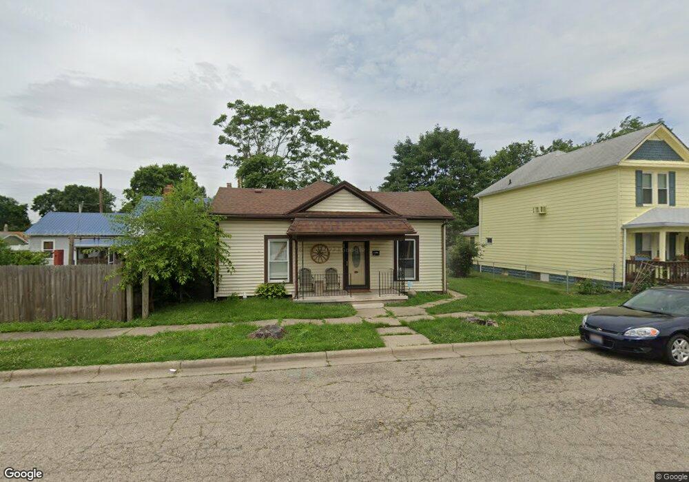
This home is located at 544 Center St, Xenia, OH 45385 and is currently estimated at $134,045, approximately $101 per square foot. 544 Center St is a home located in Greene County with nearby schools including Xenia High School, Summit Academy Community School for Alternative Learners - Xenia, and Legacy Christian Academy.
Ownership History
Date
Name
Owned For
Owner Type
Purchase Details
Closed on
Apr 4, 2008
Sold by
Parks Adrial W and Parks Teri L
Bought by
Parks Adrial W and Parks Terri L
Current Estimated Value
Purchase Details
Closed on
Nov 17, 1999
Sold by
Arrasmith Vikki M and Rife Robert L
Bought by
Parks Adrial W
Home Financials for this Owner
Home Financials are based on the most recent Mortgage that was taken out on this home.
Original Mortgage
$61,200
Outstanding Balance
$18,869
Interest Rate
7.88%
Mortgage Type
VA
Estimated Equity
$115,176
Purchase Details
Closed on
Oct 13, 1998
Sold by
Estes Richard D
Bought by
Arrasmith Vikki M and Rife Robert L
Create a Home Valuation Report for This Property
The Home Valuation Report is an in-depth analysis detailing your home's value as well as a comparison with similar homes in the area
Home Values in the Area
Average Home Value in this Area
Purchase History
| Date | Buyer | Sale Price | Title Company |
|---|---|---|---|
| Parks Adrial W | -- | Attorney | |
| Parks Adrial W | $60,000 | -- | |
| Arrasmith Vikki M | -- | -- |
Source: Public Records
Mortgage History
| Date | Status | Borrower | Loan Amount |
|---|---|---|---|
| Open | Parks Adrial W | $61,200 |
Source: Public Records
Tax History Compared to Growth
Tax History
| Year | Tax Paid | Tax Assessment Tax Assessment Total Assessment is a certain percentage of the fair market value that is determined by local assessors to be the total taxable value of land and additions on the property. | Land | Improvement |
|---|---|---|---|---|
| 2024 | $1,208 | $28,240 | $4,930 | $23,310 |
| 2023 | $1,208 | $28,240 | $4,930 | $23,310 |
| 2022 | $1,079 | $21,510 | $3,940 | $17,570 |
| 2021 | $1,094 | $21,510 | $3,940 | $17,570 |
| 2020 | $1,048 | $21,510 | $3,940 | $17,570 |
| 2019 | $911 | $17,600 | $4,420 | $13,180 |
| 2018 | $914 | $17,600 | $4,420 | $13,180 |
| 2017 | $930 | $17,600 | $4,420 | $13,180 |
| 2016 | $931 | $17,580 | $4,420 | $13,160 |
| 2015 | $933 | $17,580 | $4,420 | $13,160 |
| 2014 | $894 | $17,580 | $4,420 | $13,160 |
Source: Public Records
Map
Nearby Homes
- 556 Center St
- 387 Charles St
- 325 Locust St
- 349 Cincinnati Ave
- 341 Cincinnati Ave
- 365 Cincinnati Ave
- 511 Center St
- 339 Locust St
- 540 Center St
- 528 Center St
- 497 Center St
- 564 Center St
- 510 Center St
- 393 Cincinnati Ave
- 489 Center St
- 330 Cincinnati Ave
- 322 Locust St
- 403 Cincinnati Ave
- 479 Center St
- 330 Cincinnati Ave Unit 330-338-342