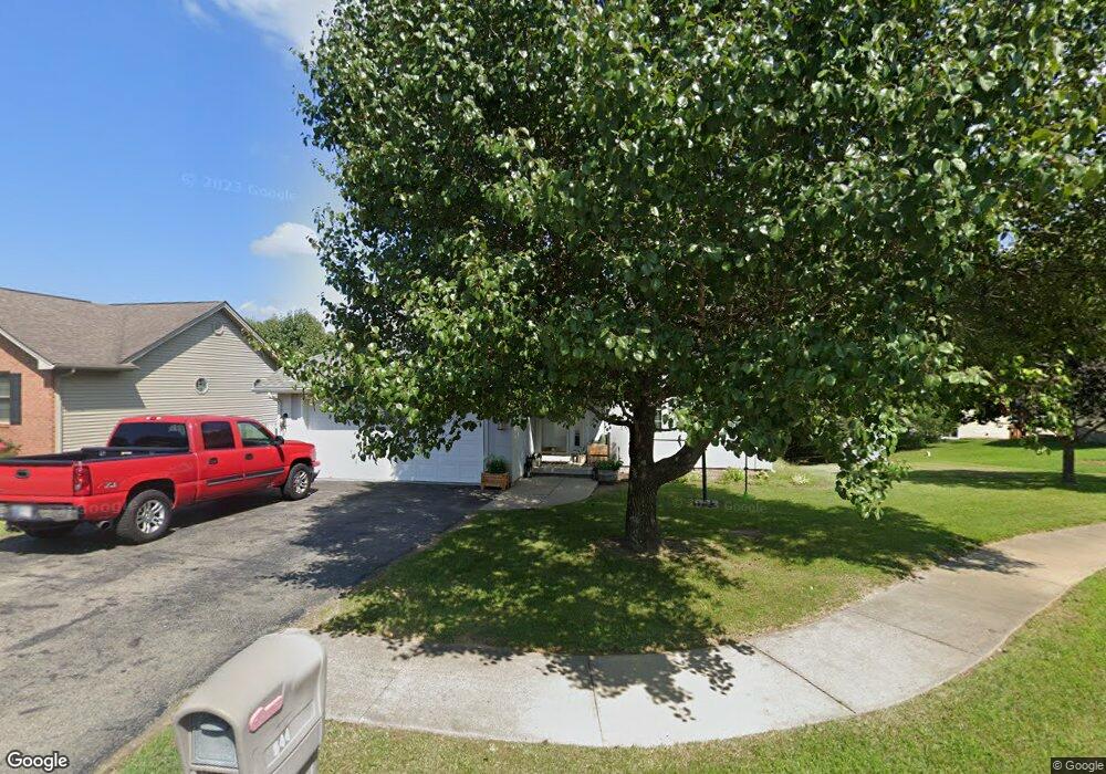
544 Daniel Dr North Vernon, IN 47265
Estimated Value: $247,190 - $275,000
3
Beds
2
Baths
1,680
Sq Ft
$156/Sq Ft
Est. Value
About This Home
This home is located at 544 Daniel Dr, North Vernon, IN 47265 and is currently estimated at $261,798, approximately $155 per square foot. 544 Daniel Dr is a home located in Jennings County with nearby schools including North Vernon Elementary School, Jennings County Middle School, and Jennings County High School.
Ownership History
Date
Name
Owned For
Owner Type
Purchase Details
Closed on
Jun 29, 2016
Sold by
Humpert William E
Bought by
Walker Matthew C and Ertel Annie
Current Estimated Value
Home Financials for this Owner
Home Financials are based on the most recent Mortgage that was taken out on this home.
Original Mortgage
$156,298
Outstanding Balance
$125,014
Interest Rate
3.64%
Mortgage Type
New Conventional
Estimated Equity
$136,784
Purchase Details
Closed on
Oct 30, 2014
Sold by
Thorpe Michael John
Bought by
Humpert William E
Home Financials for this Owner
Home Financials are based on the most recent Mortgage that was taken out on this home.
Original Mortgage
$109,479
Interest Rate
4.5%
Mortgage Type
FHA
Purchase Details
Closed on
Nov 15, 2002
Sold by
Barlow Michael S
Bought by
Thorpe Michael John
Create a Home Valuation Report for This Property
The Home Valuation Report is an in-depth analysis detailing your home's value as well as a comparison with similar homes in the area
Home Values in the Area
Average Home Value in this Area
Purchase History
| Date | Buyer | Sale Price | Title Company |
|---|---|---|---|
| Walker Matthew C | -- | None Available | |
| Humpert William E | -- | Kemp Title Agency Llc | |
| Thorpe Michael John | $110,379 | -- |
Source: Public Records
Mortgage History
| Date | Status | Borrower | Loan Amount |
|---|---|---|---|
| Open | Walker Matthew C | $156,298 | |
| Previous Owner | Humpert William E | $109,479 |
Source: Public Records
Tax History Compared to Growth
Tax History
| Year | Tax Paid | Tax Assessment Tax Assessment Total Assessment is a certain percentage of the fair market value that is determined by local assessors to be the total taxable value of land and additions on the property. | Land | Improvement |
|---|---|---|---|---|
| 2024 | $1,837 | $183,700 | $11,100 | $172,600 |
| 2023 | $1,745 | $174,500 | $11,100 | $163,400 |
| 2022 | $1,552 | $155,200 | $11,100 | $144,100 |
| 2021 | $1,432 | $143,200 | $11,100 | $132,100 |
| 2020 | $1,330 | $133,000 | $11,000 | $122,000 |
| 2019 | $1,254 | $125,400 | $11,000 | $114,400 |
| 2018 | $1,198 | $119,800 | $11,000 | $108,800 |
| 2017 | $1,140 | $114,000 | $11,000 | $103,000 |
| 2016 | $1,153 | $115,300 | $11,000 | $104,300 |
| 2014 | $1,162 | $116,200 | $11,000 | $105,200 |
Source: Public Records
Map
Nearby Homes
- 295 Persimmon Dr
- 85 N County Road 205 W
- 333 Oakridge Dr
- 1785 W Brownstown Rd
- 1905 W Brownstown Rd
- 46 Noon Dr
- 208 South St
- 1675 Twin Oaks Dr
- 0 W Walnut St Unit MBR22050857
- 245 S County Road 150 W
- 82 Norris Ave
- 310 Tiffany Ln
- 210 Norris Ave
- 174 E Norris Heights
- 201 W Hayden Pike
- 950 W Base Rd
- 10 Hicks St
- 215 S Gum St
- 52 W Poplar St
- 62 Brookside Dr
- 558 Daniel Dr
- 551 Barlow Dr Unit 553
- 531 Barlow Dr
- 561 Barlow Dr Unit 563
- 574 Daniel Dr
- 541 Daniel Dr
- 516 Daniel Dr
- 557 Daniel Dr
- 581 Barlow Dr Unit 583
- 516 Barlow Dr
- 517 Daniel Dr
- 529 Daniel Dr
- 575 Daniel Dr
- 591 Barlow Dr Unit 593
- 560 Barlow Dr Unit 562
- 540 Barlow Dr Unit 542
- 520 Barlow Dr
- 520 Barlow Dr