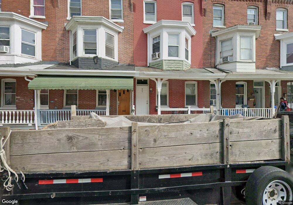
544 Kohn St Norristown, PA 19401
Estimated Value: $163,000 - $201,888
5
Beds
1
Bath
1,761
Sq Ft
$103/Sq Ft
Est. Value
About This Home
This home is located at 544 Kohn St, Norristown, PA 19401 and is currently estimated at $181,963, approximately $103 per square foot. 544 Kohn St is a home located in Montgomery County with nearby schools including Davenport Elementary School, Charles Blockson Middle School, and East Norriton Middle School.
Ownership History
Date
Name
Owned For
Owner Type
Purchase Details
Closed on
Apr 8, 2025
Sold by
Alexander Jayon
Bought by
Rymia Properties Llc
Current Estimated Value
Home Financials for this Owner
Home Financials are based on the most recent Mortgage that was taken out on this home.
Original Mortgage
$180,000
Outstanding Balance
$179,201
Interest Rate
6.65%
Mortgage Type
New Conventional
Estimated Equity
$2,762
Purchase Details
Closed on
Apr 24, 2015
Sold by
Luce Joseph J
Bought by
Gri Gro Properties Llc
Create a Home Valuation Report for This Property
The Home Valuation Report is an in-depth analysis detailing your home's value as well as a comparison with similar homes in the area
Home Values in the Area
Average Home Value in this Area
Purchase History
| Date | Buyer | Sale Price | Title Company |
|---|---|---|---|
| Rymia Properties Llc | -- | Surety Expert Abstract | |
| Rymia Properties Llc | -- | Surety Expert Abstract | |
| Gri Gro Properties Llc | $22,000 | None Available |
Source: Public Records
Mortgage History
| Date | Status | Borrower | Loan Amount |
|---|---|---|---|
| Open | Rymia Properties Llc | $180,000 | |
| Closed | Rymia Properties Llc | $180,000 |
Source: Public Records
Tax History Compared to Growth
Tax History
| Year | Tax Paid | Tax Assessment Tax Assessment Total Assessment is a certain percentage of the fair market value that is determined by local assessors to be the total taxable value of land and additions on the property. | Land | Improvement |
|---|---|---|---|---|
| 2025 | $3,402 | $55,430 | $15,030 | $40,400 |
| 2024 | $3,402 | $55,430 | $15,030 | $40,400 |
| 2023 | $3,372 | $55,430 | $15,030 | $40,400 |
| 2022 | $3,299 | $55,430 | $15,030 | $40,400 |
| 2021 | $3,283 | $55,430 | $15,030 | $40,400 |
| 2020 | $3,132 | $55,430 | $15,030 | $40,400 |
| 2019 | $3,075 | $55,430 | $15,030 | $40,400 |
| 2018 | $2,046 | $55,430 | $15,030 | $40,400 |
| 2017 | $2,823 | $55,430 | $15,030 | $40,400 |
| 2016 | $2,802 | $55,430 | $15,030 | $40,400 |
| 2015 | -- | $55,430 | $15,030 | $40,400 |
| 2014 | -- | $55,430 | $15,030 | $40,400 |
Source: Public Records
Map
Nearby Homes
- 557 Haws Ave
- 632 Chain St
- 0 Astor St
- 651 George St
- 558 Stanbridge St
- 201 Chain St Unit 28
- 905 W Marshall St
- 648 Stanbridge St
- 701 Haws Ave
- 654 Stanbridge St
- 519 Noble St
- 924 W Main St
- 1016 Thomas Barone St
- 732 Stanbridge St
- 1009 W Main St
- 521 Norris St
- 804 W Elm St Unit 70
- 804 George St
- 809 George St
- 1014 W Main St