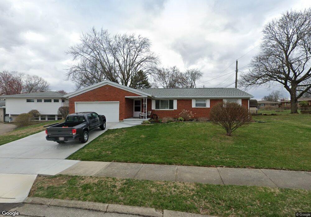
544 Latimer Dr Springfield, OH 45503
Estimated Value: $214,000 - $253,000
3
Beds
2
Baths
1,608
Sq Ft
$143/Sq Ft
Est. Value
About This Home
This home is located at 544 Latimer Dr, Springfield, OH 45503 and is currently estimated at $230,339, approximately $143 per square foot. 544 Latimer Dr is a home located in Clark County with nearby schools including Kenton Elementary School, Roosevelt Middle School, and Springfield High School.
Ownership History
Date
Name
Owned For
Owner Type
Purchase Details
Closed on
Jul 27, 2015
Sold by
Snow Betty Eileen and Snow Betty E
Bought by
Church Roger S and Church Laura G
Current Estimated Value
Home Financials for this Owner
Home Financials are based on the most recent Mortgage that was taken out on this home.
Original Mortgage
$110,461
Outstanding Balance
$85,983
Interest Rate
4.05%
Mortgage Type
FHA
Estimated Equity
$144,356
Create a Home Valuation Report for This Property
The Home Valuation Report is an in-depth analysis detailing your home's value as well as a comparison with similar homes in the area
Home Values in the Area
Average Home Value in this Area
Purchase History
| Date | Buyer | Sale Price | Title Company |
|---|---|---|---|
| Church Roger S | $112,500 | Team Title & Closing Svcs |
Source: Public Records
Mortgage History
| Date | Status | Borrower | Loan Amount |
|---|---|---|---|
| Open | Church Roger S | $110,461 |
Source: Public Records
Tax History
| Year | Tax Paid | Tax Assessment Tax Assessment Total Assessment is a certain percentage of the fair market value that is determined by local assessors to be the total taxable value of land and additions on the property. | Land | Improvement |
|---|---|---|---|---|
| 2025 | $2,668 | $71,210 | $16,870 | $54,340 |
| 2024 | $2,599 | $53,920 | $14,350 | $39,570 |
| 2023 | $2,599 | $53,920 | $14,350 | $39,570 |
| 2022 | $2,662 | $53,920 | $14,350 | $39,570 |
| 2021 | $2,209 | $41,320 | $10,960 | $30,360 |
| 2020 | $2,214 | $41,320 | $10,960 | $30,360 |
| 2019 | $2,220 | $41,320 | $10,960 | $30,360 |
| 2018 | $2,256 | $40,330 | $10,940 | $29,390 |
| 2017 | $2,254 | $44,563 | $10,938 | $33,625 |
| 2016 | $2,257 | $44,563 | $10,938 | $33,625 |
| 2015 | $1,563 | $39,929 | $10,420 | $29,509 |
| 2014 | $1,557 | $39,929 | $10,420 | $29,509 |
| 2013 | $1,540 | $39,929 | $10,420 | $29,509 |
Source: Public Records
Map
Nearby Homes
- 2540 Rebecca Dr
- 2824 Balsam Dr
- 516 Rensselaer St
- 366 Northfield Blvd Unit 1C
- 1046 Fruitland Rd
- 2553 Derr Rd
- 2951 Archer Ln
- 0 E Home Rd
- 3021 Argonne Ln N
- 2153 Olympic St Unit 2153
- 3027 Argonne Ln N Unit 3027
- 141 S Kensington Place
- 224 Roscommon Dr
- 3153 Argonne Ln N
- 2002 N Fountain Blvd
- 3135 Imperial Blvd
- 3247 Argonne Ln N Unit 3247
- 154 Floral Ave
- 3250 Argonne Ln N
- 1810 N Limestone St
- 536 Latimer Dr
- 2527 Balsam Dr
- 610 Latimer Dr
- 2533 Balsam Dr
- 528 Latimer Dr
- 2540 Carousel Dr
- 543 Zeller Dr
- 543 Zeller Dr Unit Springfield
- 2539 Balsam Dr
- 535 Zeller Dr
- 2507 Balsam Dr
- 545 Latimer Dr
- 2532 Carousel Dr
- 535 Latimer Dr
- 520 Latimer Dr
- 2606 Carousel Dr
- 609 Zeller Dr
- 527 Latimer Dr
- 2429 Balsam Dr
- 2524 Carousel Dr
Your Personal Tour Guide
Ask me questions while you tour the home.