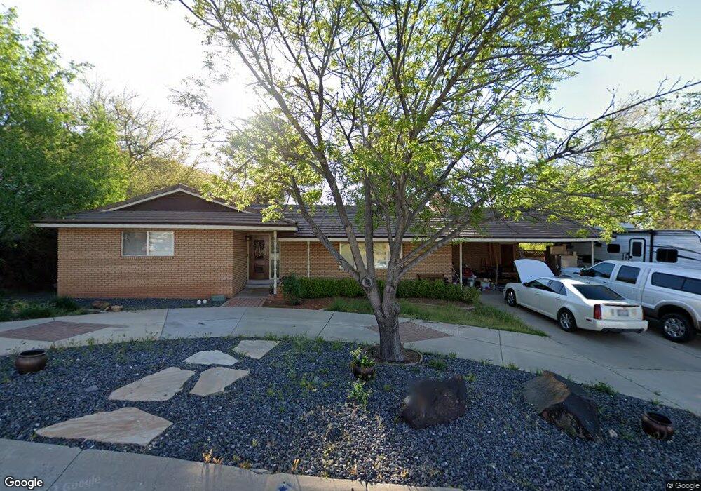
544 N 260 Cir W St. George, UT 84770
Estimated Value: $463,385 - $574,000
4
Beds
3
Baths
2,513
Sq Ft
$207/Sq Ft
Est. Value
About This Home
This home is located at 544 N 260 Cir W, St. George, UT 84770 and is currently estimated at $519,096, approximately $206 per square foot. 544 N 260 Cir W is a home located in Washington County with nearby schools including Heritage School, Dixie Middle School, and Dixie Intermediate School.
Ownership History
Date
Name
Owned For
Owner Type
Purchase Details
Closed on
Feb 27, 2009
Sold by
Kinzie David Charles and Kinzie Martha Susan
Bought by
Kinzie David C and Kinzie Martha S
Current Estimated Value
Purchase Details
Closed on
Aug 8, 2007
Sold by
Davies David B and Davies Jolynn S
Bought by
Kinzie David Charles and Kinzie Martha Susan
Home Financials for this Owner
Home Financials are based on the most recent Mortgage that was taken out on this home.
Original Mortgage
$228,750
Outstanding Balance
$144,759
Interest Rate
6.65%
Mortgage Type
Purchase Money Mortgage
Estimated Equity
$374,337
Create a Home Valuation Report for This Property
The Home Valuation Report is an in-depth analysis detailing your home's value as well as a comparison with similar homes in the area
Home Values in the Area
Average Home Value in this Area
Purchase History
| Date | Buyer | Sale Price | Title Company |
|---|---|---|---|
| Kinzie David C | -- | None Available | |
| Kinzie David Charles | -- | Southern Utah Title Co |
Source: Public Records
Mortgage History
| Date | Status | Borrower | Loan Amount |
|---|---|---|---|
| Open | Kinzie David Charles | $228,750 |
Source: Public Records
Tax History Compared to Growth
Tax History
| Year | Tax Paid | Tax Assessment Tax Assessment Total Assessment is a certain percentage of the fair market value that is determined by local assessors to be the total taxable value of land and additions on the property. | Land | Improvement |
|---|---|---|---|---|
| 2025 | $1,765 | $259,105 | $75,625 | $183,480 |
| 2023 | $1,789 | $267,245 | $75,625 | $191,620 |
| 2022 | $1,903 | $267,355 | $75,625 | $191,730 |
| 2021 | $1,668 | $349,500 | $88,000 | $261,500 |
| 2020 | $1,448 | $285,700 | $65,000 | $220,700 |
| 2019 | $1,428 | $275,300 | $60,000 | $215,300 |
| 2018 | $1,255 | $121,275 | $0 | $0 |
| 2017 | $1,372 | $132,605 | $0 | $0 |
| 2016 | $1,300 | $116,160 | $0 | $0 |
| 2015 | $1,340 | $114,950 | $0 | $0 |
| 2014 | $1,229 | $106,095 | $0 | $0 |
Source: Public Records
Map
Nearby Homes
- 485 N 400 W
- 485 W Diagonal Unit 11
- 485 Diagonal St Unit 11
- 454 W 400 N
- 550 W 600 N Unit 9
- 578 S Cecita Way
- 590 S Cecita Way
- 311 N Donlee Dr
- 301 N Donlee Dr
- 468 Ridgeview Dr
- 453 Northridge Ave
- 567 Ridgeview Dr
- 571 W 15 Cir N
- 250 S Donlee Dr Unit J
- 250 S Donlee Dr
- 135 S 100 St W
- 663 W 65 S
- 568 N 950 W
- 588 N 950 W
- 358 W 200 S
- 544 N 260 West Cir
- 556 N 260 West Cir
- 234 W 500 N
- 220 W 500 N
- 291 W 550 North Cir Unit 22
- 291 Sandstone Cir
- 545 N 260 West Cir
- 570 N 260 West Cir
- 570 N 260 Cir W
- 246 W 500 N
- 525 N 260 West Cir
- 286 Sandstone Cir
- 303 Sandstone Cir
- 575 N 260 Cir W
- 575 N 260 West Cir
- 286 W 500 N
- 580 N 260 West Cir
- 324 Sandstone Cir
- 324 W 550 North Cir
- 324 W 550 North Cir