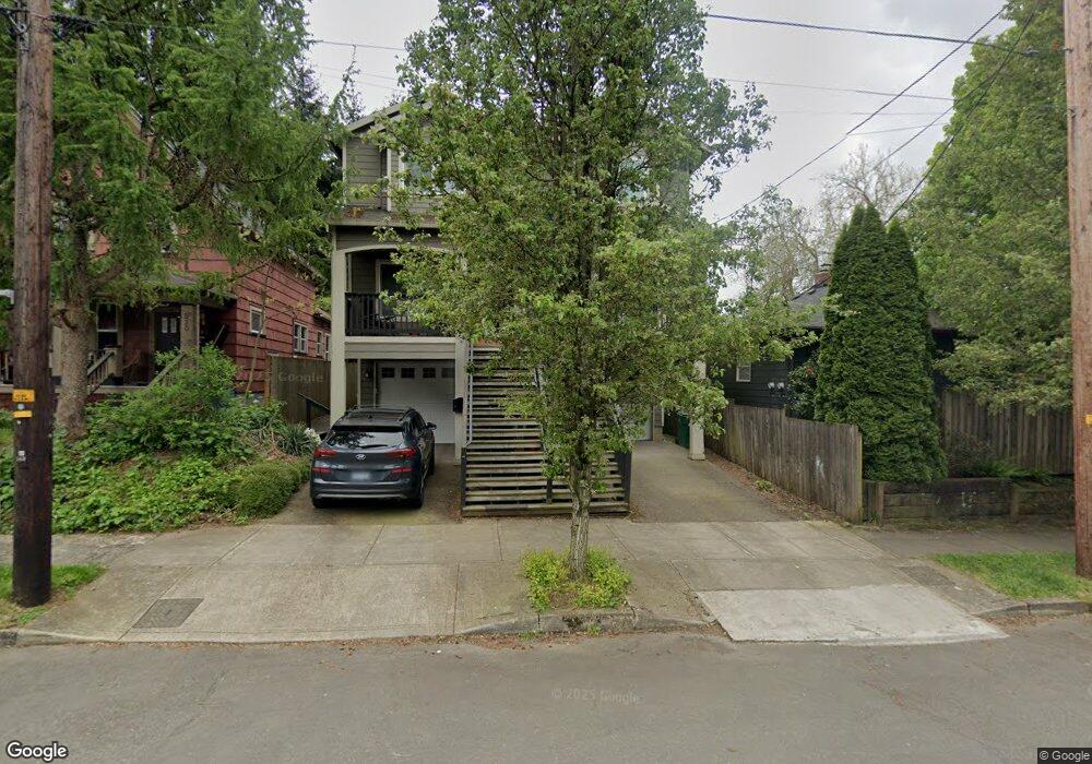
544 N Cook St Portland, OR 97227
Boise NeighborhoodEstimated Value: $602,000 - $715,000
--
Bed
2
Baths
2,124
Sq Ft
$314/Sq Ft
Est. Value
About This Home
This home is located at 544 N Cook St, Portland, OR 97227 and is currently estimated at $666,394, approximately $313 per square foot. 544 N Cook St is a home with nearby schools including Boise-Eliot Elementary School, Harriet Tubman Middle School, and Jefferson High School.
Ownership History
Date
Name
Owned For
Owner Type
Purchase Details
Closed on
Mar 26, 2013
Sold by
Av Pacific Llc
Bought by
Zalavras Charalampos
Current Estimated Value
Home Financials for this Owner
Home Financials are based on the most recent Mortgage that was taken out on this home.
Original Mortgage
$421,800
Outstanding Balance
$295,950
Interest Rate
3.49%
Mortgage Type
New Conventional
Estimated Equity
$370,444
Purchase Details
Closed on
Mar 6, 2012
Sold by
Mantis Lloyd M
Bought by
Av Pacific Llc
Create a Home Valuation Report for This Property
The Home Valuation Report is an in-depth analysis detailing your home's value as well as a comparison with similar homes in the area
Home Values in the Area
Average Home Value in this Area
Purchase History
| Date | Buyer | Sale Price | Title Company |
|---|---|---|---|
| Zalavras Charalampos | $562,500 | Lawyers Title | |
| Av Pacific Llc | $90,000 | First American |
Source: Public Records
Mortgage History
| Date | Status | Borrower | Loan Amount |
|---|---|---|---|
| Open | Zalavras Charalampos | $421,800 |
Source: Public Records
Tax History Compared to Growth
Tax History
| Year | Tax Paid | Tax Assessment Tax Assessment Total Assessment is a certain percentage of the fair market value that is determined by local assessors to be the total taxable value of land and additions on the property. | Land | Improvement |
|---|---|---|---|---|
| 2025 | $7,882 | $292,540 | -- | -- |
| 2024 | $7,599 | $284,020 | -- | -- |
| 2023 | $7,307 | $275,750 | $0 | $0 |
| 2022 | $7,149 | $267,720 | $0 | $0 |
| 2021 | $7,028 | $259,930 | $0 | $0 |
| 2020 | $6,447 | $252,360 | $0 | $0 |
| 2019 | $6,210 | $245,010 | $0 | $0 |
| 2018 | $6,027 | $237,880 | $0 | $0 |
| 2017 | $5,777 | $230,960 | $0 | $0 |
| 2016 | $5,287 | $224,240 | $0 | $0 |
| 2015 | $5,148 | $217,710 | $0 | $0 |
| 2014 | $5,736 | $239,110 | $0 | $0 |
Source: Public Records
Map
Nearby Homes
- 509 N Cook St
- 3528 N Borthwick Ave Unit 3
- 3530 N Borthwick Ave Unit 2
- 3618 N Albina Ave
- 3820 N Haight Ave
- 12 NE Fremont St Unit 3W
- 12 NE Fremont St Unit 3E
- 3781 N Vancouver Ave
- 3308 N Missouri Ave
- 3516 N Missouri Ave
- 35 NE Morris St
- 805 N Failing St
- 819 N Failing St
- 3725 N Michigan Ave
- 3721 N Michigan Ave
- 78 NE Ivy St
- 3756 N Missouri Ave
- 3550 NE Garfield Ave Unit 1
- 3552 NE Garfield Ave Unit 2
- 3564 NE Garfield Ave
- 542 N Cook St
- 530 N Cook St
- 3236 N Kerby Ave Unit 3238
- 521 N Cook St
- 519 N Cook St
- 527 N Cook St
- 3230 N Kerby Ave
- 535 N Cook St
- 539 N Cook St
- 531 N Cook St
- 523 N Cook St
- 522 N Ivy St
- 544 N Ivy St
- 551 N Cook St
- 528 N Ivy St
- 3223 N Kerby Ave Unit 3223
- 3219 N Kerby Ave Unit 3219
- 607 N Fargo St Unit 607
- 3317 N Commercial Ave
- 611 N Fargo St Unit 611