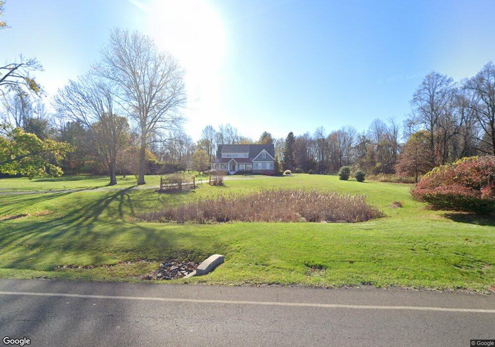
544 Pulinski Rd Warminster, PA 18974
Estimated Value: $1,139,000 - $1,430,000
4
Beds
5
Baths
4,410
Sq Ft
$303/Sq Ft
Est. Value
About This Home
This home is located at 544 Pulinski Rd, Warminster, PA 18974 and is currently estimated at $1,336,547, approximately $303 per square foot. 544 Pulinski Rd is a home located in Bucks County with nearby schools including Maureen M. Welch Elementary School, Richboro Middle School, and Council Rock High School - South.
Ownership History
Date
Name
Owned For
Owner Type
Purchase Details
Closed on
Jan 8, 2013
Sold by
Edwards Julia D and Davenport Amelia M
Bought by
Stith David J and Stith Linda M
Current Estimated Value
Purchase Details
Closed on
Nov 4, 2009
Sold by
Edwards Julia D
Bought by
Edwards Julia D and Davenport Amelia M
Purchase Details
Closed on
Oct 8, 1996
Sold by
Lubowiecki Eugene Joseph and Lubowiecki Amelia
Bought by
Lubowiecki Amelia
Create a Home Valuation Report for This Property
The Home Valuation Report is an in-depth analysis detailing your home's value as well as a comparison with similar homes in the area
Home Values in the Area
Average Home Value in this Area
Purchase History
| Date | Buyer | Sale Price | Title Company |
|---|---|---|---|
| Stith David J | $265,000 | None Available | |
| Edwards Julia D | -- | None Available | |
| Lubowiecki Amelia | -- | -- |
Source: Public Records
Tax History Compared to Growth
Tax History
| Year | Tax Paid | Tax Assessment Tax Assessment Total Assessment is a certain percentage of the fair market value that is determined by local assessors to be the total taxable value of land and additions on the property. | Land | Improvement |
|---|---|---|---|---|
| 2025 | $11,789 | $61,210 | $17,280 | $43,930 |
| 2024 | $11,789 | $61,210 | $17,280 | $43,930 |
| 2023 | $11,111 | $61,210 | $17,280 | $43,930 |
| 2022 | $11,010 | $61,210 | $17,280 | $43,930 |
| 2021 | $10,661 | $61,210 | $17,280 | $43,930 |
| 2020 | $10,422 | $61,210 | $17,280 | $43,930 |
| 2019 | $9,975 | $61,210 | $17,280 | $43,930 |
| 2018 | $9,798 | $61,210 | $17,280 | $43,930 |
| 2017 | $9,420 | $61,210 | $17,280 | $43,930 |
| 2016 | $9,420 | $61,210 | $17,280 | $43,930 |
| 2015 | -- | $17,280 | $17,280 | $0 |
| 2014 | -- | $17,280 | $17,280 | $0 |
Source: Public Records
Map
Nearby Homes
- 290 Hatboro Rd
- 8 Shady Pines Dr
- 3 Shady Pines Dr
- 223 Cecelia Acres Dr
- 23 Oxford Dr
- 105 Edwards Dr
- 56 Joshua Dr
- 636 Almshouse Rd
- 18 Lacey Ln
- 8 Lacey Ln
- 21 Spring Mill Dr Unit 12
- 59 Parry Way
- The Addis Plan at The Reserve at Spring Mill
- The Beckett Plan at The Reserve at Spring Mill
- 55 Parry Way
- 11 Spring Mill Dr
- 9 Spring Mill Dr
- 56 Parry Way
- 29 Devon Rd
- 61 Legacy Oaks Dr Unit 62