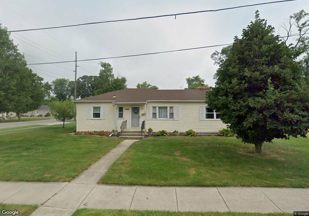
544 W Walnut St Crown Point, IN 46307
Estimated Value: $218,000 - $241,000
3
Beds
1
Bath
1,169
Sq Ft
$193/Sq Ft
Est. Value
About This Home
This home is located at 544 W Walnut St, Crown Point, IN 46307 and is currently estimated at $225,986, approximately $193 per square foot. 544 W Walnut St is a home located in Lake County with nearby schools including Lake Street Elementary School, Robert Taft Middle School, and Crown Point High School.
Ownership History
Date
Name
Owned For
Owner Type
Purchase Details
Closed on
Nov 22, 2006
Sold by
Bice James E and Bice David H
Bought by
Schroeder Keith A and Schroeder Sandra L
Current Estimated Value
Home Financials for this Owner
Home Financials are based on the most recent Mortgage that was taken out on this home.
Original Mortgage
$82,000
Outstanding Balance
$48,257
Interest Rate
6.12%
Mortgage Type
Purchase Money Mortgage
Estimated Equity
$177,729
Create a Home Valuation Report for This Property
The Home Valuation Report is an in-depth analysis detailing your home's value as well as a comparison with similar homes in the area
Home Values in the Area
Average Home Value in this Area
Purchase History
| Date | Buyer | Sale Price | Title Company |
|---|---|---|---|
| Schroeder Keith A | -- | Chicago Title Insurance Co |
Source: Public Records
Mortgage History
| Date | Status | Borrower | Loan Amount |
|---|---|---|---|
| Open | Schroeder Keith A | $82,000 |
Source: Public Records
Tax History Compared to Growth
Tax History
| Year | Tax Paid | Tax Assessment Tax Assessment Total Assessment is a certain percentage of the fair market value that is determined by local assessors to be the total taxable value of land and additions on the property. | Land | Improvement |
|---|---|---|---|---|
| 2024 | $4,117 | $165,000 | $42,100 | $122,900 |
| 2023 | $1,493 | $149,800 | $42,100 | $107,700 |
| 2022 | $1,493 | $145,700 | $42,100 | $103,600 |
| 2021 | $1,379 | $141,600 | $42,100 | $99,500 |
| 2020 | $1,450 | $142,600 | $42,100 | $100,500 |
| 2019 | $1,374 | $134,100 | $42,100 | $92,000 |
| 2018 | $1,378 | $130,100 | $42,100 | $88,000 |
| 2017 | $1,302 | $124,600 | $42,100 | $82,500 |
| 2016 | $1,330 | $124,900 | $42,100 | $82,800 |
| 2014 | $1,250 | $127,000 | $42,200 | $84,800 |
| 2013 | $1,286 | $128,300 | $42,200 | $86,100 |
Source: Public Records
Map
Nearby Homes
- 1 Walnut Pkwy
- 114 S Chase Dr
- 290 S Chase Dr
- 629 W South St
- 0 W Joliet St
- 316 W South St
- 321 Bluebird Ave
- 301 Hoffman St
- 334 Ellendale Pkwy
- 306 Holton Ridge
- 221 N West St
- 312 Fairfield Dr
- 621 Pratt St
- 511 N West St
- 138 N Grant St
- 11341 Lakewood St
- 640 Eleanor Rose Ct
- 269 Maxwell St
- 767 Kenmare Pkwy
- 531 E Joliet St
- 194 Harrington Ave
- 540 W Walnut St
- 200 Harrington Ave
- 202 Harrington Ave
- 186 Harrington Ave
- 199 Harrington Ave
- 535 W Walnut St
- 195 Harrington Ave
- 197 Harrington Ave
- 193 Harrington Ave
- 179 Harrington Ave
- 184 Harrington Ave
- 201 Harrington Ave
- 204 Harrington Ave
- 191 Harrington Ave
- 521 W Walnut St
- 187 Harrington Ave
- 203 Harrington Ave
- 182 Harrington Ave
- 517 W Walnut St