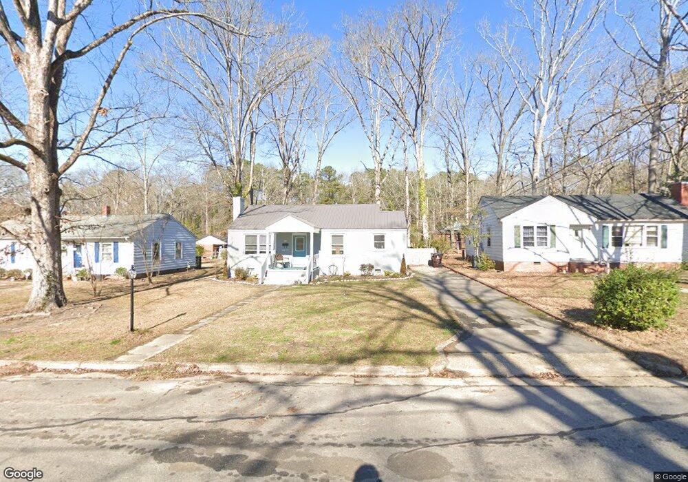
544 W Weatherspoon St Sanford, NC 27330
Estimated Value: $115,000 - $170,000
2
Beds
1
Bath
1,046
Sq Ft
$127/Sq Ft
Est. Value
About This Home
This home is located at 544 W Weatherspoon St, Sanford, NC 27330 and is currently estimated at $132,426, approximately $126 per square foot. 544 W Weatherspoon St is a home located in Lee County with nearby schools including Benjamin T. Bullock Elementary School, West Lee Middle School, and Lee County High School.
Ownership History
Date
Name
Owned For
Owner Type
Purchase Details
Closed on
Dec 1, 2020
Sold by
Womack Kent and Womack Kimberly
Bought by
544 Weatherspoon Llc
Current Estimated Value
Purchase Details
Closed on
Nov 30, 2020
Sold by
Sanderford Sharron A
Bought by
Womack Kent and Womack Kimberly
Purchase Details
Closed on
Nov 29, 2007
Sold by
Cole Billy and Cole Patricia
Bought by
Sanderford Sharron A
Home Financials for this Owner
Home Financials are based on the most recent Mortgage that was taken out on this home.
Original Mortgage
$75,900
Interest Rate
6.36%
Mortgage Type
New Conventional
Purchase Details
Closed on
Oct 4, 2002
Sold by
Perry Worth E
Bought by
Whitaker Kimberly D
Create a Home Valuation Report for This Property
The Home Valuation Report is an in-depth analysis detailing your home's value as well as a comparison with similar homes in the area
Home Values in the Area
Average Home Value in this Area
Purchase History
| Date | Buyer | Sale Price | Title Company |
|---|---|---|---|
| 544 Weatherspoon Llc | $70,000 | None Available | |
| Womack Kent | -- | None Available | |
| Sanderford Sharron A | $76,000 | None Available | |
| Whitaker Kimberly D | $73,000 | -- |
Source: Public Records
Mortgage History
| Date | Status | Borrower | Loan Amount |
|---|---|---|---|
| Previous Owner | Sanderford Sharron A | $75,900 |
Source: Public Records
Tax History Compared to Growth
Tax History
| Year | Tax Paid | Tax Assessment Tax Assessment Total Assessment is a certain percentage of the fair market value that is determined by local assessors to be the total taxable value of land and additions on the property. | Land | Improvement |
|---|---|---|---|---|
| 2025 | $1,442 | $90,500 | $17,900 | $72,600 |
| 2024 | $1,422 | $90,500 | $17,900 | $72,600 |
| 2023 | $1,412 | $90,500 | $17,900 | $72,600 |
| 2022 | $1,003 | $50,600 | $8,200 | $42,400 |
| 2021 | $1,008 | $50,600 | $8,200 | $42,400 |
| 2020 | $1,006 | $50,600 | $8,200 | $42,400 |
| 2019 | $966 | $50,600 | $8,200 | $42,400 |
| 2018 | $1,139 | $64,600 | $25,000 | $39,600 |
| 2017 | $1,126 | $64,600 | $25,000 | $39,600 |
| 2016 | $1,101 | $64,600 | $25,000 | $39,600 |
| 2014 | $1,053 | $64,600 | $25,000 | $39,600 |
Source: Public Records
Map
Nearby Homes
- 511 Maplewood Dr
- 702 N Vance St
- 612 W Chisholm St
- 506 Cross St
- 0 N Gulf St Unit 10076514
- 0 N Gulf St Unit 10079395
- 500 N Gulf St
- 505 Cross St
- 620 Carr St
- 113 Rosemont Ln
- 106 Chella Ct
- 102 Chella Ct
- 504 Summitt Dr
- 321 N Steele St
- 703 Bennett St
- 815 Park Ave
- 1701 Portico Cir
- 210 N Monroe Ave
- 822 Fitts St
- 542 W Weatherspoon St
- 546 W Weatherspoon St
- 529 Walnut Dr
- 538 W Weatherspoon St
- 538 W Weatherspoon St Unit A And B
- 525 Walnut Dr
- 533 Walnut Dr
- 543 W Weatherspoon St
- 545 W Weatherspoon St
- 539 W Weatherspoon St
- 603 Brinn Dr
- 536 W Weatherspoon St
- 547 W Weatherspoon St
- 519 Walnut Dr
- 534 W Weatherspoon St
- 607 Brinn Dr
- 537 W Weatherspoon St
- 515 Walnut Dr
- 546 Bracken St
- 550 Bracken St