Estimated Value: $247,173 - $313,000
3
Beds
2
Baths
1,132
Sq Ft
$244/Sq Ft
Est. Value
About This Home
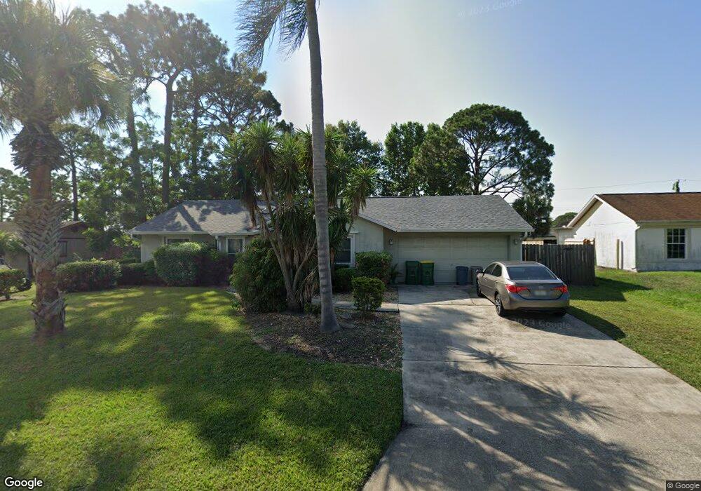
This home is located at 5440 Holden Rd, Cocoa, FL 32927 and is currently estimated at $276,543, approximately $244 per square foot. 5440 Holden Rd is a home located in Brevard County with nearby schools including Challenger 7 Elementary School, Space Coast Junior/Senior High School, and East Atlantic Prep of Brevard County.
Ownership History
Date
Name
Owned For
Owner Type
Purchase Details
Closed on
Oct 12, 2022
Sold by
Harr Michael W
Bought by
Michael W Harr Revocable Trust
Current Estimated Value
Purchase Details
Closed on
Aug 30, 2001
Sold by
Appel Craig A
Bought by
Harr Michael W and Mercier Donald F
Home Financials for this Owner
Home Financials are based on the most recent Mortgage that was taken out on this home.
Original Mortgage
$78,380
Interest Rate
7.02%
Create a Home Valuation Report for This Property
The Home Valuation Report is an in-depth analysis detailing your home's value as well as a comparison with similar homes in the area
Home Values in the Area
Average Home Value in this Area
Purchase History
| Date | Buyer | Sale Price | Title Company |
|---|---|---|---|
| Michael W Harr Revocable Trust | $100 | -- | |
| Harr Michael W | $79,000 | -- |
Source: Public Records
Mortgage History
| Date | Status | Borrower | Loan Amount |
|---|---|---|---|
| Previous Owner | Harr Michael W | $78,380 |
Source: Public Records
Tax History
| Year | Tax Paid | Tax Assessment Tax Assessment Total Assessment is a certain percentage of the fair market value that is determined by local assessors to be the total taxable value of land and additions on the property. | Land | Improvement |
|---|---|---|---|---|
| 2025 | $929 | $69,430 | -- | -- |
| 2024 | $909 | $67,480 | -- | -- |
| 2023 | $909 | $65,520 | $0 | $0 |
| 2022 | $922 | $63,620 | $0 | $0 |
| 2021 | $923 | $61,770 | $0 | $0 |
| 2020 | $878 | $60,920 | $0 | $0 |
| 2019 | $825 | $59,560 | $0 | $0 |
| 2018 | $826 | $58,450 | $0 | $0 |
| 2017 | $826 | $57,250 | $0 | $0 |
| 2016 | $832 | $56,080 | $18,000 | $38,080 |
| 2015 | $837 | $55,700 | $15,000 | $40,700 |
| 2014 | $842 | $55,260 | $11,000 | $44,260 |
Source: Public Records
Map
Nearby Homes
- 5601 Banos Ave
- 6438 Hudson Rd
- 5946 Deer Ln
- 5945 Coker Ave
- 5221 Carrick Rd
- 5680 Banos Ave
- 5220 Holden Rd
- 5720 Flint Rd
- 5215 Holden Rd
- 6020 Cannon Ave
- 6481 La Brea Ave
- 6450 Ember Ave
- 5950 Ackard Ave
- 5715 Fairbridge St
- 6094 Cardiff Ave
- 00 Unknown
- 6581 Bancroft Ave
- 6615 Dock Ave
- 6398 Cable Ave
- 0 Aruin St Unit 1222557
Your Personal Tour Guide
Ask me questions while you tour the home.