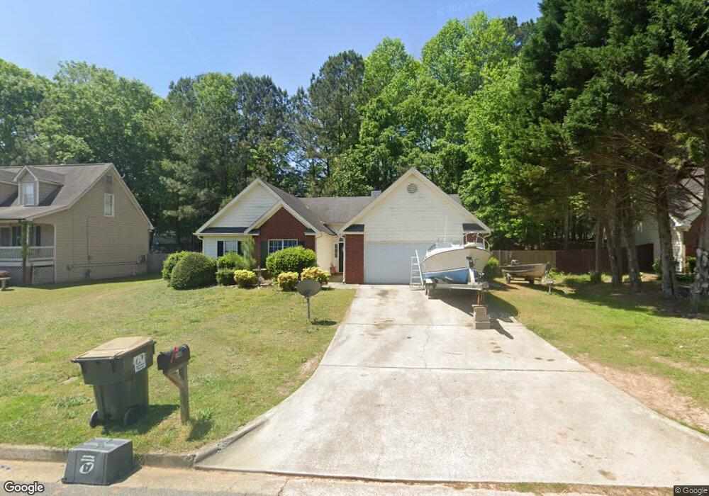
5440 Windswept Trace Sugar Hill, GA 30518
Estimated Value: $361,000 - $385,000
3
Beds
2
Baths
1,592
Sq Ft
$233/Sq Ft
Est. Value
About This Home
This home is located at 5440 Windswept Trace, Sugar Hill, GA 30518 and is currently estimated at $371,000, approximately $233 per square foot. 5440 Windswept Trace is a home located in Gwinnett County with nearby schools including Sycamore Elementary School, Lanier Middle School, and Lanier High School.
Ownership History
Date
Name
Owned For
Owner Type
Purchase Details
Closed on
Jan 29, 2026
Sold by
Fyr Sfr Borrower Llc
Bought by
Pr Borrower 27 Llc
Current Estimated Value
Purchase Details
Closed on
Apr 18, 2016
Sold by
Christiana Trust Trustee
Bought by
Arlp Reo I Llc
Purchase Details
Closed on
Sep 2, 2014
Sold by
Smith Brenda
Bought by
Christiana Trust
Purchase Details
Closed on
Oct 1, 2001
Sold by
Simmons Maurice W
Bought by
Smith Brenda
Home Financials for this Owner
Home Financials are based on the most recent Mortgage that was taken out on this home.
Original Mortgage
$137,331
Interest Rate
6.89%
Mortgage Type
FHA
Purchase Details
Closed on
Dec 29, 2000
Sold by
Simmons Molissa W
Bought by
Simmons Maurice W
Create a Home Valuation Report for This Property
The Home Valuation Report is an in-depth analysis detailing your home's value as well as a comparison with similar homes in the area
Home Values in the Area
Average Home Value in this Area
Purchase History
| Date | Buyer | Sale Price | Title Company |
|---|---|---|---|
| Pr Borrower 27 Llc | -- | -- | |
| Arlp Reo I Llc | -- | -- | |
| Christiana Trust | $155,000 | -- | |
| Smith Brenda | $138,500 | -- | |
| Simmons Maurice W | $105,400 | -- |
Source: Public Records
Mortgage History
| Date | Status | Borrower | Loan Amount |
|---|---|---|---|
| Previous Owner | Smith Brenda | $137,331 |
Source: Public Records
Tax History
| Year | Tax Paid | Tax Assessment Tax Assessment Total Assessment is a certain percentage of the fair market value that is determined by local assessors to be the total taxable value of land and additions on the property. | Land | Improvement |
|---|---|---|---|---|
| 2025 | $490 | $129,800 | $28,800 | $101,000 |
| 2024 | $3,851 | $129,800 | $28,800 | $101,000 |
| 2023 | $3,851 | $121,360 | $26,000 | $95,360 |
| 2022 | $2,831 | $80,880 | $14,400 | $66,480 |
| 2021 | $2,887 | $80,880 | $14,400 | $66,480 |
| 2020 | $3,251 | $80,880 | $14,400 | $66,480 |
| 2019 | $2,858 | $73,560 | $14,400 | $59,160 |
| 2018 | $2,639 | $67,600 | $12,000 | $55,600 |
| 2016 | $2,102 | $53,720 | $12,000 | $41,720 |
| 2015 | $1,988 | $50,160 | $9,200 | $40,960 |
| 2014 | -- | $50,160 | $9,200 | $40,960 |
Source: Public Records
Map
Nearby Homes
- 5596 Pinedale Cir
- 1170 Chastain Dr
- 1184 Chastain Dr
- 1135 Chastain Dr
- 1123 Chastain Dr
- 1114 Chastain Dr
- 978 Sugar Vista Cir
- 965 Sugar Meadow Dr
- 885 Long Branch Cir
- 875 Long Branch Cir
- 1020 Sycamore Summit
- 1025 Hunters Oak Trail
- 5424 Princeton Oaks Ln
- 5316 Under Way Unit 5
- 816 Pond View Ln Unit 3
- 704 Old Cumming Rd
- 5330 Sycamore Rd
- 5675 Bridle Glen Dr
- 818 Pond View Ct
- 591 Highway 20
- 5440 Windswept Trace Unit 5440
- 5430 Windswept Trace Unit 1
- 5450 Windswept Trace
- 5445 Windswept Trace
- 889 Pinedale Terrace
- 899 Pinedale Terrace
- 5435 Windswept Trace
- 5420 Windswept Trace Unit I
- 5460 Windswept Trace
- 5455 Windswept Trace
- 909 Pinedale Terrace
- 879 Pinedale Terrace
- 5465 Windswept Trace
- 5470 Windswept Trace
- 5410 Windswept Trace
- 919 Pinedale Terrace
- 5415 Windswept Trace
- 973 Altavista Ct
- 969 Spring View Place Unit 1
- 5475 Windswept Trace
Your Personal Tour Guide
Ask me questions while you tour the home.