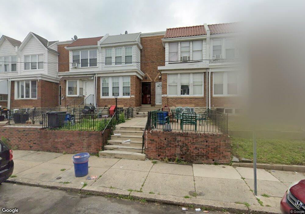
5442 Rutland St Philadelphia, PA 19124
Frankford NeighborhoodEstimated Value: $199,000 - $224,000
3
Beds
1
Bath
1,417
Sq Ft
$147/Sq Ft
Est. Value
About This Home
This home is located at 5442 Rutland St, Philadelphia, PA 19124 and is currently estimated at $208,028, approximately $146 per square foot. 5442 Rutland St is a home located in Philadelphia County with nearby schools including Frankford High School, The Philadelphia Charter School for the Arts & Sciences, and St Martin Of Tours Catholic School.
Ownership History
Date
Name
Owned For
Owner Type
Purchase Details
Closed on
Apr 26, 2024
Sold by
Bates Karen E
Bought by
Hales Shelly
Current Estimated Value
Home Financials for this Owner
Home Financials are based on the most recent Mortgage that was taken out on this home.
Original Mortgage
$116,400
Outstanding Balance
$114,550
Interest Rate
6.87%
Mortgage Type
New Conventional
Estimated Equity
$93,478
Purchase Details
Closed on
Feb 20, 2007
Sold by
Coleman Joan C and Coleman Michael P
Bought by
Bates Karen E
Home Financials for this Owner
Home Financials are based on the most recent Mortgage that was taken out on this home.
Original Mortgage
$130,000
Interest Rate
6.33%
Mortgage Type
Purchase Money Mortgage
Create a Home Valuation Report for This Property
The Home Valuation Report is an in-depth analysis detailing your home's value as well as a comparison with similar homes in the area
Home Values in the Area
Average Home Value in this Area
Purchase History
| Date | Buyer | Sale Price | Title Company |
|---|---|---|---|
| Hales Shelly | $120,000 | Abstract One | |
| Bates Karen E | $130,000 | Lawyers Title Insurance Co |
Source: Public Records
Mortgage History
| Date | Status | Borrower | Loan Amount |
|---|---|---|---|
| Open | Hales Shelly | $116,400 | |
| Previous Owner | Bates Karen E | $130,000 |
Source: Public Records
Tax History Compared to Growth
Tax History
| Year | Tax Paid | Tax Assessment Tax Assessment Total Assessment is a certain percentage of the fair market value that is determined by local assessors to be the total taxable value of land and additions on the property. | Land | Improvement |
|---|---|---|---|---|
| 2026 | $2,126 | $183,100 | $36,620 | $146,480 |
| 2025 | $2,126 | $183,100 | $36,620 | $146,480 |
| 2024 | $2,126 | $183,100 | $36,620 | $146,480 |
| 2023 | $2,126 | $151,900 | $30,300 | $121,600 |
| 2022 | $1,068 | $106,900 | $30,300 | $76,600 |
| 2021 | $1,698 | $0 | $0 | $0 |
| 2020 | $1,698 | $0 | $0 | $0 |
| 2019 | $1,629 | $0 | $0 | $0 |
| 2018 | $1,018 | $0 | $0 | $0 |
| 2017 | $1,438 | $0 | $0 | $0 |
| 2016 | $1,018 | $0 | $0 | $0 |
| 2015 | $974 | $0 | $0 | $0 |
| 2014 | -- | $102,700 | $19,394 | $83,306 |
| 2012 | -- | $13,760 | $1,358 | $12,402 |
Source: Public Records
Map
Nearby Homes
- 1431 Rosalie St
- 5902 E Roosevelt Blvd
- 5661 Miriam Rd
- 5659 Miriam Rd
- 1048 Bridge St
- 1137 Bridge St
- 996 Anchor St
- 7753 E Roosevelt Blvd
- 5640 Miriam Rd
- 991 Carver St
- 7600 E Roosevelt Blvd Unit 206
- 7600 E Roosevelt Blvd Unit 212
- 7600 E Roosevelt Blvd Unit 909
- 7600 E Roosevelt Blvd Unit 705
- 7600 E Roosevelt Blvd Unit 701
- 7600 E Roosevelt Blvd Unit 806
- 7600 E Roosevelt Blvd Unit 904
- 7600 E Roosevelt Blvd Unit 604
- 5900 Loretto Ave
- 6632 E Roosevelt Blvd
- 5440 Rutland St
- 5444 Rutland St
- 5438 Rutland St
- 5446 Rutland St
- 5436 Rutland St
- 5448 Rutland St
- 5434 Rutland St
- 5450 Rutland St
- 5432 Rutland St
- 5430 Rutland St
- 5428 Rutland St
- 5395 Oxford Ave
- 5426 Rutland St
- 5443 Rutland St
- 5445 Rutland St
- 5424 Rutland St
- 5441 Rutland St
- 5437 Rutland St
- 5439 Rutland St
- 5447 Rutland St