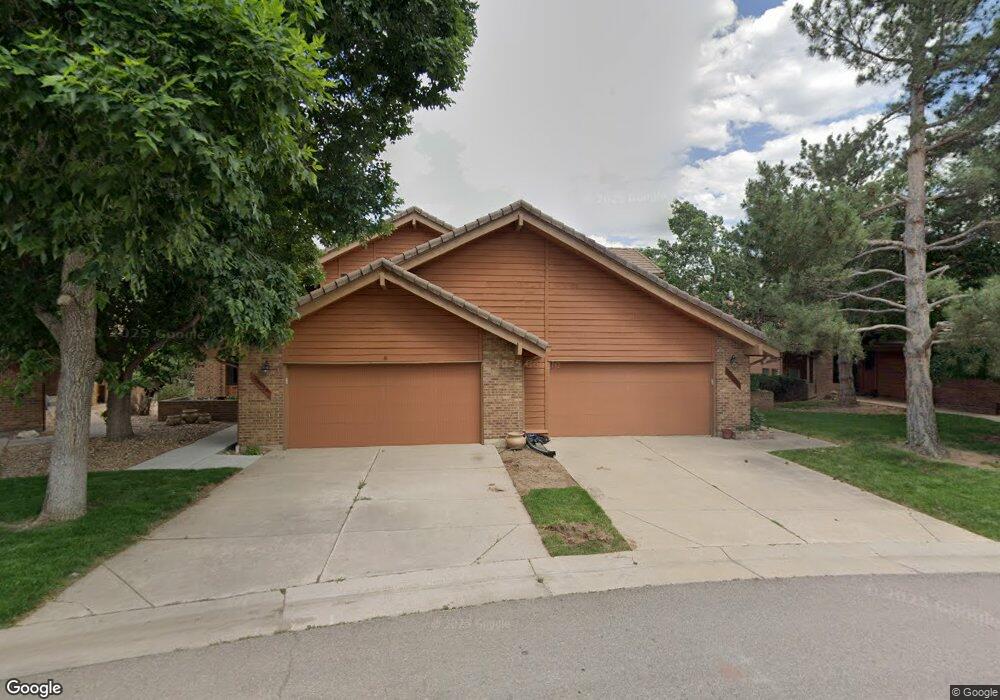
5443 Coyote Canyon Way Unit A Morrison, CO 80465
Willow Springs NeighborhoodEstimated Value: $559,068 - $768,000
2
Beds
3
Baths
1,713
Sq Ft
$406/Sq Ft
Est. Value
About This Home
This home is located at 5443 Coyote Canyon Way Unit A, Morrison, CO 80465 and is currently estimated at $695,767, approximately $406 per square foot. 5443 Coyote Canyon Way Unit A is a home located in Jefferson County with nearby schools including Red Rocks Elementary School, Carmody Middle School, and Bear Creek High School.
Ownership History
Date
Name
Owned For
Owner Type
Purchase Details
Closed on
Apr 19, 2016
Sold by
Dakotah At Willow Springs Homeowners Ass
Bought by
Smith Robert L and Smith Cynthia A
Current Estimated Value
Purchase Details
Closed on
Jun 23, 2008
Sold by
Smith Cynthia A
Bought by
Smith Robert L and Smith Cynthia A
Home Financials for this Owner
Home Financials are based on the most recent Mortgage that was taken out on this home.
Original Mortgage
$225,000
Interest Rate
6.05%
Mortgage Type
New Conventional
Purchase Details
Closed on
Jul 1, 2004
Sold by
Smith Robert L and Smith Cynthia A
Bought by
Smith Cynthia A
Purchase Details
Closed on
Sep 8, 1995
Sold by
Taylor Joan
Bought by
Smith Robert L and Smith Cynthia A
Purchase Details
Closed on
Oct 13, 1993
Sold by
Taylor Joan
Bought by
Whale Rock Country Club Inc
Create a Home Valuation Report for This Property
The Home Valuation Report is an in-depth analysis detailing your home's value as well as a comparison with similar homes in the area
Home Values in the Area
Average Home Value in this Area
Purchase History
| Date | Buyer | Sale Price | Title Company |
|---|---|---|---|
| Smith Robert L | -- | None Available | |
| Smith Robert L | -- | Northwest Title Agency Inc | |
| Smith Cynthia A | -- | -- | |
| Smith Robert L | $190,000 | Land Title | |
| Whale Rock Country Club Inc | -- | -- |
Source: Public Records
Mortgage History
| Date | Status | Borrower | Loan Amount |
|---|---|---|---|
| Previous Owner | Smith Robert L | $225,000 |
Source: Public Records
Tax History Compared to Growth
Tax History
| Year | Tax Paid | Tax Assessment Tax Assessment Total Assessment is a certain percentage of the fair market value that is determined by local assessors to be the total taxable value of land and additions on the property. | Land | Improvement |
|---|---|---|---|---|
| 2024 | $2,778 | $38,113 | $9,347 | $28,766 |
| 2023 | $2,778 | $38,113 | $9,347 | $28,766 |
| 2022 | $2,521 | $34,272 | $6,464 | $27,808 |
| 2021 | $2,546 | $35,259 | $6,650 | $28,609 |
| 2020 | $2,177 | $31,254 | $4,290 | $26,964 |
| 2019 | $2,151 | $31,254 | $4,290 | $26,964 |
| 2018 | $2,703 | $36,432 | $3,600 | $32,832 |
| 2017 | $2,445 | $36,432 | $3,600 | $32,832 |
| 2016 | $2,905 | $0 | $0 | $0 |
Source: Public Records
Map
Nearby Homes
- 5453 Coyote Canyon Way Unit A
- 15906 Double Eagle Dr
- 16096 Double Eagle Dr Unit B
- 16223 Red Deer Ct
- 15798 Weaver Gulch Dr
- 15789 Sandtrap Way
- 15740 Sandtrap Way
- 16601 Red Cliff Cir
- 16324 River Haven Way
- 5569 Willow Springs Dr
- 16066 Ridge Tee Dr
- 15191 Dinosaur Ridge Rd
- 16939 Long Winding Rd
- 15480 Dinosaur Ridge Rd
- 5852 Willowbrook Dr
- 16989 Long Winding Rd
- 17186 Lost Horse Ln
- 17121 Snow Creek Ln
- 17106 Lost Horse Ln
- 16979 Lost Winding Rd
- 5443 Coyote Canyon Way Unit B
- 5433 Coyote Canyon Way Unit A
- 5433 Coyote Canyon Way Unit B
- 5433 Coyote Canyon Way
- 5453 Coyote Canyon Way Unit B
- 5453 Coyote Canyon Way Unit C
- 5453 Coyote Canyon Way
- 5436 Coyote Canyon Way
- 15992 Deer Ridge Dr Unit C
- 15992 Deer Ridge Dr Unit B
- 15992 Deer Ridge Dr Unit A
- 15992 Deer Ridge Dr
- 15932 Deer Ridge Dr
- 5434 Coyote Canyon Way Unit B
- 5434 Coyote Canyon Way Unit A
- 5434 Coyote Canyon Way
- 15925 Double Eagle Dr
- 16033 Double Eagle Dr
- 15942 Deer Ridge Dr
- 15945 Double Eagle Dr